Forecast for the Moab Area Mountains

Eric Trenbeath
Issued by Eric Trenbeath on
Thursday morning, January 7, 2021
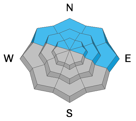
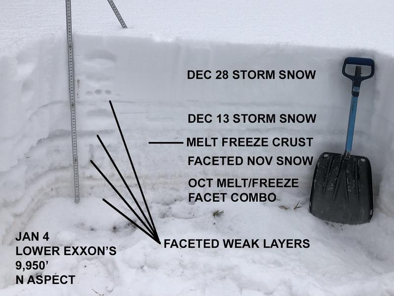
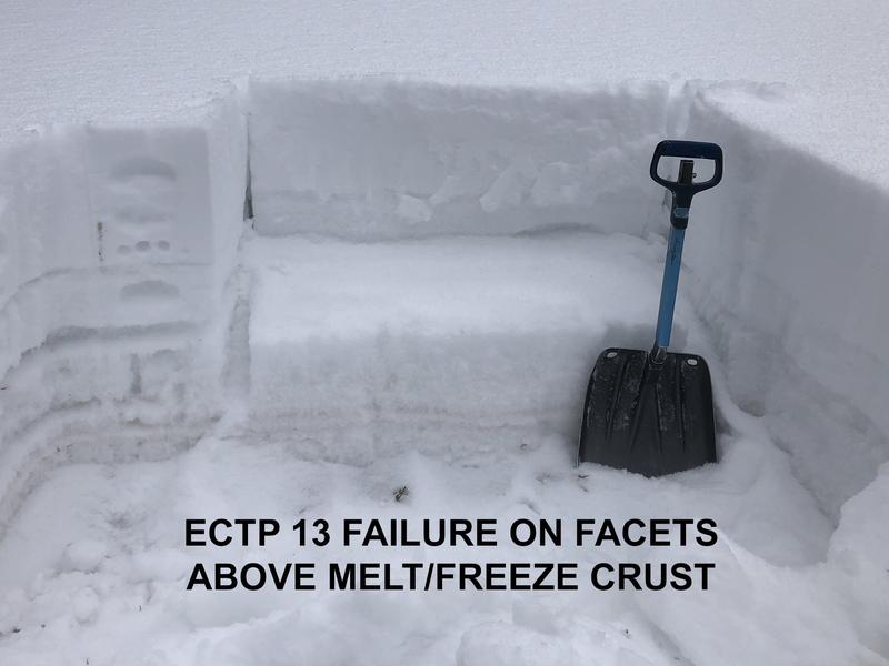
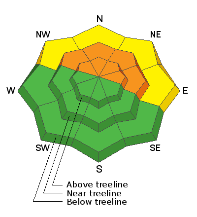
The avalanche danger remains CONSIDERABLE on steep, northerly facing slopes. In these areas, layers of weak, sugary, faceted snow have become dangerously overloaded and human triggered avalanches are likely. At upper elevations, recent wind drifting has exacerbated the problem. With the current snowpack structure, steep, N-E facing slopes should be avoided for the foreseeable future. Most south-facing terrain has generally LOW danger.
Low
Moderate
Considerable
High
Extreme
Learn how to read the forecast here
Special Announcements
The Geyser Pass Road is plowed. The surface is snow packed on dirt.
The Lower Utah Nordic Alliance (LUNA) groomed all trails on Tuesday.
Chris Benson has detailed the last two weeks in this excellent synopsis.
Weather and Snow
24 Hour Snow 0" 72 Hour Snow 0" Base Depth in Gold Basin 25" Wind SW 5-15 Temp 20F
Storm totals at the Gold Basin study plot (10,000')
Wind, temperature, humidity on Pre Laurel Peak (11,700')
Snotel site near Geyser Pass Trailhead (9600')
NWS weather forecast
Snowpack Discussion It's no secret that last week's snow load has added significant stress to our fragile snowpack. In my travels Monday, I continued to observe fairly widespread collapsing and whumphing, sure red flag signs of instability. Nate Ament and Dave Garcia ventured above treeline yesterday, read their observation here. Conditions are deceiving due to the overall lack of snow, and although avalanche terrain is difficult to access, the danger in these areas remains real. Overall coverage is still very thin so keep your enthusiasm in check and stick to low-angle grassy slopes and meadows.
Recent Avalanches
Here is a list of observed avalanches in Gold Basin from last week's storm.
Ad
Avalanche Problem #1
Persistent Weak Layer
Type
Location
Likelihood
Size
Description
Our snowpack is rife with persistent weak layers of loose, sugary, faceted snow along with a couple of smooth, hard, melt feeze layers to form a perfect bed surface. Red flag signs of instability such as collapsing and whumphing continue to be fairly widespread, even at lower elevations. Although avalanche terrain remains difficult to access due to low coverage, human-triggered avalanches are likely in these areas and steep, northerly facing terrain will remain off-limits for the foreseeable future.
These snowpit images illustrate the current precarious state of the snowpack.
General Announcements
This forecast is from the U.S. Forest Service, which is solely responsible for its content. This forecast describes general avalanche conditions and local variations always occur.