March Kicks Off Our Spring Campaign- Donate Now to Support Forecasting

Forecast for the Uintas Area Mountains

Craig Gordon
Issued by Craig Gordon on
Thursday morning, November 26, 2020
The avalanche danger is generally LOW. The greatest threat right now is slamming into a season ending tree stump or deadfall hidden under the thin facade of an early season snowpack.
Low
Moderate
Considerable
High
Extreme
Learn how to read the forecast here
Special Announcements
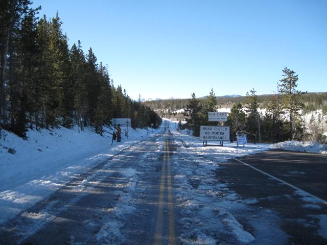
Seasonal closures are in place for the Mirror Lake Highway and currently, there's no winter maintenance or plowing.
If you missed the 13th Annual Utah Snow and Avalanche Workshop, the recordings are available for purchase from the UAC Store.
Click here for more details.
Looking for ways to navigate the winter ?
Please visit this website with information about Responsible Winter Recreation by the Utah Office of Outdoor Recreation
Weather and Snow
Happy Thanksgiving!
Nowcast-
Last night's storm materialized nicely, particularly for the North Slope, delivering 4" of light density snow. Further south across the range snow totals are about half that amount. Under mostly cloudy skies, light snow is falling and temperatures are in the single digits. Northwest winds blow 10-20 mph along the high peaks, where windchill values register in negative territory.
Forecast-
Look for scattered snow showers this morning with high temperatures barely cracking out of the teens. Skies clear as the day progresses and northerly winds increase late in the day, gusting into the 40's by late tonight. Clear skies tonight allow the bottom to fall out with overnight lows near zero.
Futurecast-
High pressure returns for Friday and builds through the weekend providing sunny skies with temperatures climbing into the 40's. A cold front slides through the region Monday, but the jury is still out regarding available moisture.
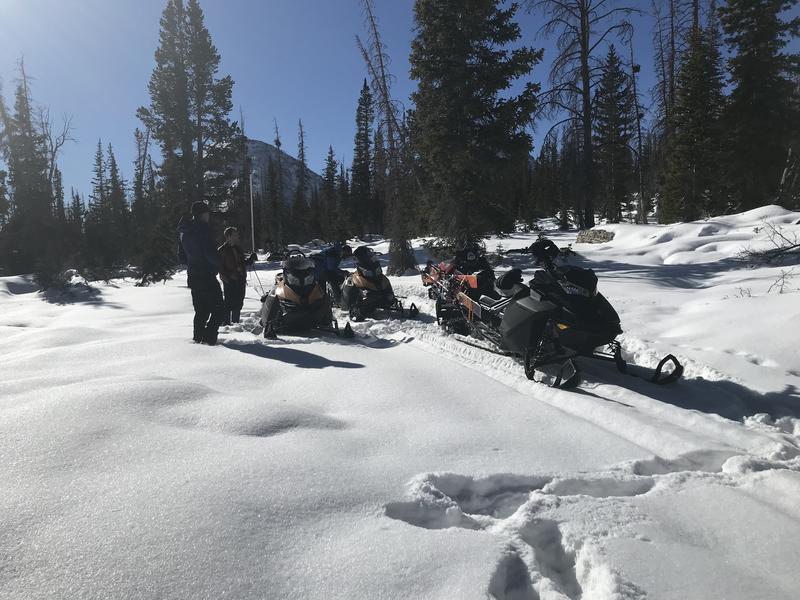
We are in the process of establishing a snow study site near Camp Steiner. The automated weather station delivers real-time snow fall, total snow depth, and current temperatures. This data fills in a big black hole of snow information near Mirror Lake. Yesterday we visited the site to establish comms with Lofty Lake Peak and all is go to start hauling the gear into place next week. I'd like to give a big shout out to Sean and Jesse from the NWS along with Ted Scroggin, our main man in the Uinta's, pictured above.
Looking for real-time temps, snow, or wind?
Click here and then on the "western Uinta" tab for western Uinta specific, weather station network.
Recent Avalanches
No new avalanche activity to report.
To view trip reports and recent avalanche activity, simply click here.
Ad
Avalanche Problem #1
Normal Caution
Type
Location
Likelihood
Size
Description
Bald Mountain and Reids Peak looking regal, yet still super boney. With only two feet of snow on the ground and four feet of rock poking through, the snowpack is thin and travel limited to grassy slopes and road rides. While the avalanche hazard is generally LOW, the danger of slamming into a season ending obstacle is very real. So... tone it down, take it slow and remember- it's a long season and you definitely don't want to instantly end it before things get going.
Additional Information
I'll update this forecast by 7:00 AM tomorrow, Friday November 27th.
Your observations are import, so please let me know what you're seeing... click HERE and contribute to this amazing community based program
Information on outdoor recreation - The State of Utah created this webpage with information about recreating on both state and federal public lands during the current health crisis.

Skiing and riding at closed ski resorts - Some resorts allow access now, and some do not. Please check HERE for the latest info on ski area access.

New to the backcountry (including riding at closed resorts) - Watch the award-winning, 15 minute Know Before You Go video, or take the 5-part, free online-learning series.
General Announcements
If you see or trigger an avalanche or just wanna let me know what you're seeing you can reach me directly at 801-231-2170 or [email protected]
The information in this forecast is from the US Forest Service which is solely responsible for its content.