March Kicks Off Our Spring Campaign- Donate Now to Support Forecasting

Forecast for the Uintas Area Mountains

Craig Gordon
Issued by Craig Gordon on
Friday morning, November 20, 2020
The avalanche danger is generally LOW and greatest threat right now is slamming into a tree stump or deadfall hidden under the thin facade of an early season snowpack.
Low
Moderate
Considerable
High
Extreme
Learn how to read the forecast here
Special Announcements
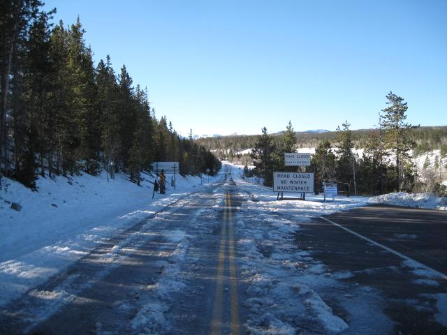
Seasonal closures are in place for the Mirror Lake Highway and currently, there's no winter maintenance or plowing.
If you missed the 13th Annual Utah Snow and Avalanche Workshop, the recordings are available for purchase from the UAC Store.
Click here for more details.
Looking for ways to navigate the winter ?
Please visit this website with information about Responsible Winter Recreation by the Utah Office of Outdoor Recreation
Weather and Snow
Nowcast-
Skies are partly cloudy and temperatures in the mid teens. Westerly winds are reasonable, blowing just 10-20 mph along the high ridges.
Forecast-
A weak weather system brings a slight chance of snow showers to the region this afternoon and evening. Drier weather and slightly warmer temperatures follows for the upcoming weekend
Futurecast-
A glimmer of hope for some snow materializes Monday night into Tuesday, with the potential for a stronger system on the horizon for Thanksgiving.
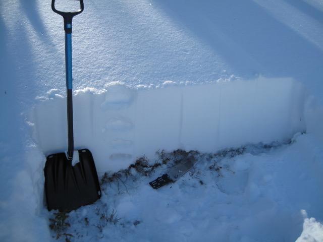
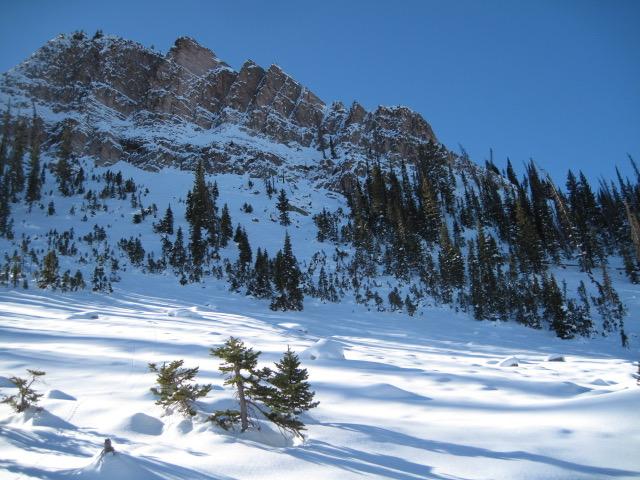
Our shallow snowpack has some strength and body to it and Ted noted, "Although the snowpack is generally around two feet deep, more up higher, the conditions are looking good. I found some old late October snow near the ground that looked weak and sugary, but it was damp and I could make a snow ball with it."
Looking for real-time temps, snow, or wind?
Click here and then on the "western Uinta" tab for western Uinta specific, weather station network.
Recent Avalanches
No new avalanche activity to report, but there's just enough snow to ride and of course, enough snow to slide. And remember- even a small avalanche this time of year will instantly end your season if you slam into a rock, or stump, or get raked through deadfall. But that doesn't mean you can't ride, you just need to tone it down a few notches. As a matter of fact, you can still have a blast on lower angle terrain.
To view trip reports and recent avalanche activity, simply click here.
Ad
Avalanche Problem #1
Normal Caution
Type
Location
Likelihood
Size
Description
With only two feet of snow on the ground and four feet of rock poking through, the snowpack is thin and travel limited to grassy slopes and road rides. In addition, recent winds coupled with very warm temperatures have worked the surface snow and essentially welded it in place. However, there may be a stiff drift or two that'll react to our additional weight. For today, you'll want to continue looking for and avoiding any fat, rounded piece of snow, especially if it sounds hollow like a drum.
Additional Information
I'll update this information as conditions warrant and the snowpack develops. Once we get rolling and winter gets going in earnest, you can expect detailed daily avalanche advisories updated by 7:00 AM.
Your observations are import, so please let me know what you're seeing... click HERE and contribute to this amazing community based program
Information on outdoor recreation - The State of Utah created this webpage with information about recreating on both state and federal public lands during the current health crisis.

Skiing and riding at closed ski resorts - Some resorts allow access now, and some do not. Please check HERE for the latest info on ski area access.

New to the backcountry (including riding at closed resorts) - Watch the award-winning, 15 minute Know Before You Go video, or take the 5-part, free online-learning series.
General Announcements
If you see or trigger an avalanche or just wanna let me know what you're seeing you can reach me directly at 801-231-2170 or [email protected]
The information in this forecast is from the US Forest Service which is solely responsible for its content.