March Kicks Off Our Spring Campaign- Donate Now to Support Forecasting

Forecast for the Uintas Area Mountains

Craig Gordon
Issued by Craig Gordon on
Tuesday morning, April 7, 2020
Limited to a small portion of the terrain available to ride in today-
At and above treeline, in the wind zone, pockets of MODERATE avalanche danger exist on wind drifted slopes. Human triggered avalanches are POSSIBLE on steep, leeward slopes facing the north half of the compass, particularly those with an easterly component to its aspect. Any avalanche triggered is gonna pack a punch and could easily ruin your day.
Wind sheltered mid and low elevation terrain offers generally LOW avalanche danger.
Low
Moderate
Considerable
High
Extreme
Learn how to read the forecast here
Special Announcements
Spring Awareness Campaign - Help us save lives through avalanche forecasts and education. Consider making a donation before April 8th.
Uncertainty, Risk, & Decision Making: before, during, and after COVID-19 - Read this thought-provoking blog post about how we take risks by guest author Tom Diegel.
Weather and Snow
Currently-
Peaking through a veil of clouds, this months "Super Pink" full moon, casts surreal shadows on the mountains this morning. It remained relatively warm overnight with temperatures hovering in the mid and upper 20's, while west and southwest winds are relentless, blowing 30-50 mph along the peaks. Recent warm temperatures and nuking winds have taken their toll on riding and turning conditions and soft snow is in limited supply. However, supportable snow surfaces transform into creamy corn-like goodness on sunny slopes as the day progresses.
Uinta weather network info is found here. Simply click on the Western Uinta tab.
For today-
Partly cloudy skies are on tap, but don't rule out a stray snow shower or two. High temperatures climb into the upper 30's and winds decrease as the day progresses.
Futurecast-
The second half of the week looks beautiful with storminess returning over the weekend, though there's quite a bit of uncertainty from Saturday and beyond.
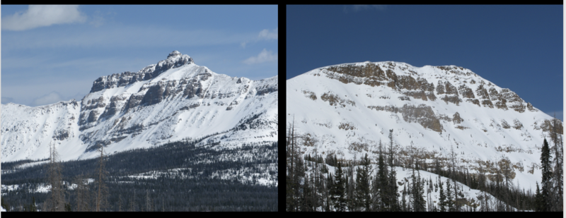
Recent Avalanches
SEE THE PATTERN?
Tough to identify, particularly when it's all white, but common theme is... repeater avalanche terrain. Steep, rocky slopes, especially those facing the north half fo the compass, that avalanched near the ground earlier this season and have remained thin and weak all season.
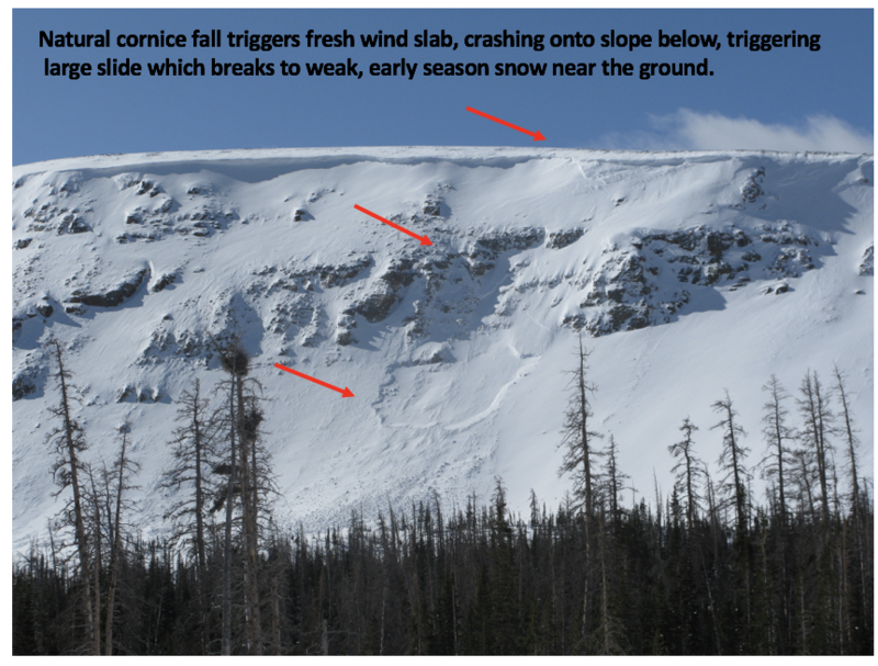
Wednesday natural avalanche in Murdock Bowl near Bald Mountain Pass. Breaking 3' deep and 200' wide, this slide would instantly ruin your day.
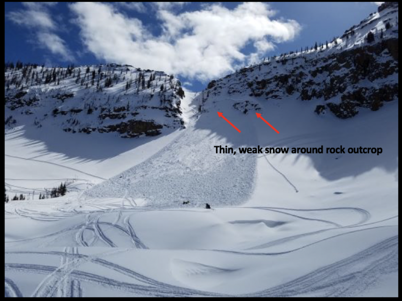
Friday human triggered avalanche on Notch Mountain-
Breaking 3' deep and a football field wide, the avalanche in the image above was triggered yesterday on the steep, heavily wind loaded, northwest facing bowl of Notch Mountain. As noted by the rider.... "I was the third snowmobiler to climb the mountain and I triggered the slide. Avalanche airbag kept my head above the snow." More details found here.
To view additional trip reports and recent avalanche activity, simply click here.
Ad
Avalanche Problem #1
Wind Drifted Snow
Type
Location
Likelihood
Size
Description
Hayden to the left of me, Bald Mountain to the right... here I am stuck in the middle with...
Not much has changed on this front. The Uinta's are amazing right now... fat, white and filled in. As a matter of fact, we've got a solid snowpack with a go anywhere base, which enables us to get onto big slopes and tag complex terrain. But, as you know, the Uinta's are a big range. And while the vast majority of our terrain is good to go, if you were looking to trigger an avalanche, I bet you could find one. And, recent avalanches near Bald Mountain Pass and Notch Mountain, not only illustrate the type of terrain we love to ride in the spring, it's also the type of terrain where we could trigger a slide today.
So... what to look for and what to avoid?
Fat, rounded slopes that feel or sound hollow like a drum.
The most likely suspects are gonna be isolated to the high country... steep, rocky, leeward slopes in the wind zone at and above treeline.
So, the key to riding safely today is... be flexible with your travel plans and adjust objectives if you're starting to see or feel obvious clues to unstable snow like shooting cracks, sudden collapses, or avalanches with the same terrain characteristics like the slopes you wanna ride. In addition, think about the consequences of triggering a slide, especially if you're getting into steep, technical terrain.
Additional Information
Information on outdoor recreation - The State of Utah created this webpage with information about recreating on both state and federal public lands during the current health crisis.

Skiing and riding at closed ski resorts - Some resorts allow access now, and some do not. Please check HERE for the latest info on ski area access.

New to the backcountry (including riding at closed resorts) - Watch the award-winning, 15 minute Know Before You Go video, or take the 5-part, free online-learning series.
General Announcements
The information in this forecast expires in 24 hours, but will be updated by 7:00 AM Wednesday Apr. 8th.
This forecast is updated daily by 7:00 AM.
In the mean-time, if you see or trigger an avalanche or just wanna let me know what you're seeing you can reach me directly at 801-231-2170
The information in this forecast is from the US Forest Service which is solely responsible for its content.