March Kicks Off Our Spring Campaign- Donate Now to Support Forecasting

Forecast for the Uintas Area Mountains

Craig Gordon
Issued by Craig Gordon on
Thursday morning, April 2, 2020
In upper elevation terrain, especially in the wind zone at and above treeline, pockets of MODERATE avalanche danger exist on wind drifted slopes. Human triggered avalanches are POSSIBLE on steep, leeward slopes, particularly those with an easterly component to its aspect.
Your risk reducing exit strategy is this- good riding with more predictable avalanche danger is found with some loss of elevation. Wind sheltered mid and low elevation terrain offers generally LOW avalanche danger.
Low
Moderate
Considerable
High
Extreme
Learn how to read the forecast here
Special Announcements
Spring Awareness Campaign - Help us save lives through avalanche forecasts and education. Consider making a donation before April 8th.

Information on outdoor recreation - The State of Utah created this webpage with information about recreating on both state and federal public lands during the current health crisis.

January 5, 2019 - Read this collection of 6 stories and a podcast about that day with a low avalanche danger, 8 skier triggered avalanches, four catch and carries... a partial and critical burial, and a trip to the emergency room.
Weather and Snow
Currently-
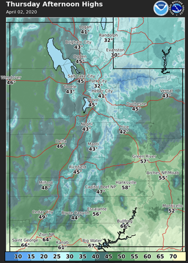
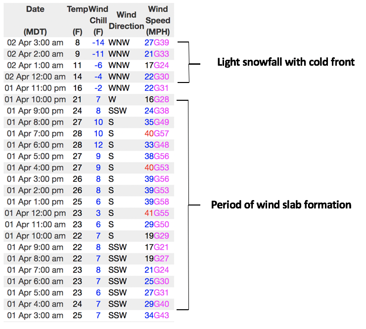
A quick hitting cold front slid through the region delivering 3" of snow, whilst some slept... whilst some worked :)
In either case, it's noticeably colder as temperatures crashed nearly 20 degrees since dinnertime Wednesday and currently register in the single digits. West and northwest winds blow in the 20's and 30's producing wind chill factors to -11 degrees along the high ridges. Riding and turning conditions might be a bit on the rugged side this morning as recent warm temperatures and strong winds wrecked a lot of our white landscape. But considering the alternatives, if you're looking for soft settled snow, wind sheltered, mid elevation terrain is the ticket.
More Uinta weather network info is found here. Simply click on the Western Uinta tab.
For today-
Scattered snow showers linger for the next few hours and it'll be much colder with highs only climbing into the teens and low 20's. West and northwest winds blow in the 20's and 30's
Futurecast-
A warming and drying trend follows Friday into Saturday. Hit or miss storminess moves into the region to begin the workweek.
Recent Avalanches
No significant avalanche activity to report from yesterday.
To view additional trip reports and recent avalanche activity, simply click here.
Ad
Avalanche Problem #1
Wind Drifted Snow
Type
Location
Likelihood
Size
Description
Yesterday's warm temperatures and strong winds jerked the snow surface all over the place, forming stiff, yet mostly unreactive drifts... good news. In addition, I think the overnight cold temperatures further helped weld things in place. However, as we know, the Uinta's are a big place and it's a range where wind was invented. So... I bet if you were looking to trigger a wind drift you could find one. The most likely suspects are steep, leeward slopes in the wind zone at and above treeline. Generally easy to detect by their fat, rounded appearance, yesterday's wind drifts are slightly disguised by overnight snowfall, so they might be a bit more elusive today.
So, the key to riding safely today is... be flexible with your travels plans and adjust objectives if you're starting to see or feel obvious clues to unstable snow like shooting cracks, sudden collapses, or avalanches with the same terrain characteristics like the slopes you wanna ride. In addition, think about the consequences of triggering a slide, especially if you're getting into steep, technical terrain.
Above is a 24 hour data dump for Windy Peak (10,662') illustrating recent winds along the high peaks.
Additional Information

Skiing and riding at closed ski resorts - Some resorts allow access now, and some do not. Please check HERE for the latest info on ski area access.

New to the backcountry (including riding at closed resorts) - Watch the award-winning, 15 minute Know Before You Go video, or take the 5-part, free online-learning series.
General Announcements
The information in this forecast expires in 24 hours, but will be updated by 7:00 AM Friday Apr. 3rd.
This forecast is updated daily by 7:00 AM.
In the mean-time, if you see or trigger an avalanche or just wanna let me know what you're seeing you can reach me directly at 801-231-2170
The information in this forecast is from the US Forest Service which is solely responsible for its content.