March Kicks Off Our Spring Campaign- Donate Now to Support Forecasting

Forecast for the Uintas Area Mountains

Craig Gordon
Issued by Craig Gordon on
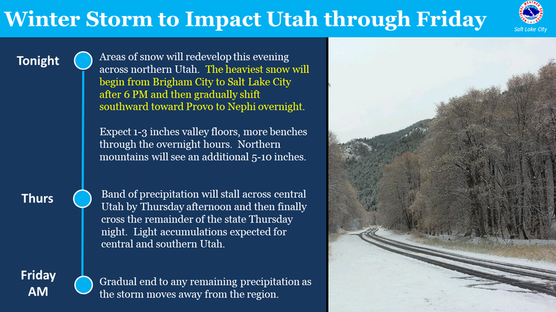
Thursday morning, March 26, 2020
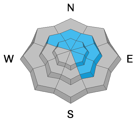
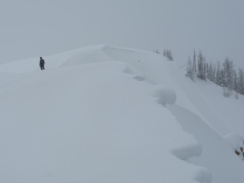
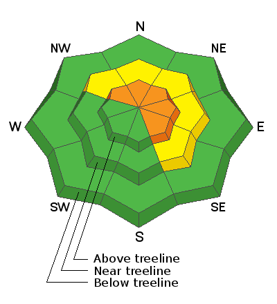
In the wind zone, at and above treeline, CONSIDERABLE avalanche danger exists in wind drifted terrain facing the north half of the compass. Human triggered avalanches are LIKELY, especially on steep leeward slopes, particularly those with an easterly component to its aspect. And remember.... any slide triggered may break deeper and wider than you might expect.
In addition, strong winds drift snow onto mid elevation slopes where you'll find MODERATE avalanche danger. Human triggered avalanches are POSSIBLE on steep slopes with recent deposits of wind drifted snow.
Lose some elevation, you lose the problem, and still have a great day of riding. Wind sheltered mid and low elevation terrain offers generally LOW avalanche danger.
Low
Moderate
Considerable
High
Extreme
Learn how to read the forecast here
Special Announcements
UAC operating schedule - We will continue issuing regular avalanche forecasts into mid April.
Spring Awareness Campaign - The UAC counts on donations from the backcountry community. We know these are uncertain times and any donation during our awareness campaign will help us continue providing avalanche forecasting and education.
CDC Guidelines - Even in the backcountry and in parking lots, please follow CDC guidelines like limiting group size and keeping a distance of at least 6 feet from other people to protect yourself and others. Read the guidelines HERE.
Taking risks - Be extra conservative to avoid the risk of accidents which can stress the capacity of our medical system.
Skiing and riding at closed ski resorts - Some resorts allow access now and some do not. Please check HERE for the latest info on ski area access.
New to the backcountry (including riding at closed resorts) - Watch the award-winning, 15 minute Know Before You Go video, or take the 5-part, free online-learning series.
Weather and Snow
Yesterday-
From a professional standpoint, I'm slightly embarrassed that I totally underestimated yesterday mornings snowfall... and by a wide margin. From a stoke standpoint, I'm thinking... "you know, that under-forecast snowfall that now blows over the hood of my sled worked out rather well didn't it?" In either case... yesterday's storm blossomed right around 05:00, delivering close to a foot of very light density, in-yer-face kinda snow.
Currently-
Mostly cloudy skies hover over the region this morning while light snow falls, adding another couple of inches to yesterday's fluff. Temperatures are in the teens and low 20's. A bit of a buzz kill are the southwesterly winds which ramped up overnight, blowing in the 30's and 40's, gusting into the 60's along the high peaks. Good news though, the powder party might've changed, but it didn't get totally crashed. Lose some elevation and you'll find deep, cold snow on wind sheltered, mid elevation terrain
Lofty Lake Peak (11,186') showing overnight wind bump.
More Uinta weather network info is found here. Simply click on the Western Uinta tab.
For today-
Steady snow continues into mid morning, but becomes more showery by early afternoon as the storm shifts further to the south. Winds decrease, veer to the northwest, and becoming generally light by midday. High temperatures climb into the low 30's and dip into the teens overnight.
Futurecast-
The graphic above lays out the timeline for the next few days.
Recent Avalanches
Along the leeward side of upper elevation ridges, I found very tender, soft wind drifts, super reactive to my additional weight yesterday. Easily triggered from a safe location, fast moving, fresh snow avalanches ran surprisingly long distances, entraining a fair amount of fresh snow as they descended steep slopes.
To view additional trip reports and recent avalanche activity, simply click here.
Ad
Avalanche Problem #1
Wind Drifted Snow
Type
Location
Likelihood
Size
Description
You know the drill.... follow the wind and you'll find the avalanche. The image above shows wind blew from the left to right. Stripping snow from the windward side of the ridge and loading it onto leeward slopes.
I found yesterday's avalanche danger rather manageable, particularly in the morning and especially by choosing wind sheltered terrain that wasn't super steep, and yeah... I had a blast. But once I was in the wind zone and stepped up slope angles, the avy danger bumped up a notch or two. Of course, that was so yesterday when winds were still reasonable and there wasn't much fresh snow to blow around. However, now it's time to recalibrate because strong winds developed overnight and there's no shortage of light, fluffy snow available to whip up a fresh round of drifts that'll react to our additional weight.
With another shot of moisture headed our way and strong winds on tap for the next few hours, yesterday's soft drifts morph into today's stiff pieces of snow, which become more connected and begin breaking deeper and wider than we might expect. So, the key to riding safely today is... be flexible with your travels plans and adjust objectives if you're starting to see or feel obvious clues to unstable snow like shooting cracks, sudden collapses, or the biggest clue to avalanches and of course, that's avalanches!
General Announcements
The information in this forecast expires in 24 hours, but will be updated by 7:00 AM Friday Mar. 27th.
This forecast is updated daily by 7:00 AM.
In the mean-time, if you see or trigger an avalanche or just wanna let me know what you're seeing you can reach me directly at 801-231-2170
The information in this forecast is from the US Forest Service which is solely responsible for its content.