Join us at our 2nd Annual Blizzard Ball

Observation: Broads Fork/Mill B

Observation Date
12/28/2019
Observer Name
Staples / Meisenheimer
Region
Salt Lake » Big Cottonwood Canyon » Broads Fork/Mill B
Location Name or Route
Broads Fork to Mill B
Weather
Sky
Overcast
Precipitation
Light Snowfall
Wind Speed
Calm
Weather Comments
Cold and clear in the am, followed by increasing clouds and snowfall on our exit around 4pm. The truck at the s-curves had 3" of new snow on the hood at 430pm.
Snow Characteristics
New Snow Depth
10"
New Snow Density
Low
Snow Surface Conditions
Powder
Snow Characteristics Comments
It's 5 star conditions out there.
Red Flags
Red Flags
Poor Snowpack Structure
Red Flags Comments
We decided to head back into Broads Fork to gain more elevation and continue to look for weak faceted snow. Yesterday, I only made it to 8,800' and saw no signs of poor snowpack structure. However, after gaining just a few hundred feet more in elevation THERE IT WAS. We dug on a NE facing slope at 8,900' and found 140 cm snowpack with densities increasing from fist at the surface down to one finger hardness just above 10" of weak faceted snow. The facets were DRY and LOOSE. Our ECT produced no propagation. However, after removing all but a foot of snow above the weak layer and hitting it out of the shoulder we saw the column fully propagate across the weak layer. We decided to do a propagation saw test (video below) to see if it would easily propagate. Our score was 35/105. The main red flag is the simple existence of this weak faceted snow. All other red flags are negative (no recent avalanches, no collapsing or even recent reports of collapsing on this layer, it is generally buried >1m deep, ECT does not fracture in normal loading steps). We are keeping an eye on this layer for the future. With a large storm with lots of wind, we may see it come back to life and produce large avalanches.
Snow Profile
Aspect
Northeast
Elevation
8,900'
Slope Angle
20°
Comments
At 8,900' we did find a very poor snowpack structure. Total depth was about 140 cm with increasing densities down to the old weak Oct/Nov snow. ECTX and PST 35/105 were the tests we performed. It only took another couple hundred feet in elevation to find poor snowpack structure. Link to yesterday's observation can be found HERE.
Video
Photo: Mark Staples taking in a little exposure and appreciating the view into Stairs Gulch
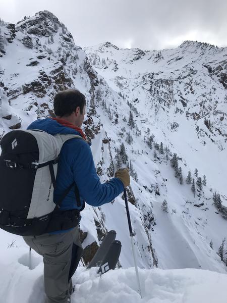
Despite a LOW danger below 9500 feet, we did find a poor snowpack structure. The weak layer is buried deeply which means it is slowly gaining strength and is harder to trigger an avalanche on this layer.
To stack the odds in our favor, we decided to avoid a direct entrance to the slide path and instead descended a ridge and entered the slide path just a bit lower to reduce the odds of triggering an avalanche. The upper part of the path is rocky, shallow, and much steeper.
Video
Winds have generally been light in many areas. However, in the distance, we could spot trees stripped of their snow which told us that winds had likely drifted snow and formed soft wind slabs that could avalanche.
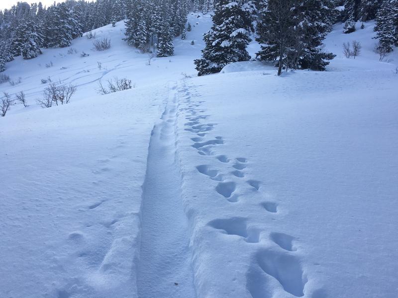
Winds had blown a little stronger in the morning which was evident by a small amount of snow that had drifted into the skin track.
Today's Observed Danger Rating
Low
Tomorrows Estimated Danger Rating
None
Coordinates