Greg Gagne
Forecaster
Our Week in Review highlights significant snowfall, weather, and avalanche events of the previous week. (Click here to review the archived forecasts for the Salt Lake mountains.)
The danger roses for the Salt Lake mountains from Friday, December 13 through Thursday, December 19, 2019:

Summary: A strong, windy, and wet storm system entered the region on Thursday, December 12, and by the time the system departed on Sunday morning, storm totals included:
- Little Cottonwood Canyon: 31" snow (3.6" water)
- Big Cottonwood Canyon: 35" snow (3.5" water)
- Park City ridgeline: 18" snow (2.0" water)
There were several natural and human-triggered avalanches over this past week. Sadly, the first avalanche fatality of the season occurred on Sunday, December 15 in Dutch Draw in the backcountry adjacent to the Canyons resort. More details on this accident appear below. Several of these avalanches have occurred in a persistent weak layer of faceted snow down near the ground. This weak layer can be found at mid and upper elevations facing northwest through north and northeast. This blog published by the UAC describes the origin of this weak layer, and why these northerly aspects are more dangerous than other aspects. By the middle of the week, field observations report the snowpack gaining stability.
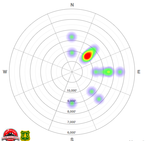
A heat map of avalanche activity over this past week which illustrates most avalanche activity occurring on northeast aspects at the mid and upper elevations. (A link to all avalanche observations.)

Friday, December 13 - By the end of the day, storm totals reach 24" in the upper Cottonwoods and 14-18" along the Park City ridgeline. Strong westerly winds accompany the heavy snowfall. Both natural and human-triggered avalanches are reported, including a close call in the Brighton backcountry on Figure 8 Hill with a partial burial and shoulder injuries (observation). This avalanche was 3' deep, failing on a persistent layer of weak faceted snow down near the ground. Another slide on the steep northerly run Paradise in Porter Fork where a skier, fortunately, was able to ski off to the side to avoid the avalanche (observation).

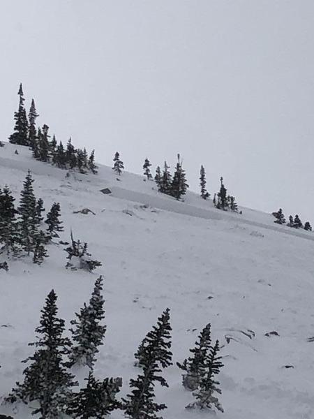
Saturday, December 14 - A cold front enters the region mid-day, accompanied by continued heavy snowfall and moderate to strong winds. Widespread avalanche activity within the storm snow, as well as avalanche failing in weak snow down near the ground. Some slides are triggered remotely (from a distance) such as the avalanche shown below which occurred along the Twin Lakes Pass ridgeline.

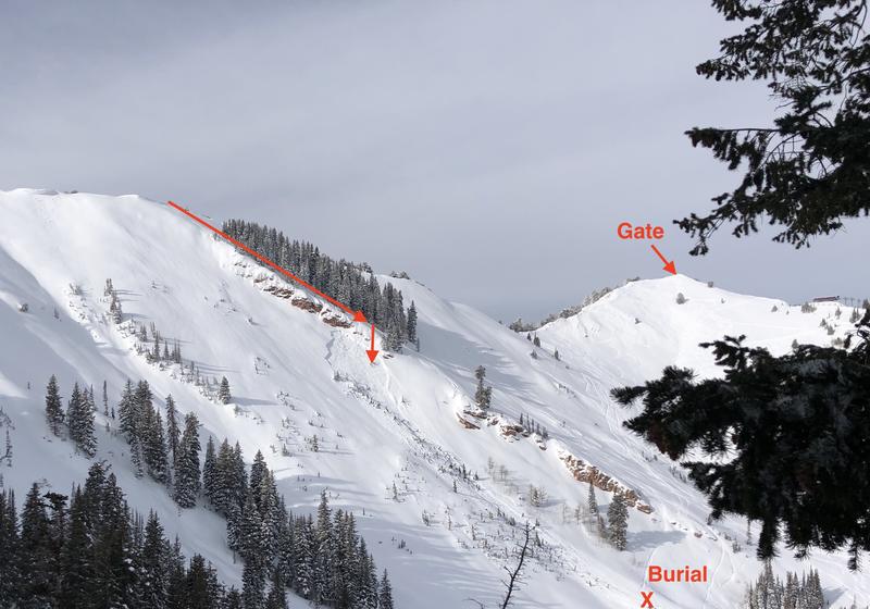
Sunday, December 15 - Sadly, an avalanche fatality in Dutch Draw in the backcountry adjacent to the Canyons Resort. The photo below shows the line of descent by the rider:

A video summary of the accident
The UAC report of the accident.
Please consider donating to the Matt Tauszik Memorial Fund to help Matt's wife and young son.
Monday, December 16 - A large avalanche (likely natural from a cornice fall) in Alexander Basin on Gobblers Knob. You can read the excellent observation by Nat Grainger. This slide was adjacent to another avalanche (observation) in Depth Hoar Bowl in Alexander Basin.

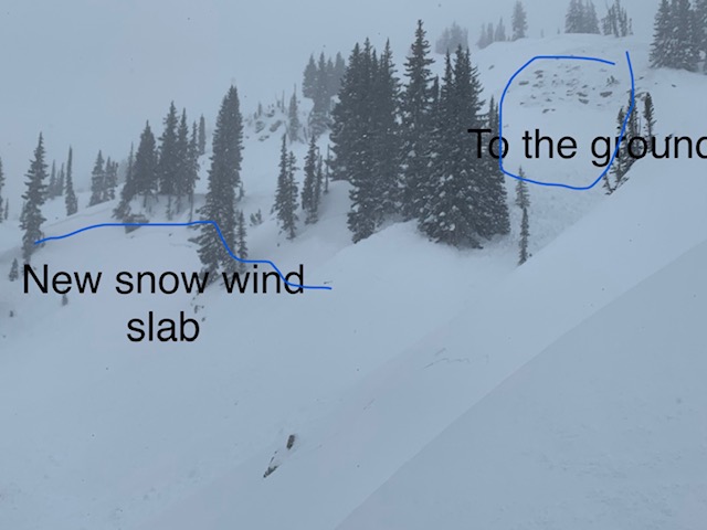
Tuesday, December 17 - Avalanche activity includes a wind slab in the Snake Creek drainage (observation) and control work at a Cottonwood resort results in another avalanche failing in weak snow down near the ground on a steep, upper elevation northerly slope.
Wednesday, December 19 - Southerly winds increase in exposed alpine terrain and upper elevation ridgelines. No backcountry avalanches are reported.
Thursday, December 19 - Warming temperatures and the snow surface weakens on shady aspects. No backcountry avalanches are reported.
Thanks for a great write-up!
Emmett (not verified)
Fri, 12/20/2019


