I'll be giving a free Know Before You Go avalanche awareness presentation Thursday, Dec 13, at 6:00 pm at the Grand County Library. Hope to see you there!
Also, check out the new free online
avalanche course series developed by the Utah Avalanche Center. This is a great way to refresh your skills or prepare you for a Backcountry 101 or Level 1 class.
Skies are mostly clear, southwesterly winds are on the increase blowing in the 20-30 mph range on Pre-Laurel Peak, and 10,000' temps are in the low 20's. A fast moving storm system will blow through to the north today binging us increasing clouds by this afternoon and a slight chance of snow. Blustery SW winds will average 15-20 mph with gusts as high as 40. High temps will be in the low 20's. High pressure returns for the weekend with models diverging on the next system that is expected to impact the region Monday-Tuesday. Long term forecasts currently show a ridge building over the desert southwest by late next week.
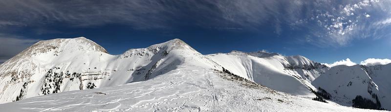
It's now been 10 days since the last storm cycle, and wind and sun have taken their toll on exposed snow surfaces. You'll have to work harder to find soft snow in sheltered locations. It's still low snow conditions out there and rocks and deadfall lurk just beneath the surface so be careful out there. Base depth in Gold Basin is 30".
Thanks to all who have sent in observations this week! Check out the full list
here.
It's been a week since we saw a round of natural activity when wind transported snow, from strong WSW winds, overloaded buried persistent weak layers, producing several avalanches up to 4' deep on N-E facing aspects.