


Forecast for the Moab Area Mountains

Issued by Eric Trenbeath on
Monday morning, December 10, 2018
Monday morning, December 10, 2018
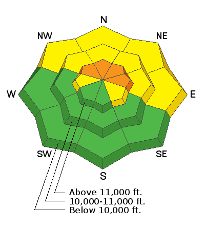
The avalanche danger remains CONSIDERABLE today on steep, upper elevation terrain that faces NW-N-E, and human triggered avalanches breaking down into buried, persistent weak layers are likely in these areas. At mid and lower elevations the danger is MODERATE, and human triggered avalanches are still possible on steep, northerly facing slopes that have buried, weak, faceted snow.
Low
Moderate
Considerable
High
Extreme
Learn how to read the forecast here
 Special Announcements
I'll be giving a free Know Before You Go avalanche awareness presentation Thursday, Dec 13, at 6:00 pm at the Grand County Library. Hope to see you there!
 Weather and Snow
Another day like this is on tap.
Skies are mostly clear, westerly winds are light, and 10,000' temps are in the mid teens. Today look for mostly sunny skies, light to moderate SW winds, and high temps at 10,000' near 30 degrees. A weak and splitting storm system will spread high clouds over our area later today and tonight. Another splitting system will move through the region on Wednesday
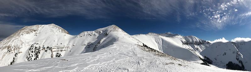
It's been more than a week since the last storm cycle,and wind and sun have taken their toll on exposed snow surfaces. Observers on Sunday however reported "fantastic" conditions on sheltered, low angle, northerly facing terrain. It's still low snow conditions out there and rocks and deadfall lurk just beneath the surface so be careful out there. Base depth in Gold Basin is 32".
Lots of folks have been out and about enjoying the early December snow, and much thanks to all who have sent in observations this week! Check them out here.
New snow totals in Gold Basin (10,000')
Snow totals at the Geyser Pass Trailhead (9600')
Wind, temperature, and humidity on Pre Laurel Peak (11,700')
National Weather Service point forecast.
 Recent Avalanches
In my travels on Saturday I was able to observe more natural activity from last weeks snow and wind event. Evidence of soft slabs and loose sluffs releasing in the storm snow last Sunday was abundant on steep, upper elevation terrain primarily facing NE. More importantly however, were avalanches with fractures up to 4' deep on steep slopes facing NW-N-NE. These likely occurred late Tues night or early Wed morning when strong WSW winds drifted snow overloading buried persistent weak layers. This was not a widespread cycle, and slopes with similar aspect and elevation still have the potential to avalanche with a human trigger.

Avalanche Problem #1
Persistent Weak Layer
Type
Location
Likelihood
Size
Description
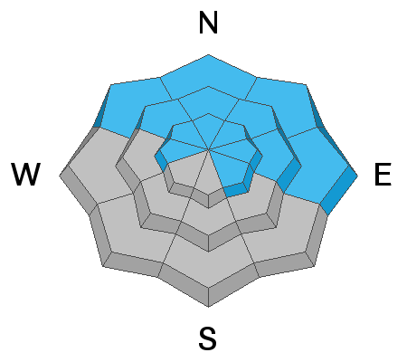
Observers continue to report collapsing in the snowpack. Snowpits continue to reveal a poor snowpack structure with last week's storm snow forming a slab over persistent weak layers of loose, sugary, faceted snow. These weak layers are present on any slope that has held snow since October - basically any slope above about 10,000' that faces NW-N-E. I consider this to be a dangerous situation with the likelihood for triggering an avalanche increasing with elevation. It's all about your terrain choices, and for the foreseeable future, local observers and I will be avoiding steep, northerly facing terrain. This excellent observation from Dave Garcia sums it up.
General Announcements
Volunteers from LUNA were up grooming over the weekend and it's game on for Nordic skiing!