

Forecast for the Uintas Area Mountains

Wednesday morning, February 28, 2018
Heads up- the avalanche danger might be slightly more pronounced from about Trial Lake to Strawberry.
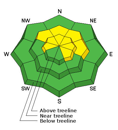
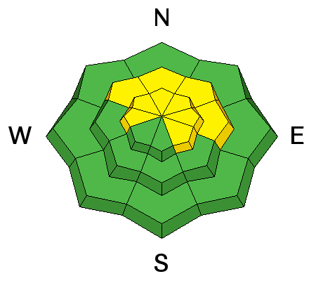
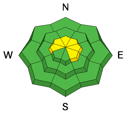
In mid and upper elevation terrain, especially in the wind zone at and above treeline, the avalanche danger is MODERATE. Human triggered avalanches are POSSIBLE on steep wind drifted slopes facing the north half of the compass, particularly those with an easterly component to their aspect. An avalanche triggered today can quickly get out of hand if it breaks into weak layers of snow, now buried deeper in our snowpack.
Lose some elevation or switch aspect and you'll find LOW avalanche danger on lower elevation, wind sheltered terrain and on most slopes facing the south half of the compass.
 Weather and Snow
Breif high pressure is giving us partly cloudy skies and temperatures in the single digits and low teens. Yesterday's midday wind bump mellowed overnight. Currently, west and southwest winds are blowing 15-25 mph along the high ridges. Recent winds have worked over some of our upper elevation terrain, but lose a little elevation and head to low angle, wind sheltered slopes and you'll be treated to some of the best riding and turning conditions all year.
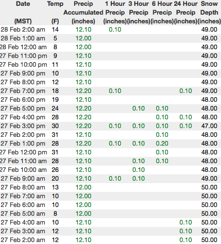
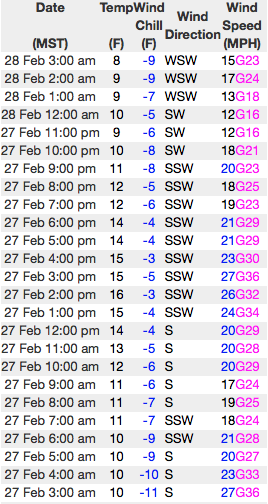
Above are 24 hour temperatures and snow depth from upper Trial Lake along with winds and temperatures from Windy Peak. More remote Uinta weather stations are found here
Ted was near Bald Mountain yesterday and found stable snow, good riding, and commented on how the big terrain is starting to fill in, but still remains a bit on the rocky side. More on is his travels here.
You can find a great body of recent trip reports, observations, and snow data here.
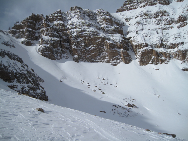
 Recent Avalanches
A couple of naturally triggered wind slabs yesterday in Upper Weber Canyon. Thanks to Shannon Finch for grabbing the image above.

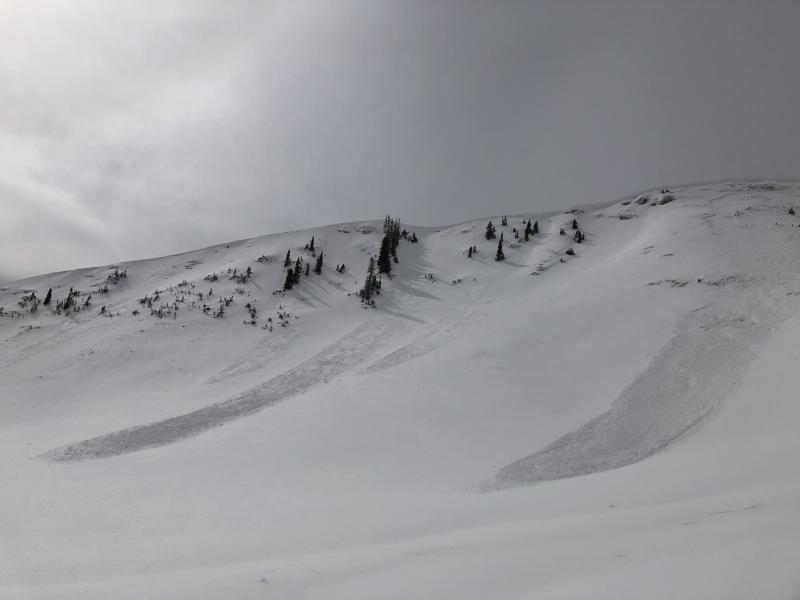
Persistent Weak Layer
Description
Definately big enough to catch your attention... the image above is a closeup of a slab from yesterday that broke into weak, sugary snow on a steep, shady slope. This avalanche dragon isn't healing any time soon and prime suspects include terrain that has already avalanched this year along with a vast majority of steep, shady slopes on the south half of the range. Terrain with these characteristics remains suspect and should be considered guilty until proven otherwise. Sounds complicated, but the answer is easy. The way we manage unpredictable avalanche dragons is to simply avoid where they live. So today you'll want to steer clear of steep, rocky, wind drifted slopes, especially if they've got a "trapdoor" or punchy feeling.
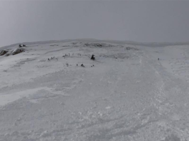
Wind Drifted Snow
Description
Today's drifts may be a little more stubborn, but still have the possibility to break into several storms worth of snow. Once triggered, they'll pack a punch and could definately boss you around. You can ride safely today by... being on the lookout for clues to unstable snow such as shooting cracks. In addition, tweak small test slopes like road banks and see how they're reacting before getting into steep, commiting terrain. And finally, consider avoiding fat, rounded pillows of snow, especially if they sound hollow like a drum.
Additional Information
Expect thinning clouds this morning, revealing a beautiful day in the mountains. High temperatures rise into the upper 20's and winds remain relatively light, blowing in the teens and 20's along the high ridges. Light snow and strong winds develop on Thursday with a good looking storm sliding into the region Friday. Heavy snow and continued strong winds are on tap for Friday with a cold front swinging through the region late Friday night and snow continuing into Sunday. We're looking at a foot plus storm totals.
General Announcements
The information in this advisory expires 24 hours after the date and time posted, but will be updated by 7:00 AM Thursday March 1st, 2018.
If you're getting out and about, please let me know what you're seeing especially if you see or trigger and avalanche. I can be reached at [email protected] or 801-231-2170
It's also a good time to set up one of our very popular avalanche awareness classes. Reach out to me and I'll make it happen.
This information does not apply to developed ski areas or highways where avalanche control is normally done. This advisory is from the U.S.D.A. Forest Service, which is solely responsible for its content. This advisory describes general avalanche conditions and local variations always occur.