Forecast for the Provo Area Mountains

Issued by Evelyn Lees for
Sunday, February 25, 2018
Sunday, February 25, 2018
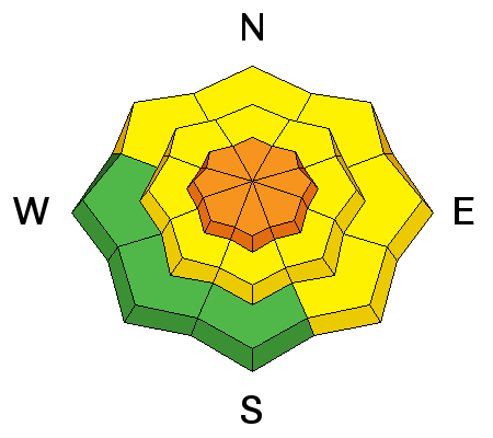
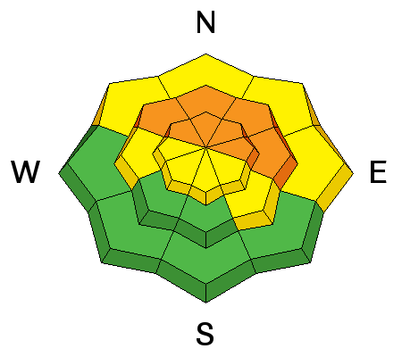
The avalanche danger is CONSIDERABLE on all steep, upper elevation slopes, especially those with recent wind drifts, and on many steep mid elevation slopes. Other steep slopes have a MODERATE danger. Complex and dangerous avalanche conditions exist – cautious route finding, careful snow pack evaluation and conservative decision making essential.
You will find better and safer skiing and riding conditions on lower-angled wind sheltered slopes. But be aware of what's above you and avoid travel below steep slopes.
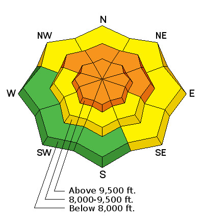
Low
Moderate
Considerable
High
Extreme
Learn how to read the forecast here