Forecast for the Uintas Area Mountains

Craig Gordon
Issued by Craig Gordon for
Friday, February 23, 2018

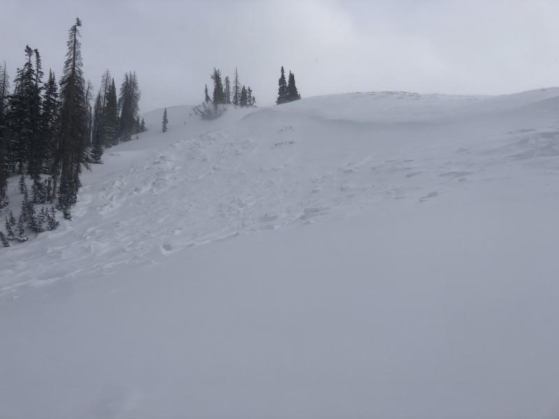
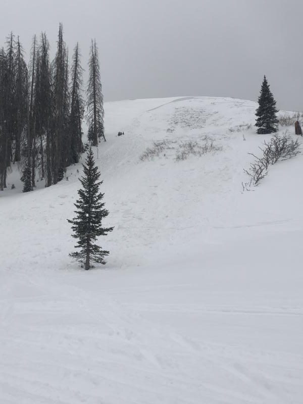
Heads up- the avalanche danger might be slightly more pronounced from about Trial Lake to Strawberry.

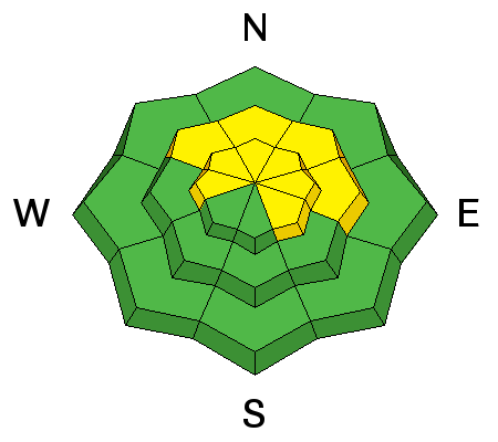
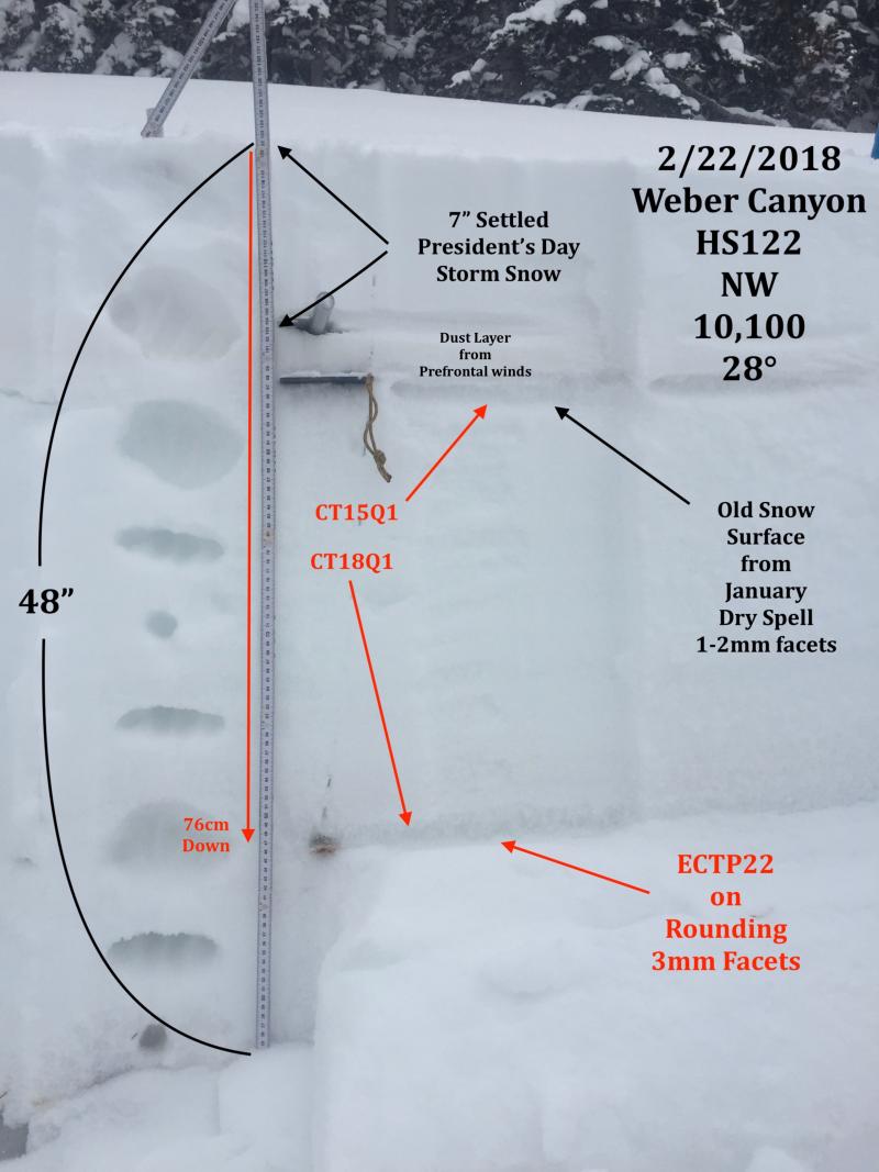
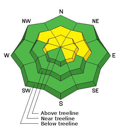
In mid and upper elevation terrain, especially in the wind zone at and above treeline, the avalanche danger is MODERATE. Human triggered avalanches are possible on steep wind drifted slopes, facing the north half of the compass, particularly those with an easterly component to their aspect. An avalanche triggered today can quickly get out of hand if it breaks into weak layers of snow, now buried deeper in our snowpack.

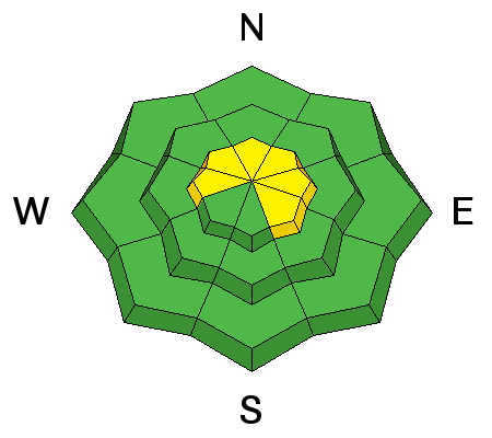
Lose some elevation or switch aspect and you'll find LOW avalanche danger at lower elevation wind sheltered terrain and on most slopes facing the south half of the compass.

Low
Moderate
Considerable
High
Extreme
Learn how to read the forecast here
Weather and Snow

Skies are mostly cloudy and temperatures have warmed into the single digits.. a couple degrees warmer than yesterday morning at this time. However, with southerly winds blowing 15-20 mph along the high ridges, there's still a bite in the air and wind chill values register right around -20 degrees. Sunday's storm snow has settled somewhat and riding conditions remain excellent, especially on wind sheltered, shady slopes.

Above are 24 hour temperatures and snow depth from upper Trial Lake along with winds and temperatures from Windy Peak. More remote Uinta weather stations are found here

You can find a great body of recent trip reports, observations, and snow data here.


Recent Avalanches


Tyler St. Jeor was stomping around Currant Creek yesterday and found this recently triggered slide on a steep, wind loaded slope near Tower Mountain. More on his travels here.

Ad
Avalanche Problem #1
Persistent Weak Layer
Type
Location
Likelihood
Size
Description

JG's beautiful pit profile clearly illustrates where the pack is deep, it's comfortable in its own skin and can take a good thump. His take was... "Feeling like the snowpack is gaining strength but the persistent slab issue in your face doesn't inspire confidence to jump into steeper terrain." Sage advice fo sho.

However, where the pack is shallow, (like this older slide pictured above near Currant Creek that Tyler found yesterday) the jury is still out. Suspect areas include terrain that has already avalanched this year along with a vast majority of steep, shady slopes on the south half of the range... from about Trial Lake through Strawberry. As always in this case, the best offense is a good defense. Simply avoid steep, rocky, wind drifted slopes, especially if they've got a "trapdoor" or punchy feeling.

Avalanche Problem #2
Wind Drifted Snow
Type
Location
Likelihood
Size
Description

A storm is approaching and snow begins later today. No... winds won't get too crazy, but the fact is, there's no shortage of light snow avaiilable for transport. Today's drifts will be manageable in size and depth, but you could none-the-less get surprised on steep leeward slopes or near the entrances of steep chutes where even a small wind drift could take you for an unexpected ride. While not widespread, it's not completely straiight-forward and today you'll want to gather as much information as possible. Be on the lookout for clues to unstable snow such as shooting cracks and tweak small test slopes like road banks and see how they're reacting before getting into steep, commiting terrain.

Additional Information

We can expect cloudy skies with snow developing later today. Accumulations should be in the 4"-8" range. High temperatures only reach into the low teens with overnight lows near zero. West and northwest winds blow 15-25 mph along the high ridges. A break in the action is slated for Saturday and then another fast moving system crosses the area late Saturday afternoon through Saturday night bringing another round of snow.

General Announcements

The information in this advisory expires 24 hours after the date and time posted, but will be updated by 7:00 AM Saturday February 24th, 2018.

If you're getting out and about, please let me know what you're seeing especially if you see or trigger and avalanche. I can be reached at [email protected] or 801-231-2170

It's also a good time to set up one of our very popular avalanche awareness classes. Reach out to me and I'll make it happen.

This information does not apply to developed ski areas or highways where avalanche control is normally done. This advisory is from the U.S.D.A. Forest Service, which is solely responsible for its content. This advisory describes general avalanche conditions and local variations always occur.