Sign Up for the Utah Snow and Avalanche Workshop (USAW) on December 7th!

Forecast for the Logan Area Mountains

Toby Weed
Issued by Toby Weed on
Saturday morning, November 16, 2013

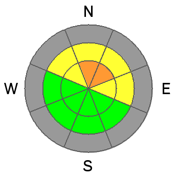
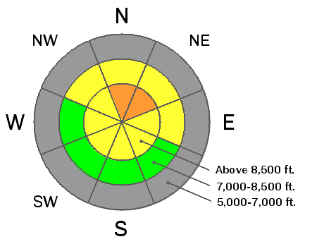
New snow yesterday and overnight drifting from southwest winds created heightened avalanche conditions at upper elevations in the backcountry. This morning there is a MODERATE ( or level 2) danger on drifted upper elevation slopes, and you could trigger fresh wind slab avalanches in steep terrain. Heavy snowfall and continuing westerly wind will cause the danger to increase and become more widespread. Storm snow and persistent slab avalanches will become possible in steep upper elevation terrain as heavy new snow piles up today and will most likely occur on smooth slopes with preexisting weak snow. The danger on some upper elevation north facing slopes could rise to CONSIDERABLE (level 3) by afternoon, with triggered avalanches becoming likely and naturals possible. Avoid steep drifted slopes, especially those facing the northern quarter of the compass at upper elevations.
Low
Moderate
Considerable
High
Extreme
Learn how to read the forecast here
Weather and Snow

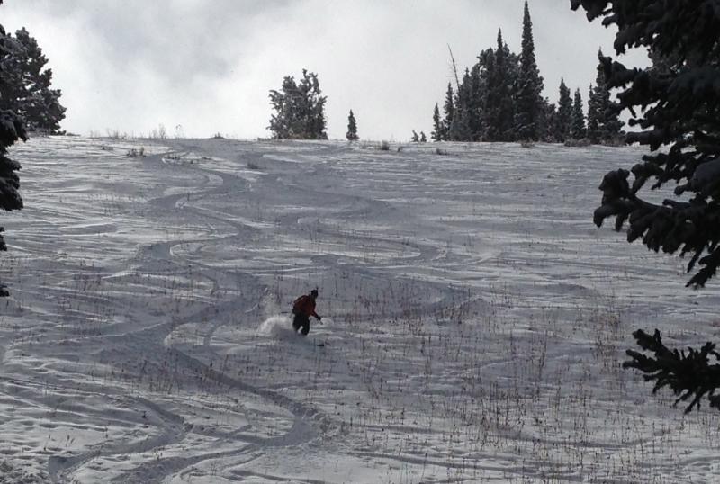
There is only 9 inches of total snow at the 8400' Tony Grove Snotel, containing 1.5 inches of water equivalent, which is a bit less then 50% of average for the date. It's 22 degrees up at 8400' and 16 up at the 9700' Logan Peak weather station where a southwest wind is averaging in the upper teens after posting a 44 mph high gust earlier this morning. There's still not really enough snow to cover the rocks in most areas yet, but we found some smooth terrain above the Tony Grove Campground yesterday where we could do a few turns... The Tony Grove Road is not maintained for wheeled travel in the winter, and today's storm will likely make the drive a bit tricky.

It's a good time to check your avalanche rescue equipment, change to fresh batteries in your beacon, and test it's range. Refresh yourself and your partners with easy rescue scenarios while the snow is still shallow. History shows that early season avalanches are not uncommon in the area, and you might as well start the winter season on top of your game.

Check out my video observation from Monday, November 11....... HERE

Recent Avalanches

No avalanches have yet been reported in the backcountry around Logan

Ad
Avalanche Problem #1
Persistent Weak Layer
Type
Location
Likelihood
Size
Description

With last night's southwest winds, there are probably some fresh and sensitive wind slabs in exposed upper elevation terrain this morning. You could trigger a fresh wind slab avalanche on a steep drifted slope, especially in a terrain feature like a gully or scoop that has old faceted snow as a basal layer. Keep in mind that with such shallow snow cover, a ride in even a small avalanche will likely be fairly dangerous this weekend.

Avalanche Problem #2
New Snow
Type
Location
Likelihood
Size
Description

The danger of storm snow avalanches will rise significantly on steep slopes as heavy snow starts to pile up with today's storm at upper and mid elevations. Loose snow avalanches or sluffs are likely in steep terrain, and the danger of human triggered soft slabs will rise throughout the day. Watch for obvious signs of instability like fresh avalanche activity or cracking within the new snow....

Avalanche Problem #3
Loose Dry Snow
Type
Location
Likelihood
Size
Description

The shallow old snow from the Halloween storms remained on upper elevation north facing slopes, and it has become very weak and faceted.... Today's storm will probably create a nice slab on some slopes that will overload this existing weak snow. Triggered soft slab avalanches releasing within the sugary old snow are possible, especially on smooth upper elevation slopes. The danger of persistent slabs will increase significantly during the day, and could rise to CONSIDERABLE in some areas by evening if we reach today's forecast snow amounts and the wind continues to drift it into avalanche starting zones. Persistent slab avalanches could be triggered remotely, from a distance or worse from below....

Additional Information

Expect a nice winter storm in the mountains today with 10 to 16 inches of accumulation forecast and strengthening southwest winds. High temperatures at 8500' should stay around 20 degrees today, with tonight's lows around 17. Winds will continue to increase tonight and several more inches of accumulation is likely. It'll be breezy and cold tomorrow in the mountains, and snow showers should taper off in the morning. Expect fair weather on Monday, becoming unsettled again Tuesday and through the remainder of the work week.

Check out our one stop weather page........HERE

General Announcements

Our annual "Pray for Snow" fundraiser/party is scheduled for the evening of December 5 at the Italian Place in downtown Logan, and you are invited, so save the date.

Sign up early for one of our life-saving avalanche classes.......HERE And refresh your avalanche knowledge, check out some of our tutorials........HERE

Stay tuned for my early season intermittent updates, and I'll start issuing regular backcountry advisories as soon as there is enough snow for you to get out on.