Forecast for the Uintas Area Mountains

Craig Gordon
Issued by Craig Gordon for
Tuesday, April 2, 2019
The avalanche danger will rise accordingly with the incoming storm. For today though, the avalanche danger is LOW with both human triggered and natural avalanches UNLIKELY.
Low
Moderate
Considerable
High
Extreme
Learn how to read the forecast here
Special Announcements
When the forecasting ends, the UAC’s work keeps going strong. Summer is a busy time for the UAC. During the summer we are working hard on our fall and winter planning; putting together the Fall Fundraiser and USAW; updating our awareness and education programs; this summer we will be finishing up the website redesign project. Your donation shows you’re invested in this community all year round! You can still be part of the UAC’s success in 2019. Consider making a donation HERE by April 8.
Weather and Snow
Clouds drifted into the area overnight ahead of stormy weather slated to roll into the region later today. In the meantime, temperatures register in the 20's and southerly winds blow 15-25 mph along the high peaks. Riding and turning conditions remain quite good in upper elevation terrain facing the north half of the compass.... however getting there might be a little rugged first thing out of the gates this morning.
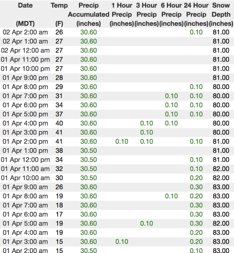
Above is hourly data from Trial Lake (9,945')
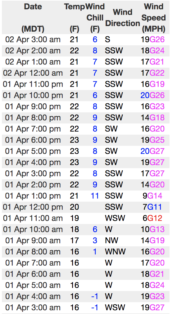
And Windy Peak (10,662')
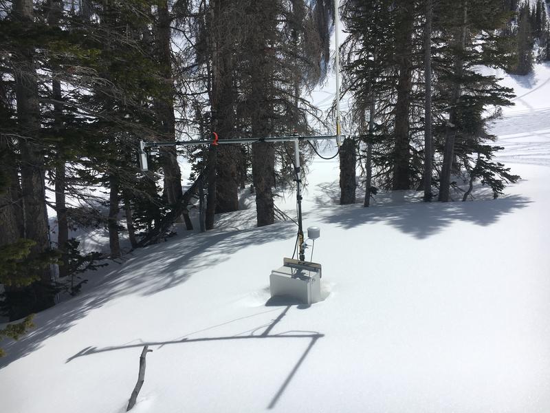
Doing some weather station maintenance yesterday... you know it's a big year when the snow depth site in Upper Moffit Basin is nearly buried :)
To view more regional weather stations click here.
Recent Avalanches
Other than this heat induced wet slide I found yesterday on a steep, mid elevation, sun baked slope... it's been pretty quiet on the eastern front.
Recent trip reports and avy activity found HERE.
Ad
Avalanche Problem #1
Normal Caution
Type
Location
Likelihood
Size
Description
The snowpack is pretty comfortable in its own skin and in general, the avalanche danger is LOW. However, as our next storm begins to take shape, be aware that upper elevation north facing terrain harbors a variety of weak snow surfaces... not a big deal at the moment because we're missing a slab. However, as the storm materializes we'll want to keep a close eye on both storm totals along with wind speed and direction.
Additional Information
A storm system slides into the region throughout the day, producing snow showers late this afternoon which intensify overnight. Today, look for mostly cloudy skies, temperatures rising into the upper 30's, and increasing southwest winds, blowing in the 30's and 40's by around dinnertime. This isn't a big snow producer, but I think 6"-10" is a good bet by Wednesday afternoon when the storm winds down.
General Announcements
The information in this advisory expires 24 hours after the date and time posted, but will be updated by 7:00 AM Wednesday April 3rd, 2019.
If you're getting out and about, please let me know what you're seeing especially if you see or trigger and avalanche. I can be reached at [email protected] or 801-231-2170
It's also a good time to set up one of our very popular avalanche awareness classes. Reach out to me and I'll make it happen.
This information does not apply to developed ski areas or highways where avalanche control is normally done. This advisory is from the U.S.D.A. Forest Service, which is solely responsible for its content. This advisory describes general avalanche conditions and local variations always occur.