Forecast for the Uintas Area Mountains

Issued by Craig Gordon on
Wednesday morning, March 12, 2025
Wednesday morning, March 12, 2025
With a solid shot of snow, water, and wind headed our way, expect changing avy danger in the next 36 to 48 hours-
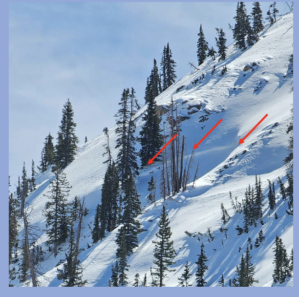
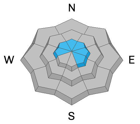
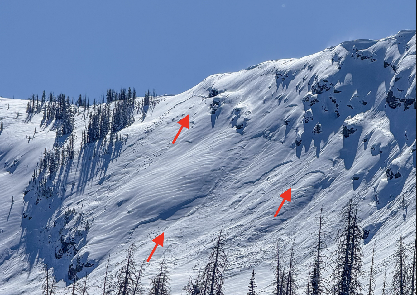
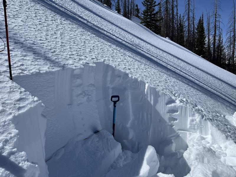
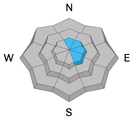
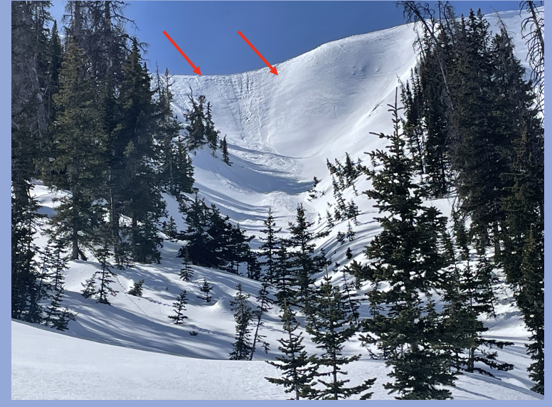
For today, MODERATE avalanche danger is found on upper elevation slopes facing the north half of the compass. Becoming pockety and more difficult to initiate, human-triggered persistent slab avalanches breaking deeper and wider than we might expect are still POSSIBLE. Steep, rocky terrain with a shallow snowpack fits the bill for slopes to avoid. While the snow feels solid under our feet, remember... unusually weak snow still lingers in the snowpack on upper elevation, shady slopes.
In addition, steep, upper elevation slopes, especially those in the windzone, offer MODERATE avalanche danger where it's POSSIBLE to trigger fresh wind-drifts on the leeward side of ridges, particularly those with an easterly component to their aspect.

Low
Moderate
Considerable
High
Extreme
Learn how to read the forecast here