March Kicks Off Our Spring Campaign- Donate Now to Support Forecasting

Forecast for the Uintas Area Mountains

Craig Gordon
Issued by Craig Gordon on
Thursday morning, March 12, 2020
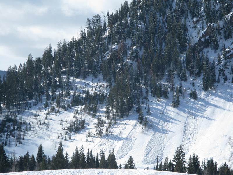
The avalanche danger is generally is LOW this morning on all slopes. However, nearly all terrain takes on heat today and the danger of wet slides and sluffs increases to MODERATE. As temperatures rise, human triggered avalanches are possible on steep sun-baked slopes, especially as the day wares on.
Low
Moderate
Considerable
High
Extreme
Learn how to read the forecast here
Special Announcements
Save the date and bring a date! Please join me at Backcountry HQ in Park City, tonight, Thursday March 12th, beginning at 6:30. I'll lead an interactive discussion on current Wasatch snowpack conditions, a recap of this season’s close calls and accidents, how to stay on the right side of the fracture line, and predictions for the rest of the season. It's a free gig, but space is limited and registration is required. Click here to reserve a space.
Weather and Snow
Currently-
If you blinked, you probably missed last nights weak storm which delivered just about an inch of snow along the high peaks. Skies cleared in the past few hours and temperatures dropped slightly, currently registering in the upper 20's and right around freezing at the trailheads. West and southwest winds are a nuisance, blowing 30-50 mph along the ridges. It's a mixed bag of snow conditions. Up high you'll find a narrow wedge of dry, cold snow on north facing terrain, and sunny slopes down low offer a short-lived supportable corn-like surface. In between... it's every man for himself.
Uinta weather network info is found here. Simply click on the Western Uinta tab.
For today-
Look for mostly sunny skies with temperatures climbing into the 40's. Southerly winds blow in the 40's along the high peaks.
Futurecast-
Winds ramp up even more late Friday with stormy weather returning for next week.
Recent Avalanches
No significant avalanche activity to report.
To view additional trip reports and recent avalanche activity, simply click here.
Ad
Avalanche Problem #1
Wet Snow
Type
Location
Likelihood
Size
Description
The image above clearly illustrates how damp snow can fan out and entrain even more snow as it descends a steep slope.
The snowpack will get its first taste of strong spring sunshine and the danger of wet slides and sluffs increases on all quadrants of the compass and all elevations as the day wares on. Remember- if you're feeling like an ant under a magnifying glass, so is the snow. (Of note... no ants were injured during the use of this analogy :)
Here's the good news... wet avalanches are a straight-forward and easy avalanche problem to avoid. As daytime temperatures climb and the snow get damp, manky, or unsupportable, simply get off and out from under steep, sun-baked slopes. In addition, you'll want to avoid terrain traps like gullies and road cuts where wet, cement-like snow can stack up very deeply.
Additional Information
If you want pow... head south!
General Announcements
The information in this forecast expires in 24 hours, but will be updated by 7:00 AM Friday Mar. 13th.
This forecast is updated daily by 7:00 AM.
In the mean-time, if you see or trigger an avalanche or just wanna let me know what you're seeing you can reach me directly at 801-231-2170
This is a great time of year to schedule one of our free avy awareness presentations.
You can email me directly [email protected]
The information in this forecast is from the US Forest Service which is solely responsible for its content.