March Kicks Off Our Spring Campaign- Donate Now to Support Forecasting

Forecast for the Uintas Area Mountains

Craig Gordon
Issued by Craig Gordon on
Wednesday morning, March 11, 2020
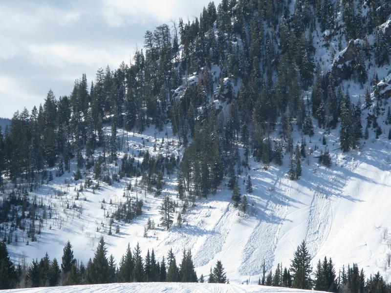
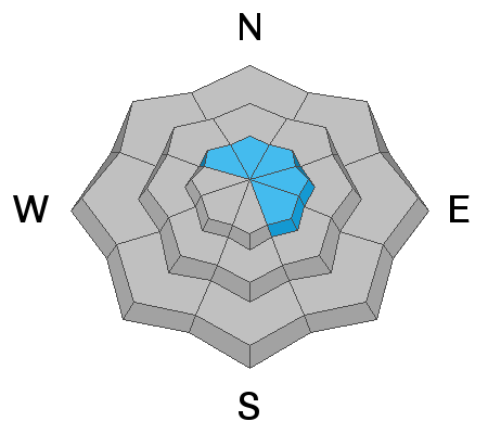
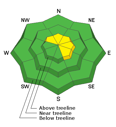
In the wind zone, at and above treeline, a narrow wedge of MODERATE avalanche danger exists. Human triggered avalanches are possible on steep wind drifted, upper elevation slopes, especially those with an easterly component to their aspect. And here's something to consider... if you're getting into steep, technical terrain, even a small slide can knock you off your ride, slam you into a tree, and throw a curve ball at your day.
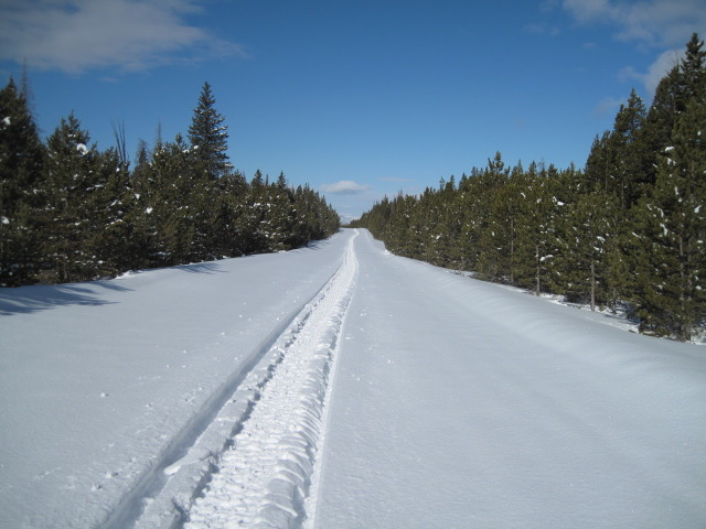
Lose a little elevation, you lose the wind and you'll encounter generally LOW avalanche danger.
Low
Moderate
Considerable
High
Extreme
Learn how to read the forecast here
Special Announcements
Save the date and bring a date! Please join me at Backcountry HQ in Park City, this Thursday March 12th, beginning at 6:30. I'll lead an interactive discussion on current Wasatch snowpack conditions, a recap of this season’s close calls and accidents, how to stay on the right side of the fracture line, and predictions for the rest of the season. It's a free gig, but space is limited and registration is required. Click here to reserve a space.
Weather and Snow
Currently-
Skies are clear and temperatures dipped into the teens and low 20's overnight, where they sit this morning. Southwest winds blow in the 20's and 30's along the high peaks. The March sun is high in the sky and most low elevation terrain around the compass took on heat. However, gain some elevation, head to wind sheltered shady terrain, and you'll be rewarded with cold, shallow, creamy snow.
Uinta weather network info is found here. Simply click on the Western Uinta tab.
For today-
High clouds drift through the region offering the possibility for scattered snow showers, especially this afternoon. Winds diminish as the day progresses and high temperatures climb into the mid 30's.
Futurecast-
Dry and warm for Thursday. Looking into the crystal ball... a change in the weather pattern begins late Sunday with computers models suggesting a return to cold and stormy weather for most of next week.
Recent Avalanches
Unfortunately, my field day was preempted by a faulty throttle cable. But through the windshield of frustration and the mantra of "we are where we're supposed to be"... I spotted a few damp sluffs on steep, lower elevation slopes in Weber Canyon. Otherwise, no significant avalanche activity to report.
Meanwhile, Ted was on the east side of the range and found mostly stable snow with miles of smiles in untracked terrain. More on his travels here.
To view additional trip reports and recent avalanche activity, simply click here.
Ad
Avalanche Problem #1
Wind Drifted Snow
Type
Location
Likelihood
Size
Description
A few lingering drifts sensitive to our additional weight are found on the leeward side of upper elevation ridges and once triggered, they're large enough to catch your attention. Not particularly widespread, but remember... if you're tagging steep, technical terrain, be aware that even a small slide could knock you off your feet and boss you around. So, the ticket to riding safely today is simply look for and avoid any fat, rounded piece of snow, especially if it sounds hollow like a drum.
General Announcements
The information in this forecast expires in 24 hours, but will be updated by 7:00 AM Thursday Mar. 12th.
This forecast is updated daily by 7:00 AM.
In the mean-time, if you see or trigger an avalanche or just wanna let me know what you're seeing you can reach me directly at 801-231-2170
This is a great time of year to schedule one of our free avy awareness presentations.
You can email me directly [email protected]
The information in this forecast is from the US Forest Service which is solely responsible for its content.