Donate to the 2024 Spring Campaign to help rebuild the UAC website.

Forecast for the Uintas Area Mountains

Craig Gordon
Issued by Craig Gordon for
Friday, March 10, 2023
Heads up.... avalanche danger rose significantly overnight and will continue that trend as a powerful storm sets its sights on the region-
For today, CONSIDERABLE avalanche danger is found on steep, mid and upper elevation leeward slopes at and above treeline. Human triggered avalanches are LIKELY, especially in the wind zone on drifted terrain facing the north half of the compass, and particularly on slopes with an easterly component to its aspect.
Dense heavy snow, possibly mixed with rain, creates MODERATE avalanche danger at lower elevations and human triggered avalanches are POSSIBLE on all steep, snow covered slopes... think foothills and trailheads.

Low
Moderate
Considerable
High
Extreme
Learn how to read the forecast here
Special Announcements
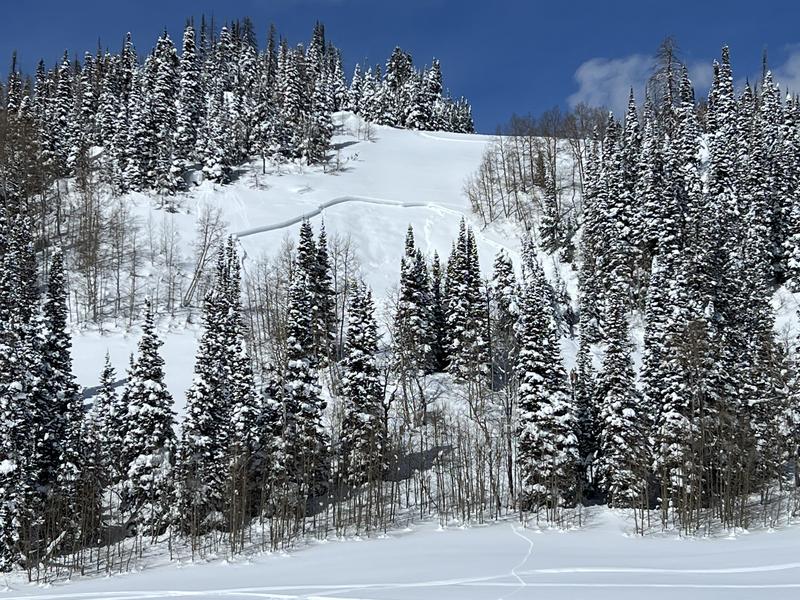
I am deeply saddened to report a very tragic avalanche accident. Two skiers were caught and buried in a large avalanche in Upper Weber Canyon yesterday. One skier was successfully rescued and survived. Sadly, the second skier was buried deeper and did not survive. A preliminary report is available
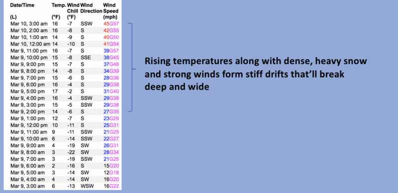
 HERE.
Weather and Snow
Nowcast- A thick band of clouds slide into the area this morning, delivering a light coat of white paint across the region. Temperatures are mild, registering in the teens and upper 20's, nearly 10 degrees warmer than yesterday at this time. Southerly winds stole the show at the turn of the new day, blowing 40-60 mph near the high ridges, and continue in that spirit early this morning. A good shot of cold snow is on the way, so it's a good day to get some chores done and gear up for a deep weekend.
Forecast- A rough and rowdy atmospheric river brings rising snow levels and warming temperatures throughout the day. We can expect 3"-6" of very dense snow as temperatures climb into the mid 30's. South and southwest winds crank into the 70's.
Futurecast- A cold front arrives around 8:00 tonight, delivering cooler air along with a switch to west and northwest winds and a decrease in velocity. Snowfall rates quickly diminish after midnight, becoming light and showery. A foot of snow is a good bet by Saturday morning.
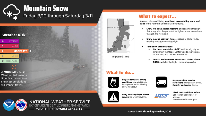
Our good friends and partners at the NWS lay out the timeline for our incoming storm in the graphic above.
Detailed trip reports and recent obs are found HERE.
Recent Avalanches
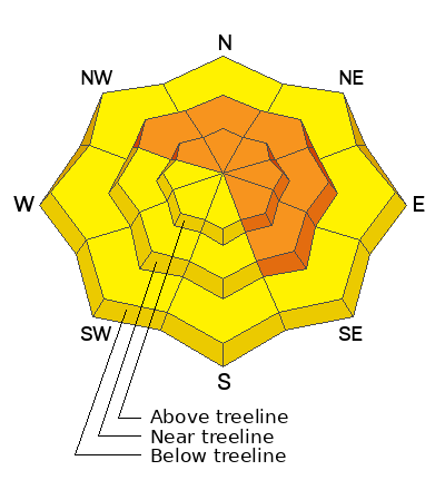
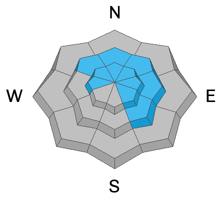
Remotely triggered Wednesday in Mill Hollow, a small pocket on a southeast facing slope at 9,400'. The heads up here is a trend that mimics the Wasatch from earlier this week and yesterday's accident as well. I often think southeast aspects in the Uinta's have a little more polar, than solar to their snow structure and with a robust storm to round out the work week, we might wanna keep an eye on this aspect.
Otherwise, plenty of avy activity to peruse if ya wanna geek out... click HERE to track this years slide activity throughout the range.
Ad
Avalanche Problem #1
Wind Drifted Snow
Type
Location
Likelihood
Size
Description
Winds are always the game changer for the Uinta's and today's storm isn't going to break the mold. As winds continue cranking and snow stacks up, steep, wind drifted slopes, especially those facing the north half of the compass are bulls-eye terrain and will react to our additional weight. And while our snowpack is relatively strong, dense heavy storm snow coupled with raging winds will reveal any weaknesses or chinks in the armor, so today's avalanches will break deeper and wider than you might expect. In addition, with more snow on the way and several layers of storm snow to work with there's enough volume to easily knock to off your feet and take you for an unexpected ride. If your objective is tagging sustained steep terrain, please consider the consequences of triggering a slide and have an exit strategy in place. No mystery here as this avalanche dragon is straight-forward and easy to avoid. Lose the wind and you lose the problem.

Avalanche Problem #2
New Snow
Type
Location
Likelihood
Size
Description
Dense heavy snow mixed with white rain begins overloading pre-existing snow at all elevations and will react to our additional weight. That means we need to think about avoiding steep slopes across the board, even at lower elevations around our trailheads.
Additional Information
Weather stations-
And... rime events from January's atmospheric rivers severely crippled the Uinta weather station network. I'm working to get it back up and running, but a few stations are found HERE (click weather stations, and then on the Western Uinta tab)
Observations-
Your observations are important, so please let me know what you're seeing... click HERE and contribute to this amazing community-based program
General Announcements
Issued at 03:23 on Friday March 10th this forecast expires 24 hours after the date and time posted, but will be updated by 07:00 Saturday March 11th 2023.
Before it gets too crazy, now is the time to book an avalanche awareness presentation for your group, club, or posse. You can reach Craig directly at 801-231-2170 or [email protected].

This forecast is from the U.S.D.A. Forest Service, which is solely responsible for its content. This forecast describes general avalanche conditions and local variations always occur.