March Kicks Off Our Spring Campaign- Donate Now to Support Forecasting

Forecast for the Uintas Area Mountains

Craig Gordon
Issued by Craig Gordon on
Saturday morning, February 29, 2020
It's a virtual sea of LOW avalanche hazard across the range, but that doesn't necessarily mean GREEN light, tag it if it's white conditions. Sure, climbing is easy right now, but a few lingering drifts in the wind zone may catch you off guard and boss you around once initiated. So, if you're getting into steep, technical terrain, remember.... any slide triggered has the potential to break a bit deeper than expected, particularly on steep rocky slopes with a shallow, weak snowpack.
Low
Moderate
Considerable
High
Extreme
Learn how to read the forecast here
Special Announcements
The UAC's Avy Awareness Auction is currently underway with tons of great gear, jewelry, artwork and experiences available. Visit the auction page here to help support the UAC's spring avalanche awareness and outreach efforts.
Click here for more details.
And... a new version of the UAC IOS application is now available on the Apple App Store. This version fixes many of the issues that occur when running IOS 13.
Click here for more details.
Weather and Snow
Currently-
Overnight, high clouds drifted into the region ahead of a quick hitting system slated to slide through the range late tonight. Southerly winds bumped into the 20's and 30's late Friday afternoon and continued humming along the high ridges through the night. Current temperatures register in the low to mid 20's.
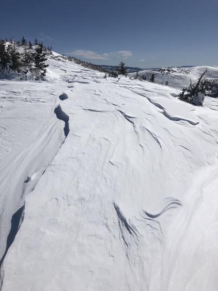
It's hit or miss out there. Recent winds blasted our high alpine terrain and there's a lot of old, hard, scratchy surfaces. But on a go-anywhere base, if you seek out mid elevation, wind sheltered slopes, you'll be rewarded with shallow, creamy snow.
Uinta weather network info is found here. Simply click on the Western Uinta tab.
For today-
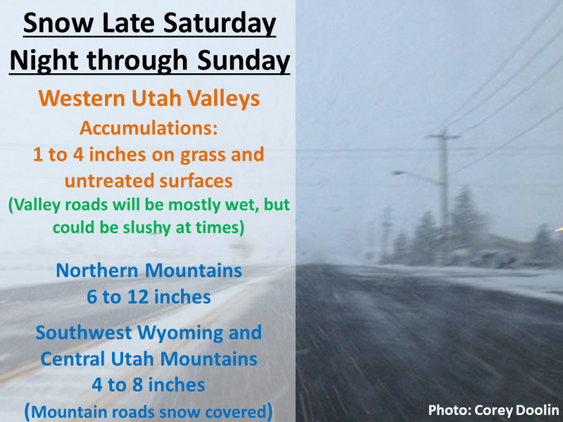
Clouds thicken, temperatures rise into the mid 30's, and southerly winds ramp up into the 30's and 40's along the high peaks. Snow begins late tonight and I think we should stack up 6"-10" by late Sunday afternoon.
Futurecast-
A break on Monday and then another shot of moisture slated for Tuesday, though it just looks like a weak brush-by, delivering only a few inches of snow.
Recent Avalanches
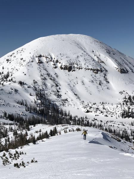
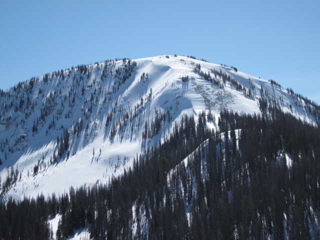
You came for the snow, but I encourage you to look around and stay for the scenery. UAC forecasters amongst the giants... Greg Gagne was near Bald Mountain Thursday and Ted Scroggin stomped around Moffit Peak Friday. Both report stunning views and a mostly stable snowpack. Trip reports and insight found here.
To view additional trip reports and recent avalanche activity, simply click here.
Ad
Avalanche Problem #1
Normal Caution
Type
Location
Likelihood
Size
Description
A few things to keep in mind in your travels today.
First-
While more the exception than the rule, repeater slide paths and terrain remaining shallow all season like steep, rocky slopes in the image above, continue producing pockety avalanches with a little nudging.
It's been several days since I've heard of any avalanches breaking to older layers in the snowpack and that's good news. However, snow is a curious medium and all we need to do is find one inconsistency or a shallow zone, maybe around a rock or bush, collapse the pack, and now we've got a bigger slide than we might've bargained for. So my safe travel strategy is to think about suspect terrain I want to continue avoiding and that includes steep, rocky terrain and slopes that avalanched near the ground earlier in the season.

Second-
Climbing is easy right now and if you're tagging steep, technical terrain, remember that even a small slide could knock you off your feet and boss you around. So, the ticket to riding safely today is simply look for and avoid any fat, rounded piece of snow, especially if it sounds hollow like a drum.
Additional Information
JG was in Upper Weber Canyon and posted one of his beautiful pit profiles. Common theme with all observations from avy pros across the range is we need to keep an eye on a crust/facet combo, now buried about a foot below the surface snow.
General Announcements
The information in this forecast expires in 24 hours, but will be updated by 7:00 AM Sunday Mar. 1st.
This forecast is updated daily by 7:00 AM.
In the mean-time, if you see or trigger an avalanche or just wanna let me know what you're seeing you can reach me directly at 801-231-2170
This is a great time of year to schedule one of our free avy awareness presentations.
You can email me directly [email protected]
The information in this forecast is from the US Forest Service which is solely responsible for its content.