Forecast for the Uintas Area Mountains

Issued by Craig Gordon on
Thursday morning, February 13, 2025
Thursday morning, February 13, 2025
Heads up-
A solid looking storm slams into the Uinta zone later today and we can expect rapidly changing avy conditions overnight.
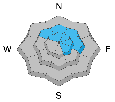
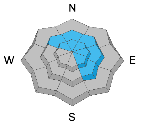
For a good portion of the day, mid and upper elevation terrain delivers MODERATE avalanche danger and human-triggered avalanches are POSSIBLE, especially on steep wind drifted slopes facing the north half of the compass and particularly in terrain with an easterly component to its aspect. Now, here's the wind up and the pitch... once triggered, today's avalanches can fail on faceted snow now buried several feet deep, resulting in a slide breaking deeper and wider than you might expect, throwing a complete curve ball at my day. Slopes that are thin and rocky or have avalanched several times this season remain suspect and should be avoided.
Flipping to the solar half of the compass, south aspects, along with shady slopes near our trailheads offer LOW avalanche danger.

Low
Moderate
Considerable
High
Extreme
Learn how to read the forecast here