Donate to Our Spring Campaign or Bid on our Spring Auction to Support Forecasting

Forecast for the Uintas Area Mountains

Craig Gordon
Issued by Craig Gordon on
Monday morning, December 9, 2019
There's two distinct avalanche problems today with two distinct outcomes.
Unpredictable-
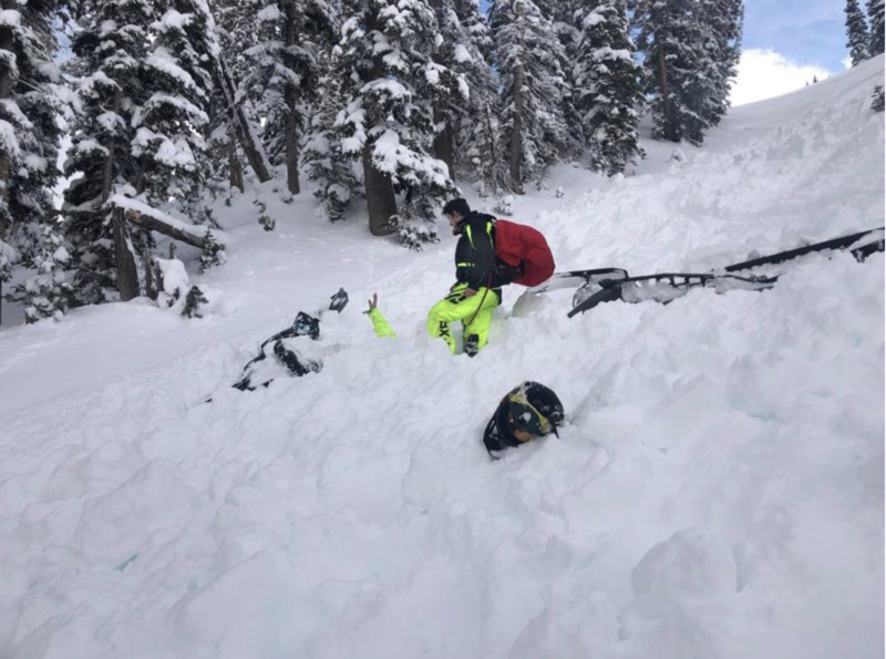
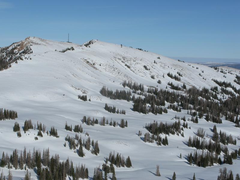
In the wind zone at upper elevations, CONSIDERABLE avalanche danger exists on steep slopes facing the north half of the compass, especially those that have an easterly component to their aspect. Human triggered avalanches are likely, particularly on upper elevation slopes harboring weak, pre-existing snow. Remember- any avalanche that breaks to old snow near the ground may quickly get out of hand, resulting in a deep and dangerous slide.
More predictable-
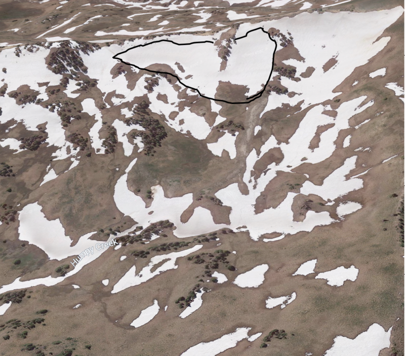
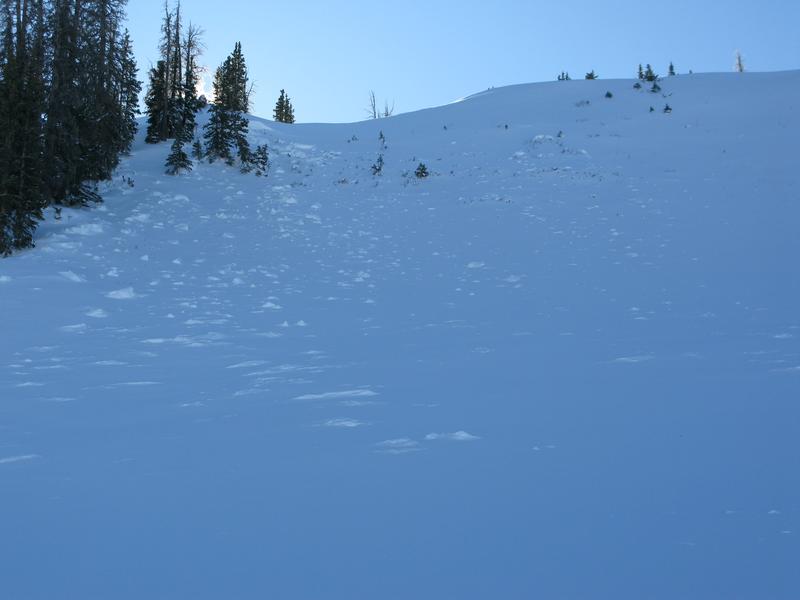
In addition, fresh wind slabs will react to our additional weight, but may break a little deeper and wider than you might expect. Along the leeward side of mid and upper elevation ridges you'll find a MODERATE avalanche danger. Human triggered avalanches breaking within the newly formed wind drifts are possible.
Here's your exit strategy-
Wind sheltered low elevation terrain that held no old snow prior to the Thanksgiving storm generally offers LOW avalanche danger and human triggered avalanches are unlikely. South facing terrain with no old snow and big open meadows with no steep terrain above or adjacent to where you're riding are the ticket.
Low
Moderate
Considerable
High
Extreme
Learn how to read the forecast here
Special Announcements
Huge thanks to Weller's Recreation in partnership with Ski-Doo for generously providing this years loaner sled. This critical piece of gear allows us to get deeper into the same places our customers ride, giving us to the ability to issue more accurate forecasts, which, of course, ultimately saves more lives!
Weather and Snow
A shallow coat of white paint at the trailheads translates to big gains in the high country where 8"-10" inches of snow stacked up since yesterday at this time. Currently, skies are mostly cloudy and temperatures in the teens and low 20's. Westerly winds bumped into the 20's and 30's late last night, but have backed off somewhat and now blow 15-25 mph along the high ridges. We've got a good thing going with total snow depths averaging just under three feet.
For today-
Expect partly cloudy skies with temperatures rising into the mid 20's. West and northwest winds blow in the mid 20's with a few gusts to 40 mph along the high peaks. Sunny skies are on tap for Tuesday with a weak system slated for midweek. Unsettled weather rounds out the work week.
Above is 24 hour weather data from Windy Peak (11,186') and Trial Lake (9,945')
Click here for more real time Uinta winds, temperatures, and snow depth.
Recent Avalanches
Breaking news from the Logan area below-
Two riders were caught and carried, and one of them was partially buried in an avalanche just north of the Idaho State Line on Saturday afternoon. Here's the report.
Closer to home-
Week old news, but significant none-the-less, I discovered a large natural avalanche on the north face of Cherry Hill in upper Humpy Basin. Releasing during the Thanksgiving storm cycle this avalanche fits the trend of recent slides breaking deep and wide, failing on weak, early season snow near the ground. While the snowpack slowly gains strength and avalanche activity tempers somewhat, the scary fact is... any slide you trigger in terrain that has weak, old snow near the ground, there's a distinct possibility it'll produce a deep, dangerous avalanche
Of historic note... the piece of snow to the lookers right which remained intact, is the same slope that led to a tragic avalanche accident on Thanksgiving Day of the 2010-11 winter. .
Ad
Avalanche Problem #1
Persistent Weak Layer
Type
Location
Likelihood
Size
Description
Yesterday's storm may be enough additional weight needed to wake up our problem child, a persistent weak layer of snow, now buried close to the ground in our early season snowpack. And while it's been nearly a week since we've heard from this layer of snow, in reality little has changed on this front and that's why it's call "persistent". You see, anything "persistent" in a snowpack takes a long time to heal and that's where it gets a little tricky. As the weak layers grow slightly stronger and get comfortable in their own skin you can ride some steep slopes, often without incident, giving us a false sense of snowpack stability. However, all we need to do is find one weakness, maybe around a bush or rock that we can't see buried underneath the snow, collapse the pack, and now we're staring down the barrel of a scary avalanche. The way I'm avoiding this scenario is by simply avoiding the terrain where this setup exists- steep, upper elevation, north facing slopes that harbored snow prior to the big Thanksgiving storm. With plenty of safe options, there's no reason to pull on the avalanche dragons tail.
But wait... here's the good news. There's a lot of terrain to ride today and not have to deal with unmanageable avalanche conditions, IF you chose slopes that had NO old snow prior to the big Thanksgiving storm.
Micheal J was in upper Weber Canyon yesterday and his pit profile clearly shows our current setup. Micheal's snowpit stability tests suggest a strengthening snowpack (good news), but failures continue to revolve around weak, basal snow (bad news). What this means is... it might be harder to initiate a slide, but the piece of snow you trigger will dangerously break to the ground.
So here's your exit strategy... simply swing around to the south half of the compass where there's no junk in the trunk, ride in the sun, and you can have a blast!
Avalanche Problem #2
Wind Drifted Snow
Type
Location
Likelihood
Size
Description
Yesterday's storm provides no shortage of fresh snow available to blow around and last night winds will have no problem creating fresh wind drifts will react to our additional weight. Found mostly on upper elevation leeward slopes, you can also expect pockets of wind drifted snow cross-loaded in a terrain features like chutes or gullies. Your best bet for avoidance is to simply steer clear of any fat, rounded piece of snow, especially if it looks chalky or sounds hollow like a drum. In addition, look for and listen to clues like whoomphing sounds or shooting cracks in the snow which are sure signs of unstable conditions.
Additional Information
Please join me on Friday Dec. 13th at 6:30 for a free avalanche awareness presentation in partnership with Wasatch County SAR. It's guaranteed to be entertaining, informative, and I'll share safety tips that allow you to rip powder safely and come home to your families at the end of the day.... pretty good deal... huh?
General Announcements
The information in this forecast expires in 24 hours, but will be updated by 7:30 AM Tuesday Dec. 10th.
This forecast is updated daily by 7:30 AM.
In the mean-time, if you see or trigger an avalanche or just wanna let me know what you're seeing you can reach me directly at 801-231-2170
It'll be a minute or two before we're riding, but while you're waiting....
This is a great time of year to schedule one of our free avy awareness presentations.
You can email me directly [email protected]
The information in this forecast is from the US Forest Service which is solely responsible for its content.