Forecast for the Uintas Area Mountains

Issued by Craig Gordon on
Sunday morning, December 8, 2019
Sunday morning, December 8, 2019
There's two distinct avalanche problems today with two distinct outcomes.
Unmanageable-
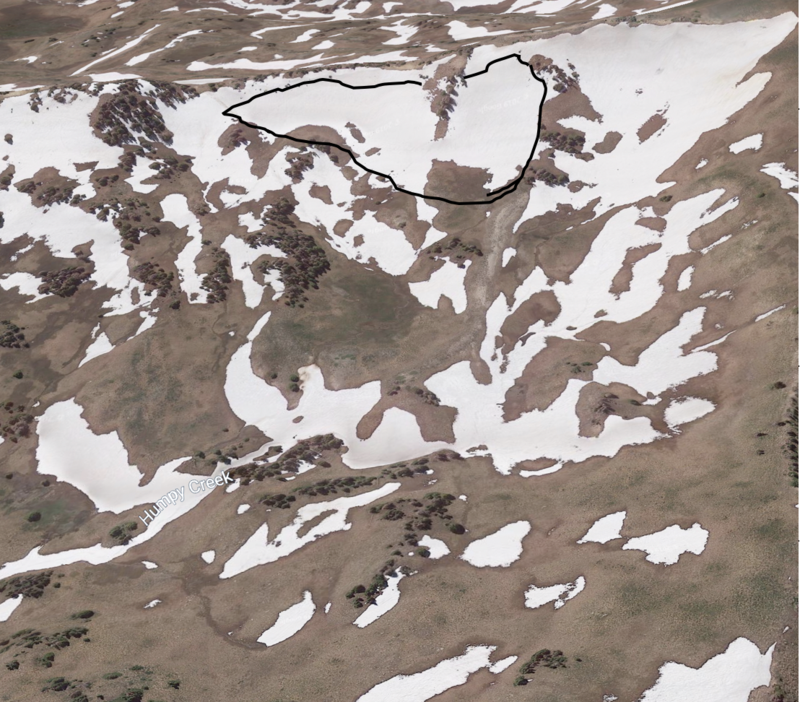
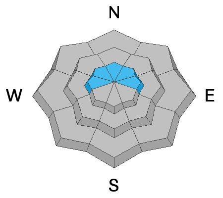
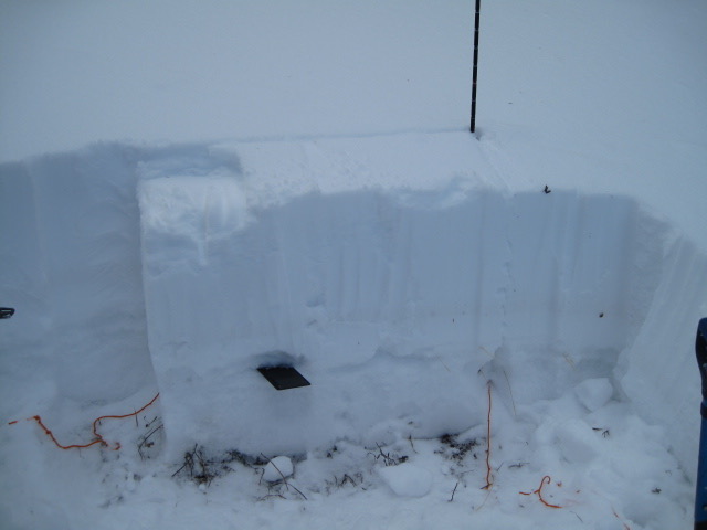
In the wind zone at upper elevations, you'll continue finding MODERATE avalanche danger on steep slopes facing the north half of the compass. Human triggered avalanches are possible, particularly on upper elevation slopes harboring weak, pre-existing snow. Remember- any avalanche that breaks to old snow near the ground may quickly get out of hand, resulting in a deep and dangerous slide.
Manageable-
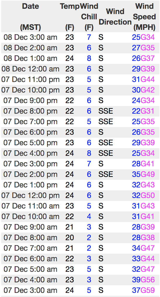
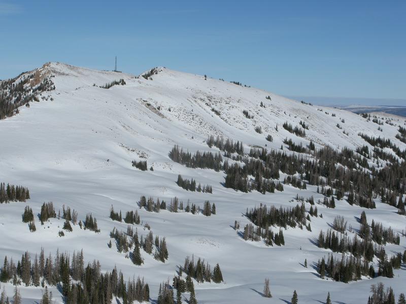
In addition, while there's not an abundance of loose snow available to blow around, winds are cranking and the Uinta's are a big place. As the storm materializes, fresh wind slabs will react to our additional weight. Along the leeward side of upper elevation ridges you'll find a MODERATE avalanche danger. Human triggered avalanches breaking within the newly formed wind drifts are possible.
Here's your exit strategy-
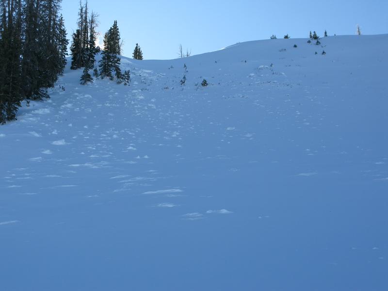
Wind sheltered low elevation terrain that held no old snow prior to the Thanksgiving storm generally offers LOW avalanche danger and human triggered avalanches are unlikely. South facing terrain with no old snow and big open meadows with no steep terrain above or adjacent to where you're riding are the ticket.
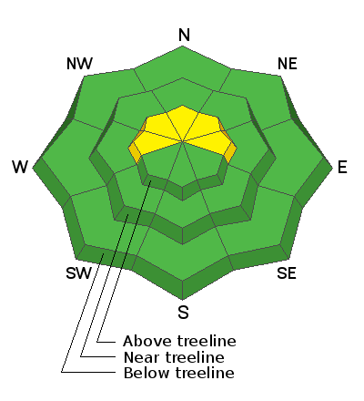
Low
Moderate
Considerable
High
Extreme
Learn how to read the forecast here