Forecast for the Uintas Area Mountains

Craig Gordon
Issued by Craig Gordon for
Saturday, December 30, 2023
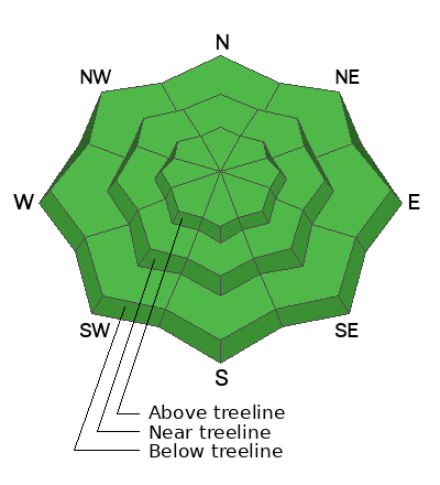
Limping to the finish line, the western Uinta's look to close out 2023 with generally LOW avalanche danger and human triggered avalanches unlikely. So yeah... you'd really have to go out of your way to get into trouble today. But the Uinta's are a vast place and if your objectives take you into big terrain, look for and avoid, shallow, stiff wind drifts around terrain features like chutes or gullies near the high ridges. While not particularly alarming, think it through... even a small slide has big consequences in high exposure terrain.
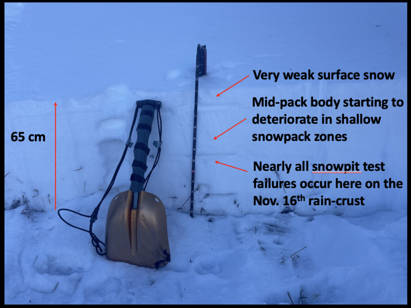
It's still low tide and there's a whole 'lotta reef out there. Rock and stump tagging conditions are a significant hazard so you'll wanna throttle it down a titch 'til the snowpack matures a bit more.
Low
Moderate
Considerable
High
Extreme
Learn how to read the forecast here
Special Announcements
To fulfill our mission, the UAC relies on our amazing backcountry community. Your support helps pay for the daily avalanche forecast, free awareness presentations across the state, and new tools like the new Avalanche and Observation Explorer. As the end of the year approaches, please consider donating to the UAC.
Weather and Snow
Nowcast- High clouds are just beginning to drift into the region and temperatures remain slightly inverted.... in the low to mid 20's near the trailheads and upper 20's along the ridges. Winds blow from the south, clocking in at 10-20 mph near the high peaks. And even though we haven't received any new snow in a week, riding and turning conditions remain quite good, especially in our deeper snowpack zones that register in the three foot range. Upper elevation, wind sheltered, shady slopes are the ticket.
Forecast- Mostly cloudy skies usher in a slight chance for a flurry or two. High temperatures climb into the upper 30's as southwest winds bump into the 20's and 30's, but taper off as the day wares on. Skies begin clearing overnight and temperatures dip into the low 20's.
Futurecast- A return to sunny skies and warm temperatures through the New Year. Still looking at the beginning of the second week of January for the next chance of potentially significant snow.
Inspired Summit Adventures guide du jour, Wes Shirey, was in the Wolf Creek zone Thursday and reports... "Mostly found recrystallized pow that made for great riding conditions." Our weakening surface is today's loud pow and potentially, a problem in the future once winter returns from its hiatus.
Recent Avalanches
No significant avalanches have been reported in the Uinta's since December 10th. Meanwhile, our western neighbors in the Wasatch report a handful of small wind slabs triggered by ski patrols and backcountry travelers.
Trip reports and the latest observations are found HERE.
Ad
Avalanche Problem #1
Normal Caution
Type
Location
Likelihood
Size
Description
This pit profile from a Northeast facing slope at 10,002' shows the current state of affairs. Rather shallow for the end of December with under 3' of total settled snow.
We're in a holding pattern and for the moment our snowpack is happy in it's own skin. But it's lean throughout much of the range and shallow snow zones are beginning to show their structural weakness hand. In fact, the only thing holding it all together is the early December storm or what I call the midpack body.
The good news is.... the recent bout of warm weather keeps some insulation in the snowpack and temporarily slows the bleeding. If it were clear and cold our snowpack would be a rotten, sugary mess.
Now the bad news... with no storms in sight we eventually lose the insulation and there's diminishing return on investment. In fact, it's only a matter of time before our snowpack catches up to the warm weather ploy, isn't fooled any more, and falls apart. We're not there just yet, but Banksy is waiting in the wings and the writing is 'almost' on the wall.
Additional Information
The Uinta weather station network was upgraded this summer and all that real-time info is found HERE. Simply click on "western Uinta" tab and then "weather stations" tab.

We are always looking for snow and avalanche observations or just general riding conditions. So... if you see something, say something. You can reach me directly at [email protected] or 801-231-2170.
Also, if you're looking for more avy education opportunities for yourself, your crew, or your club please don't hesitate to reach out to me and we'll find a presentation, class, or clinic for ya!
General Announcements

Issued at 0415 on Saturday, December 30th this forecast will be updated by 0700 Sunday, December 31st, 2023.
This forecast is from the U.S.D.A. Forest Service, which is solely responsible for its content. This forecast describes general avalanche conditions and local variations always occur.