Forecast for the Uintas Area Mountains

Issued by Craig Gordon on
Sunday morning, December 22, 2019
Sunday morning, December 22, 2019
Strong winds will create two distinct avalanche problems today-
UNPREDICTABLE-
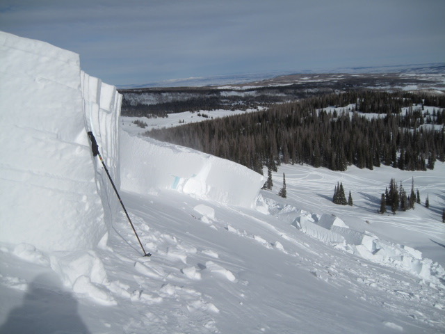
In the wind zone at mid and upper elevations, a CONSIDERABLE avalanche danger exists for both new and old snow issues. Primarily found on steep slopes facing the north half of the compass, terrain with easterly component to its aspect remains super suspect as well. Human triggered avalanches initiated on fresh wind drifted slopes and then breaking to old snow near the ground are LIKELY, particularly in rocky terrain harboring weak, pre-existing, early season snow.
MORE PREDICTABLE-
While drifts become slightly more manageable near and just above the trailheads, they're stout enough to boss you around, especially if you're walking around on snowshoes, skis, or a board. Fresh wind drifts are most prevalent around terrain features like chutes and gullies where MODERATE avalanche danger is found and human triggered avalanches are POSSIBLE.
Wind sheltered, low and mid elevation terrain and big open meadows with no steep slopes above or adjacent to where you're riding generally offers LOW avalanche danger and human triggered avalanches are unlikely.

Low
Moderate
Considerable
High
Extreme
Learn how to read the forecast here