Forecast for the Uintas Area Mountains

Craig Gordon
Issued by Craig Gordon for
Wednesday, December 13, 2023
We're headed in the right direction, but we've got a long way to go. Today, MODERATE avalanche danger exists at and above treeline and human triggered avalanches are POSSIBLE, especially on steep, wind drifted terrain facing the north half of the compass. Steep, rocky slopes in the wind zone are likely suspects where an avalanche could fail on old November snow, producing a slide that breaks deeper and wider than you might expect.

The danger is LOW below treeline at low elevations and on all south and southwest-facing slopes.
Low
Moderate
Considerable
High
Extreme
Learn how to read the forecast here
Special Announcements
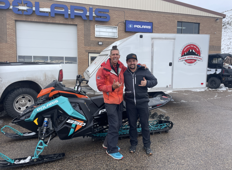
Huge thanks to Rylan from Young Powersports for trusting me with the keys to the backcountry kingdom as well the keys to this 2023 Polaris. The decades old "loaner sled" partnership with Polaris allows me to see more terrain, issue more accurate forecasts, and ultimately saves lives!
Also... join the UAC and Young Powersports in Centerville on Thursday, December 14, from 5 - 7 PM for a FREE avalanche transceiver training. Details here.
Weather and Snow
Nowcast- Get out of the valley junk, gunk, and funk because up high, clouds thinned out last night and the mountain air is clear. Temperatures remained relatively mild overnight, registering in the mid teens and low 20's at o'dark thirty . Winds blow from the east and southeast, clocking in at 10-20 mph along the high ridges. Sunny slopes have taken on heat the past few days and offer variable conditions, while riding and turning conditions remain quite good on shady slopes where you'll find shallow, creamy pow.
Forecast- A beauty of a day awaits your arrival! Look for sunny skies, light morning winds, and temperatures climbing into the 30's. Overnight lows are gonna be on the warm side, bottoming out in the teens. One buzz-kill to a gorgeous day... we'll keep an eye on a potential snow wrecking wild card as a closed low churns in the four corners area, potentially bumping easterly winds into the 30's.
Futurecast- Looking to bring your winter tanning game to the next level? Well then... this is our week! Sunny skies, warm temperatures, and generally light winds are on tap through the weekend.
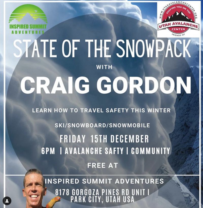
Please join me for a current conditions, State of the Snowpack prezo at Inspired Summits HQ (8178 Gorgoza Pines Road) Friday night at 6:00. Guaranteed to be informative, educational, and inside sources tell me... it'll be entertaining :)

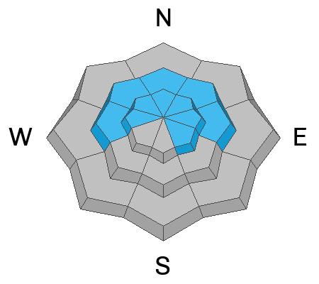
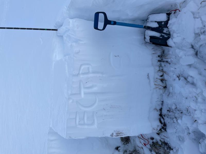
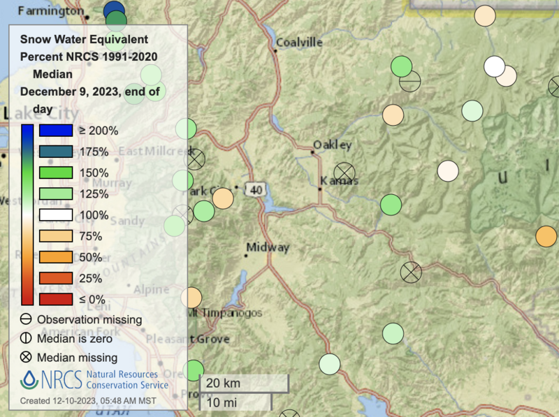
Even though it may seem like a slow start to the season, the snowpack is about average (scroll to the bottom of the forecast for more info). There are 3 basic layers in the snowpack (1) old snow from October and mainly November with a crust from mid-November, (2) snow from the warm, wet storm from the first weekend of December with a crust on top of it, and (3) snow from last Friday which favored the northern part of the Uintas.
Recent Avalanches
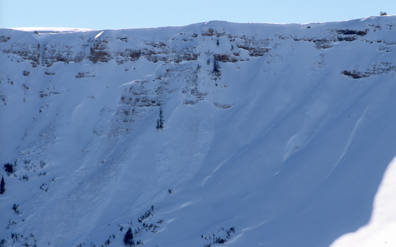
On Monday, I spotted this piece of snow from a distance. Breaking to old November snow, I suspect this large pocket on a steep, rocky, unsupported slope in Upper Chalk Creek occurred late in the weekend storm and was most likely triggered by a small piece of cornice crashing down onto the slope below.

Trip reports and the latest observations are found HERE.
Ad
Avalanche Problem #1
Persistent Weak Layer
Type
Location
Likelihood
Size
Description
Avy savvy, snow-pro Trevor Katz was out and about Monday and the results from his snowpit tests (ECTP 16) echo our concerns for avalanches breaking to a layer of old faceted snow, formed in November.
Here's the deal-
A cohesive piece of snow or what we in snow-geek-speak call a slab rests on top a persistent weak layer (PWL) of old, faceted, sugar snow formed during November. Unfortunately, this setup is structurally challenged and here to stay with us for some time. And while not quite as talkative as just a few days ago, backcountry travelers continue reporting collapses and audible whumpfs which is Mother Natures heads up, telling us to pump the brakes and think about our terrain choices and consequences of triggering a slide.
Additional Information
While it seems like a slow start to the season, in terms of water amounts, SNOTEL sites in the Western Uintas generally have median values. White dots are at the median. Green are a little above, and beige dots are a little below. Click on the image for an interactive map from the NRCS.

We are always looking for snow and avalanche observations or just general riding conditions. So... if you see something, say something. You can reach me directly at [email protected] or 801-231-2170.
Also, if you're looking for more avy education opportunities for yourself, your crew, or your club please don't hesitate to reach out to me and we'll find a presentation, class, or clinic for ya!
General Announcements

Issued at 04:00 on Wednesday, December 13th this forecast will be updated by 0700 Thursday, December 14th, 2023.
This forecast is from the U.S.D.A. Forest Service, which is solely responsible for its content. This forecast describes general avalanche conditions and local variations always occur.