Just 'cause you can see it from the car doesn't mean it's safe or you're good to go. With all that's going on overburdening our health care workers, let's collectively think about our decisions and the consequences that may have on others.
If you missed the 13th Annual Utah Snow and Avalanche Workshop, the recordings are available for purchase from the UAC Store.
Click
here for more details.
Looking for ways to navigate through an unusual winter ?
Nowcast-
A big, bright beautiful moon, continues its encore, taking center stage and it's a stunning morning! High pressure dominates our weather with clear skies and temperatures in the teens to low 20's. Northeast winds have been generally light, but just bumped into the 20's right around 4:00 this morning. Our Thanksgiving storm helped freshen things up a bit, delivering 4" of light density white paint, but with overall snow depths just below two feet, it's still pretty thin out there.
Forecast-
Look for mostly sunny skies with temperatures climbing into the mid 30's. Northerly winds should remain reasonable, blowing in the low 20's even along the high peaks. Overnight lows dip into the teens.
Futurecast-
Clear skies for most of Monday, with a quick moving cold front sliding across the region late Monday into Tuesday, bringing cooler temperatures and the potential for light snow showers.
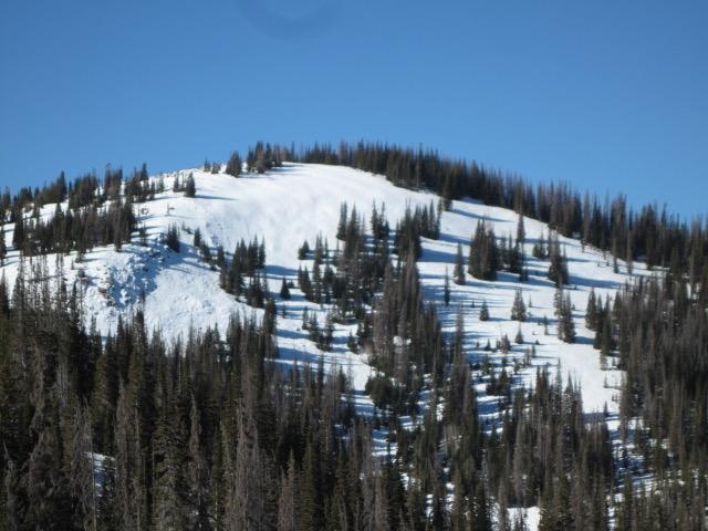
Ted was in the Gold Hill area yesterday and found similar snow structure and coverage to what I saw near Wolf Creek on Friday. The snowpack is thin and travel limited to grassy slopes and road rides. Ted's insight and take on North Slope conditions is found
here.
Looking for real-time temps, snow, or wind?
Click
here and then on the "western Uinta" tab for western Uinta specific, weather station network.
No new avalanche activity to report.
To view trip reports and recent avalanche activity, simply click
here.