


Forecast for the Uintas Area Mountains

Issued by Craig Gordon on
Friday morning, November 11, 2022
Friday morning, November 11, 2022
It's about as straight-forward as it gets-
The recent series of storms formed strong, dense layers near the ground and the solid building blocks of a designer snowpack. And while we're off to a great start, I'd still be on the lookout for a few old drifts lurking on the leeward side of upper elevation ridges and around terrain features like chutes and gullies. So today... step out cautiously and continue practicing safe travel by avoiding steep, upper elevation terrain, especially slopes facing the north half of the compass. And remember... any avalanche triggered today can result in a season ending, traumatic injury.

Low
Moderate
Considerable
High
Extreme
Learn how to read the forecast here
 Special Announcements
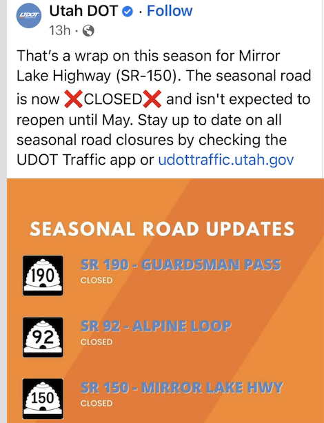
Mirror Lake Highway is closed for the season.
 Weather and Snow
Nothin' but blue skies!
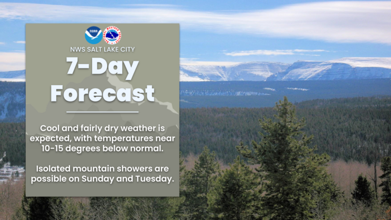
Nowcast- Clear skies with light northerly winds blowing 10-20 mph along the ridgetops await your arrival this morning. Temperatures register in negative territory and in the single digits as cold air settles into the region in the wake of this weeks big storm. Cold smoke caps off snow depths averaging 24"- 30". Riding and turning conditions are all time with grassy meadows or smooth, rock free roads the terrain of choice.
Forecast- Northwest winds blow in the teens and a few high clouds drift through the region. High temperatures climb into the mid 20's and overnight lows dip into the single digits.
Futurecast- Clear and cold through the weekend.

Micheal J found excellent skiing and snow structure, commenting... "Supportive, right side up, smoke on top." His observation is found HERE.
Yeah... just the way we like it!
 Recent Avalanches
No recent avy activity to report. Trip reports are found HERE
Avalanche Problem #1
Wind Drifted Snow
Type
Location
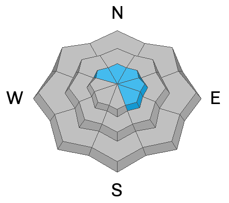
Likelihood
Size
Description
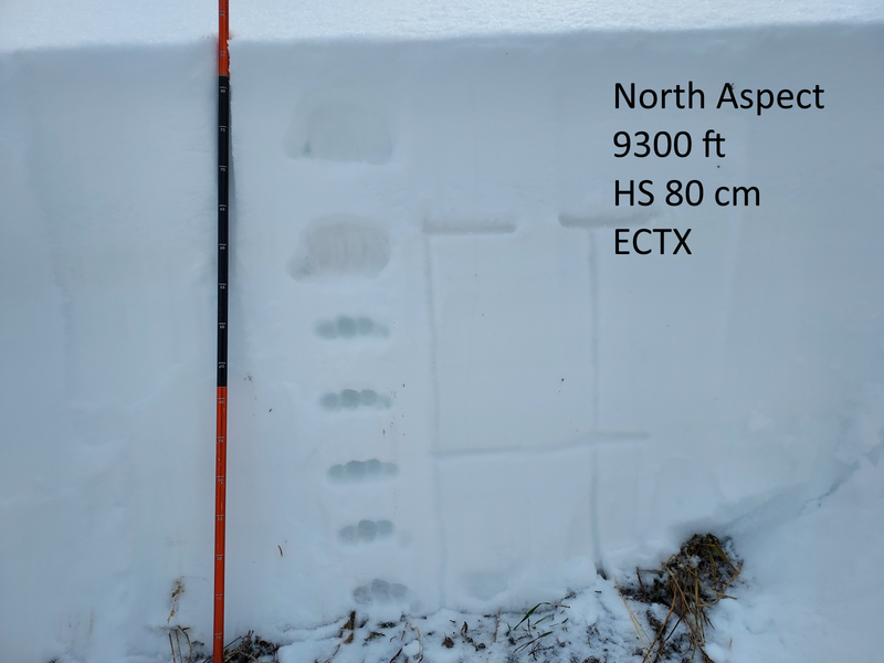
We are off to an amazing start! And while most of our snowpack is welded in place, I bet a few old wind drifts may react to our additional weight. Best bet for today is avoiding any fat, rounded pillow of snow, especially if it sounds hollow like a drum. Once triggered, today's avalanches have the potential to break deeper and wider than you might expect. Remember, even a small wind drift can easily knock you off your feet and slam you into a group of trees or over a cliff band.
Additional Information
And we've been super busy this summer upgrading the western Uinta weather station network and this real-time info is found HERE (click weather stations, and then on Western Uinta tab)
Your observations are important, so please let me know what you're seeing... click HERE and contribute to this amazing community based program
General Announcements
Issued at 03:06 on Friday November 11th, this information expires 24 hours after the date and time posted, but will be updated as conditions change.
I will update this forecast as conditions change and then once winter kicks into gear you can expect the usual daily forecasts issued by 07:00... or perhaps earlier :)
Before it gets too crazy, now is the time to book an avalanche awareness presentation for your group, club, or posse. You can reach me directly at 801-231-2170 or [email protected]
This forecast is from the U.S.D.A. Forest Service, which is solely responsible for its content. This forecast describes general avalanche conditions and local variations always occur.