Party with a grateful date- Thursday October 23rd, from 6-10 PM- Please join Park City Brewing, Powder Buoy, and Utah Avy to kick off winter in Park City! All the deets here
Saturday, November 1 - 18th Annual Professional Snow and Avalanche Workshop (PROSAW). The in-person session will be held at the Eccles Center Park City. 1750 Kearns Blvd, Park City, UT 84060. - Information and tickets are available here.
Saturday, December 6 - 18th Annual Utah Snow and Avalanche Workshop (USAW). This session will be held in-person at the Wasatch Jr High School Auditorium. 3750 S 3100 E, Salt Lake City, UT 84109. Information and tickets are available here.
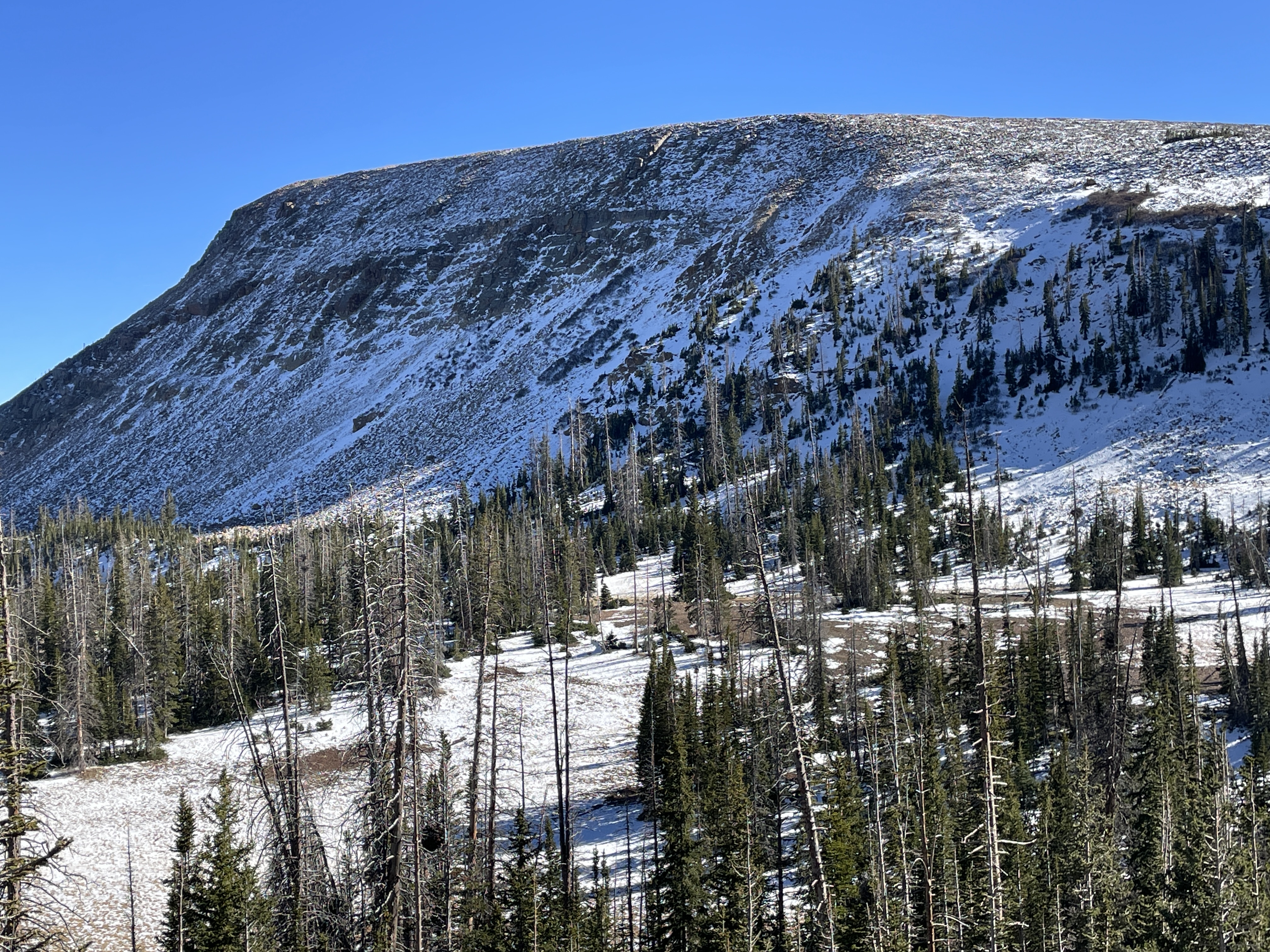
Nowcast- Even with clear skies overhead, temperatures are mild and slightly inverted this morning with the mercury registering in the mid 20's at the trailheads and close to 40 degrees along the high ridges. West and southwest winds blow 5-15 mph near the high peaks. No new snow to report since the mid month storm.
Forecast: Expect increasing clouds, wind, and maybe even a passing shower or two as storminess drifts into the Uinta zone later in the day. It looks like the most of the moisture camps out in central and southern Utah, while the north half of the state remains generally high and dry to round out the work week.
Futurecast: A more energetic storm slides into northern Utah Sunday morning and that'll deliver a modest shot of snow throughout the day, lingering into Monday. I think we'll see a fair amount of moisture with this storm, but computer models are tempering my enthusiasm and suggest a more northern track for the system, bumping the bulk of the storm into Idaho. I'll have a better handle on strength and timing for Saturday mornings update.
'Twas a glorious day to be in the high country getting things tight before weather shuts down access
No recent avalanche activity reported or observed.