Donate to Our Spring Campaign or Bid on our Spring Auction to Support Forecasting

Forecast for the Skyline Area Mountains

Brett Kobernik
Issued by Brett Kobernik on
Thursday morning, March 20, 2025
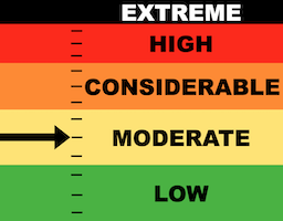
The overall danger rating on the Skyline is MODERATE today.
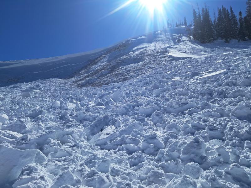
The new snow is fairly stable. You might find a pocket that could release on very steep upper elevation wind loaded slopes.
There's still a minor chance that you could trigger something that breaks deeper into sugary faceted weak layers. This is most likely in shallow snowpack locations.
Low
Moderate
Considerable
High
Extreme
Learn how to read the forecast here
Special Announcements
Weather and Snow
Current Conditions: Wow. Wednesday was sublime. I heard reports of "best day of the winter" from different regions around the state. Temperatures stayed in the 20s keeping the snow quality good. Sun definitely still heated the new snow and made it heavy by the end of the day but there will still be lots of good powder out there today. The wind from the northwest dropped to almost calm. It's generally light this morning from the southwest.
Mountain Weather: The weather looks unsettled through Saturday. We'll see clouds, high temperatures in the 30s, and light to moderate speed wind from the southwest switching more northwest later on and increasing in speed. Another small storm will clip us Friday night that could bring a couple of inches of snow. High pressure sets in Sunday through next week with VERY warm temperatures. Hints of a stormy pattern for early April are materializing.
Recent Avalanches
There were no significant avalanches reported from the Skyline on Wednesday. However, there was another VERY CLOSE CALL in the Gooseberry zone on Fish Lake just south of us. A snowmobile rider was on a very steep northeast facing slope when it broke to the ground. He was caught, carried and buried with only part of his boot sticking out. His partners were able to rescue him before it was too late.
PHOTO: Micklesen
Ad
Avalanche Problem #1
Persistent Weak Layer
Type
Location
Likelihood
Size
Description
The new snow was pretty well behaved on Wednesday. If you are monkeying around on cornices or steep wind loaded slopes below ridges, you might find a pocket that will release.
Really though, the serious concern is the off-chance of triggering a deeper avalanche. The close call in Gooseberry demonstrates this concern. Overall, I believe the snowpack on the Skyline is more stable than in the Gooseberry zone but I think there are still shallow spots around the range where a person could find trouble. The chances are low. The consequences are high.
General Announcements
This forecast is from the U.S.D.A. Forest Service, which is solely responsible for its content. This forecast describes general avalanche conditions and local variations always occur.