Forecast for the Skyline Area Mountains

Brett Kobernik
Issued by Brett Kobernik for
Saturday, March 18, 2023
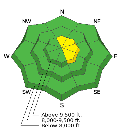
The overall avalanche danger is LOW on the Skyline today.
There is still a pockety MODERATE danger in the higher elevation north through east facing terrain where cornices and scattered wind drifts are present.
Human triggered avalanches are possible but not all that likely.
Low
Moderate
Considerable
High
Extreme
Learn how to read the forecast here
Weather and Snow
Current Conditions: Temperatures stayed relatively cold on Friday and dropped into the single digits to low teens overnight. Wind has been from the east with light to moderate speeds. Sunny facing slopes have a melt-freeze crust. Soft dense powder can be found on higher elevation northerly facing slopes.

Mountain Weather: We'll have sunny skies this morning with the chance for some clouds moving in later today. Temperatures will get into the mid to upper 20s. Wind will be from the southeast with moderate speeds along the higher terrain. Sunday looks mostly cloudy with warmer temperatures. I hope you got out and enjoyed the recent days of sunny weather because starting Monday we go back into a very active weather pattern with periods of snow through the next couple of weeks.
Recent Avalanches
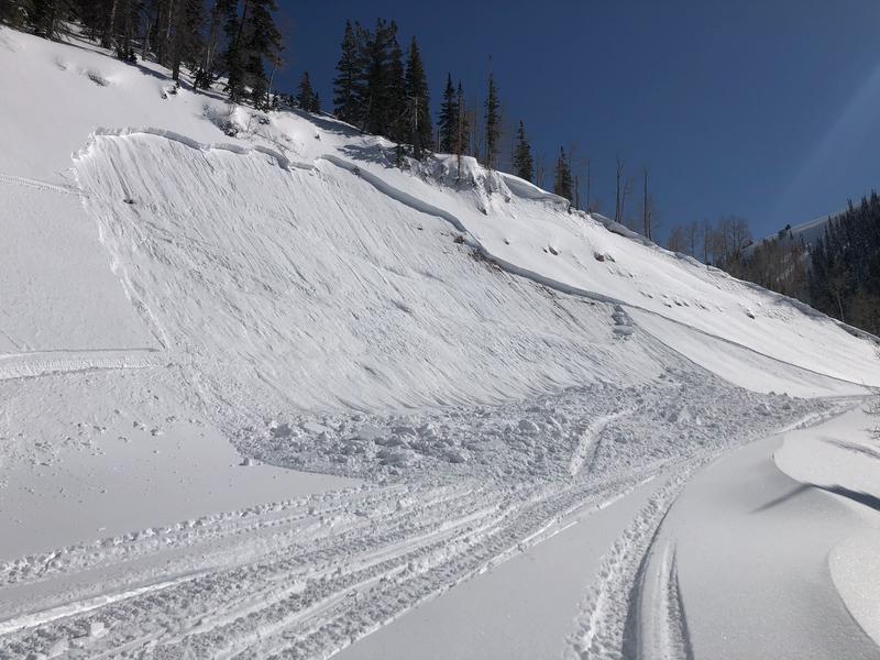
There was one small slab avalanche triggered by a snowmachine in Ephraim Canyon late Friday. The rider was reportedly not caught. It was on a steep road cut that faces west. It became damp and unstable from daytime heating. MORE DETAILS HERE Photo: Jayson Albee
Ad
Avalanche Problem #1
Normal Caution
Type
Location
Likelihood
Size
Description
Overall, the snowpack is mostly stable. Here are the two things I'm watching out for today:
  • Wind drifted snow issues along the higher ridgelines. This includes avoiding large cornices and recent deposits of wind drifted snow on very steep slopes.
  • Wet snow from daytime heating. Snow becomes unstable when it gets too wet. Avoid steep terrain where the snow is wet, punchy or sloppy. South through west facing slopes tend to get the wettest during the afternoon.
General Announcements
This forecast is from the U.S.D.A. Forest Service, which is solely responsible for its content. This forecast describes general avalanche conditions and local variations always occur.