Forecast for the Skyline Area Mountains

Brett Kobernik
Issued by Brett Kobernik for
Sunday, March 17, 2024
The overall avalanche danger rating for the Skyline is LOW.
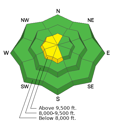
There is a "pockety" MODERATE avalanche danger on steep upper elevation slopes with recent deposits of wind drifted snow.
Human triggered avalanches are possible but not all that likely.
The most likely place to trigger something is on steep upper elevation slopes with recent deposits of wind drifted snow, especially on more west facing slopes.
Low
Moderate
Considerable
High
Extreme
Learn how to read the forecast here
Special Announcements
Support the UAC website rebuild by donating to our spring campaign. Save lives by making a donation today! DETAILS HERE
If you're heading into the desert to enjoy some of the warm weather this week, The Utah Avalanche Center is hosting The Banff Film Festival in Moab on Thursday, March 21, and Friday, March 22. DETAILS HERE
Weather and Snow
Current Conditions: I was pleasantly surprised to find a good amount of excellent riding conditions on Saturday. It was in sheltered terrain on the east side of the Skyline. There is extensive wind damage across the higher terrain. Skies remained mostly cloudy on Saturday with light snowfall happening on the east side of the range. Temperatures stayed in the upper 20s and are in the mid 20s this morning. The wind slowed on Saturday and is generally light to moderate in speed this morning.
Mountain Weather: We should see the clouds start to break today. Temperatures are going to get into the mid to upper 30s. Wind will still be from the east with light to moderate speeds. We'll see a significant warming trend through the week with temperatures getting into the 40s most days. Weather models continue to suggest an active pattern with storms from the 24th through the end of the month.
Ad
Avalanche Problem #1
Normal Caution
Type
Location
Likelihood
Size
Description
In general, avalanche conditions are pretty safe. There is no specific avalanche problem that poses a great threat. However, it seems you can always find trouble if you're not paying attention. Here's what to look for today:
  • Scattered fresh wind drifts and slabs. These formed over the last few days. I have not found any of these to be sensitive but I'm still not screwing around on steep slopes where they are present. You're most likely to find these on west facing slopes due to east wind loading snow there. However, watch for pockets on all aspects in the upper elevations.
  • Wet avalanches. This is always a minor concern as we move into spring. The snow gets damp during the day and can produce wet avalanches especially the first time new dry snow heats up and becomes damp. Upper elevations have cold snow this morning which will probably become damp for the first time today. Avoid steep slopes and terrain traps when the snow starts to become wet and sloppy.
General Announcements
This forecast is from the U.S.D.A. Forest Service, which is solely responsible for its content. This forecast describes general avalanche conditions and local variations always occur.