Current Conditions: The Skyline picked up another good shot of snow on Sunday bringing storm totals up to 14 to 18" since Saturday and 20 to 30 inches since Thursday. Most high elevation weather stations are reading around 40 inches total depth to the ground. The snowpack is almost completely unconsolidated from the surface to the ground in many areas. The top half is the new low density powder snow. The bottom half is old loose sugary facets. The best way to describe it is there's no base. Trail breaking on skis is difficult. Snowmachines trench deep into the pack. Check out this
excellent backcountry observation from Chris Magerl who was in Fairview Canyon on Sunday:
DETAILS HERE
Temperatures dropped into the single digits overnight and wind from the west northwest has stayed fairly light with moderate speed gusts along the higher more exposed ridges.
Mountain Weather: The tail end of the storm is moving through and we might see some light snowfall still this morning and maybe a little clearing later this PM. Temperatures stay in the single digits. Wind should stay in the light to moderate speed category blowing from the northwest. Tuesday looks partly cloudy and then it looks like we'll see a couple of periods of snow mid week. One early Wednesday morning and one early Thursday morning. It looks like we'll see some stronger wind with these next impulses. I think each one should produce a few inches with a total of 4 to 8 inches by Thursday.
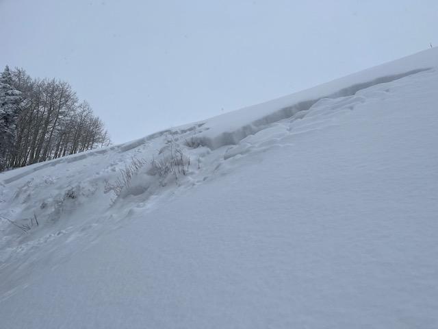
There was some natural avalanche activity on Sunday. It involved the new snow breaking down into older weak sugary faceted snow. I describe this activity as "pockety" right now. This is only a hint of things to come.