Forecast for the Skyline Area Mountains

Brett Kobernik
Issued by Brett Kobernik for
Tuesday, January 8, 2019
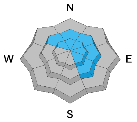
The avalanche danger is CONSIDERABLE today. Today is a likely day for someone to trigger an avalanche. Avoid being on or below any steep slope with recent deposits of wind drifted snow. These fresh drifts will become more stubborn so you may not see any signs of danger like cracking in the snow until you trigger something.
Low
Moderate
Considerable
High
Extreme
Learn how to read the forecast here
Weather and Snow
Storm totals from the most recent storm are about 18" along the northern Skyline near the top of Fairview Canyon and Huntington Canyon. Other areas farther south didn't pick up quite as much but are still in the 8 to 10 inch range. The new snow is upside down meaning it is more dense on top than underneath. It will feel "punchy" This is also due to the very strong wind on Monday that really blew the snow around.
Recent Avalanches
Visibility was poor on Monday but I was able to spot a couple of small natural slab avalanches while doing fieldwork in Huntington Canyon. No doubt the strong wind played a role in these. I expect there were more avalanches in the higher terrain.
Ad
Avalanche Problem #1
Wind Drifted Snow
Type
Location
Likelihood
Size
Description
Areas with wind drifted snow will still be sensitive today. This is your biggest concern. Any avalanche that gets triggered has the potential to be very deep due to the amount of freshly drifted snow. The issue is most pronounced on the more north through east facing slopes but watch for areas with fresh drifts on all aspects in the mid and upper elevations.
Additional Information
Below is a quick video from Monday.

This forecast is from the U.S. Forest Service, which is solely responsible for its content. This forecast describes general avalanche conditions and local variations always occur.