Join us at our 2nd Annual Blizzard Ball

Forecast for the Salt Lake Area Mountains

Dave Kelly
Issued by Dave Kelly on
Sunday morning, January 5, 2025
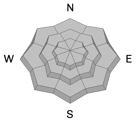
The avalanche danger is HIGH in upper elevation west-north-east-southeast facing terrain for triggering a new or wind drifted snow avalanche that fails on a layer of buried facets. These avalanches could be 2'-4' deep and up to 800' wide.
The snowpack does not like rapid change and your best bet to enjoy this newest snow is to stay out of avalanche terrain and stick to lower angle slopes less than 30 ° in steepness.
Low
Moderate
Considerable
High
Extreme
Learn how to read the forecast here
Special Announcements
Join the UAC and Backcountry Ready at Skimo CO at 7PM on January 6 for an After the Avalanche Wilderness First Aid discussion.
Weather and Snow
Overnight there was a trace to 1" of new snow reported. Storm totals in the Cottonwood Canyons are 12"-22" snow/ .7"-1.32" water and the Park City Ridgeline saw 6"-9" snow/ .40"-.85" water. It was a storm that was made for high snowfall numbers in Little Cottonwood canyon and we saw periods of up to 5" of snow an hour yesterday morning.
Under partly cloudy skies it is snowing lightly at some mountain location. Temperatures are in the low teens °F at the trailheads and in the single digits at the highest ridgelines. Winds are blowing from the west in the teens gusting to the 20's MPH at the lower ridgelines and blowing from the northwest in the teens gusting to the 20's at the highest weather stations.
Today, under overcast skies look for warming temperatures with a high of 22-26 °F. Winds will blow from the west 10 gusting to 15 MPH at the lower ridgelines and from northwest 30 gusting to 40 MPH at the highest peaks. We can expect to see light snow with 1"-3" snow/ .05-.2" water expected.
Recent Avalanches
Yesterday, there were reports of collapsing, cracking, and whumpfing from backcountry travelers. We continue to get observations of remotely triggered avalanches failing on the buried facets (photo below). Ski area and highway operations reported numerous long running, large explosive triggered avalanches and sensitive new and wind drifted snow avalanches yesterday. Check out all observations and avalanches HERE.
Photo (Ambler) of a remotely triggered avalanche on a north facing slope at 9,200'
Ad
Avalanche Problem #1
Persistent Weak Layer
Type
Location
Likelihood
Size
Description
Additional snowfall and strong winds will stress the buried persistent weak layer that has been the culprit in multiple avalanches and the two recent avalanche fatalities in the Central Wasatch (Porter Fork and Davenport Hill). This weak faceted snow has not yet had time to adjust to the most recent series of storms. With very little break between last week's wintry event and the quick hitting storm from yesterday this layer needs time to adjust. For the time being I will avoid traveling on or under slopes greater than 30 ° in steepness that may have this buried weak layer near the ground.
Our current setup is much more of a what a mountain environment with a continental snowpack sees every year. Former longtime director of the Utah Avalanche Center, Bruce Tremper talks more about differences between the snowpack types HERE.
Avalanche Problem #2
Wind Drifted Snow
Type
Location
Likelihood
Size
Description
Stiff wind drifts that formed during high winds yesterday and overnight are now covered over by new snow and will be hard to see. These drifts will be lower on the slope than you may expect and I will be avoiding these areas of wind drifted snow today. Cornices are sure fire signs that the slope below has been recently wind loaded.
Photo (Climaco) from the Park City Ridgeline of a recently formed cornice on an east facing aspect at 9,200'
Additional Information
At the Utah Avalanche Center, we strive to learn from every avalanche incident and share insights to help others avoid similar accidents. We have all experienced close calls and understand how easily mistakes can happen. Our goal with these reports is to provide valuable learning opportunities.
The accident reports for the Porter Fork and Davenport Hill Accident have been completed. You can read them HERE.
General Announcements
This information does not apply to developed ski areas or highways where avalanche control is normally done. This forecast is from the U.S.D.A. Forest Service, which is solely responsible for its content. This forecast describes general avalanche conditions and local variations always occur.