We are in the process of finalizing a report about the March 9th avalanche fatality in the Uintas. Thank you for your patience, and we will publish the final report in coming days.
Thank you to everyone who donated to our Spring Campaign. We appreciate your support and look forward to creating new tools to help you stay safe in the backcountry.
Would you believe me if I told you it was still snowing?
The Cottonwoods and Park City areas picked up 3-5" of cold smoke overnight, with mid-LCC reporting 12" overnight. We're now pushing storm totals to 40-60" (4.0"-4.50" SWE) since mid-week.
Mountain temperatures are in the single digits but winds are currently playing the spoiler. 11,000' winds have averaged 35-45mph with gusts to 60mph the last few hours. Even many mid-elevation anemometers are blowing 20-25mph with gusts to 40mph.
We should be seeing "peak" snowfall and winds this morning. We'll start to dry out (if only for a day or two) and possibly see a touch of blue by afternoon. Winds will lose steam and average 15mph along the 10k ridgelines.
Tuesday will be a bit of a break ahead of the next prolonged storm system that will bring at-times heavy snowfall Wednesday afternoon through Friday. 1-2' can be expected. The next storm is forecast for late weekend.
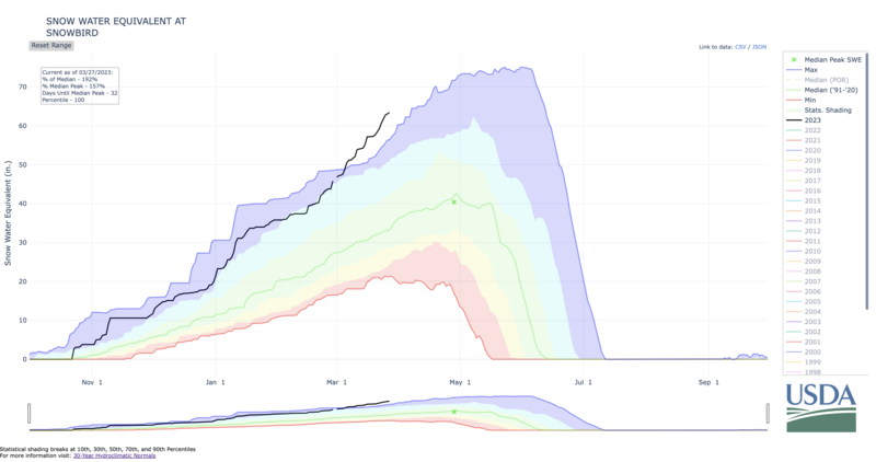
Off the charts at Snowbird. Almost 200% of "average".
NRCS pageSkiers triggered a few shallow soft slabs in the new snow in Neffs and on Kessler Peak yesterday. These were up to a foot deep and 50' wide. One skier was briefly caught and carried in the west couloir of Kessler Peak. Just up canyon, a likely natural cornice-fall triggered a fresh soft slab on the steep Silver Fork headwall 2' deep and 150' wide.
Avalanche control work along the southern end of the Park City ridgeline pulled out a 2-4' deep avalanche on a lightly-trafficked and heavily wind loaded northeast facing slope at 9900'.
***The Outlier - on
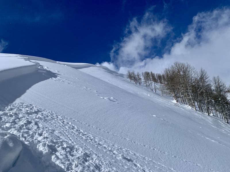
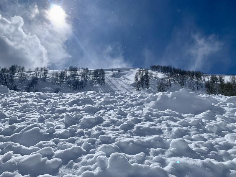
Saturday, a snowmobile remotely triggered a significant avalanche just south of the Ant Knolls in upper Snake Creek (above Heber/Midway). (pics 1, 2) This avalanche ripped out 2' deep and 700' wide on a steep easterly facing slope at 9400', failing on a thin layer of surface facets, and buried by the mid-week storm(s). It left large debris piles and barely overran the groomed Cummings Parkway track below.
What is troubling is that this was the only avalanche I noted in the vicinity; that I experienced no cracking or collapsing, and snow tests did not necessarily send a bunch of red flags. How should this affect terrain choices for today?