Forecast for the Salt Lake Area Mountains

Nikki Champion
Issued by Nikki Champion for
Sunday, February 25, 2024
Today, the avalanche danger is MODERATE across mid and upper-elevation slopes facing east, southeast, south, and southwest where triggering a persistent weak layer avalanche that breaks to a crust with faceted snow 1-3 feet deep is possible. Additionally, there is a MODERATE avalanche danger across all upper-elevation terrain for stubborn slabs of wind-drifted snow.
On low-elevation slopes facing southwest through south and southeast, the avalanche danger may rise to MODERATE as the snow surface heats up, potentially leading to small wet-loose avalanches on solar aspects. The remaining aspects have a LOW avalanche danger.
It's crucial to carefully evaluate snow and terrain today, identifying potential hazards, as human-triggered avalanches are possible.
Low
Moderate
Considerable
High
Extreme
Learn how to read the forecast here
Special Announcements
Join the UAC and Inspired Summit Adventures for the grand opening of our new Transceiver Training Park at Pinebrook, Sunday, February 25, from 3:00-6:00PM.
Weather and Snow
This morning, under clear skies there is a temperature inversion in the mountains, with trailhead temperatures in mid-teens F, and ridgetop temperatures in the mid-20 F. The westerly winds have begun to pick up overnight, averaging 10-15 mph with gusts up to 30 mph at mid-elevations, and gusts near 50 mph at 11,000 feet.
Today will be another day of strong sunshine, with temperatures warming into the upper 30s F at upper elevations and the mid-40s F at low and mid-elevations. Winds will remain from the west-southwest and continue to increase throughout the day, averaging 15-20 mph and gusting up to 30 at mid-elevations, with gusts near 50 mph at 11,000 feet.
Outlook: On Monday, strong winds will start blowing as a new storm system approaches. This storm will be colder than recent ones and will bring heavy snow starting on Monday. The snow levels will stay high, and the snow will be wet due to the direction of the wind. By early Tuesday, the storm front will pass through, bringing strong winds, heavy snow, and a quick drop in temperature. There might even be lightning near the front. Snow will continue on Tuesday, gradually easing off by Tuesday night, as the wind shifts to the northwest. This next storm could bring 15-25 inches of snow to the Central Cottonwoods.
Riding conditions remain excellent in the backcountry, although solar slopes may now have developed a firm crust this morning due to days of strong sun.
Recent Avalanches
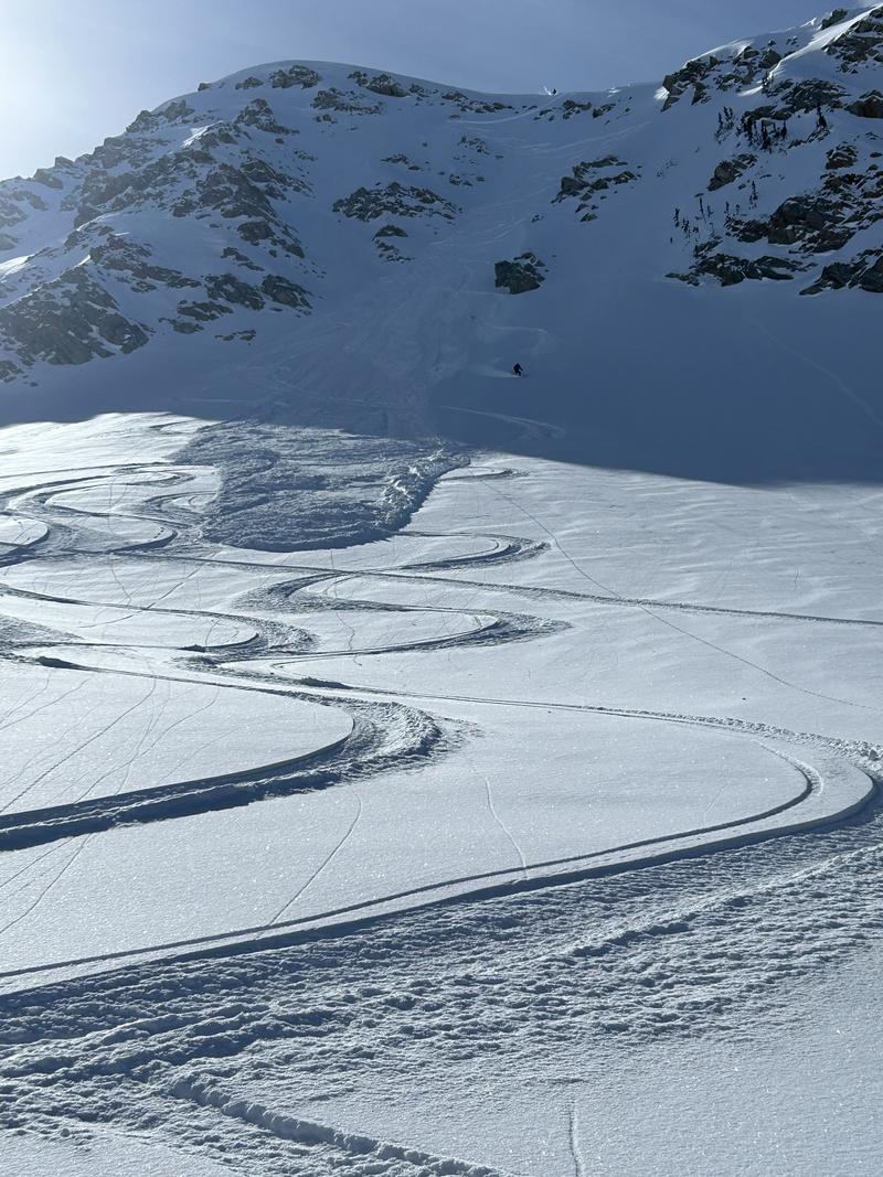
Avalanche activity yesterday included long-running dry-loose avalanches within the ski resorts and backcountry, as well as some smaller slab avalanches of wind-drifted or new snow that could have failed on the 2/14 facets, though these observations were from a distance, so this is not confirmed. On Red Baldy, one rider was caught and carried in a large dry-loose avalanche that broke approximately 6" deep at it's deepest. See photo below.
Red Baldy avalanche - find detailed report HERE.
Reports of glide avalanches in Broads Fork continue to roll in.

On Thursday evening, a very large avalanche occurred on Miller Hill in American Fork Canyon. One or two people were likely caught in the avalanche. However, they were gone when the second group arrived and conducted a beacon search to ensure no one was buried. Mark Staples visited the avalanche Friday; it was approximately 1,500 feet wide and 2 feet deep, and it broke on a layer of faceted snow above a crust.
Ad
Avalanche Problem #1
Persistent Weak Layer
Type
Location
Likelihood
Size
Description
On specific ‘solar’ slopes, particularly those facing east and southeast, there is a persistent weak layer (PWL) of facets just above a crust buried by storms beginning February 14. As the warm weather and clear skies persist, the likelihood of triggering an avalanche on this layer will continue to decrease, and the facets will begin to heal. However, as demonstrated by this week's avalanche activity, including the massive avalanche on Mill Hiller on Thursday, we have not reached that point yet. I'm addressing this issue by avoiding these slopes and opting for northerly-facing slopes where the snow quality is superior.

Mark discusses the avalanche problem primarily isolated to the East and southeast-facing aspects.

While we are considering shrinking this avalanche problem, as it appears to be primarily isolated to southeast through east-facing aspects, there is still a chance of encountering this layering and issue on western-facing slopes.
Avalanche Problem #2
Wind Drifted Snow
Type
Location
Likelihood
Size
Description
With increasing winds before the next front, stubborn slabs of wind-drifted snow are likely to be encountered on all upper-elevation slopes and some mid-elevation terrain features that allow for drifting snow accumulation. Some of these wind drifts may be reactive if they formed on top of graupel. The graupel layers vary, but they can often be found below steeper cliff bands where graupel can accumulate.
These drifts could be 1-3 feet deep and up to 150 feet wide. Watch out for signs of wind-drifted snow, such as pillow-shaped deposits, and avoid those slopes. Any recent wind drifts were covered by snowfall Wednesday night, so you will need to dig down to search for them.
Outside the wind zone, on shaded aspects, there is still soft snow. As you step into steeper terrain, remember that even a loose-dry avalanche can travel far and entrain a lot of snow, especially in areas that may have graupel. Consider an exit plan and safe sluff management.
Avalanche Problem #3
Wet Snow
Type
Location
Likelihood
Size
Description
The elevated winds should keep the wet snow at bay today, but with such strong sunshine and warm temperatures, there is still the potential to trigger wet-loose avalanches on steep, sunny slopes. If temperatures really heat up on mid and upper elevation slopes facing southeast, any wet avalanches may trigger larger slab avalanches, resulting in failure on the persistent weak layer (PWL).
Wet snow is the easiest avalanche problem to avoid; simply move to shady slopes once the snow surface becomes wet. Look for signs that the snow surface is becoming wet, such as rollerballs and pinwheels.
Glide avalanches: Reports of glide avalanches continue to come in from Broad's Fork. These are large and destructive avalanches. Glide avalanches usually aren't triggered by people, making them hard to predict. Since they only happen on certain slopes, it's important to recognize and stay away from them. Open glide cracks and recent avalanches are key signs to watch out for.
General Announcements
This information does not apply to developed ski areas or highways where avalanche control is normally done. This forecast is from the U.S.D.A. Forest Service, which is solely responsible for its content. This forecast describes general avalanche conditions and local variations always occur.