Forecast for the Salt Lake Area Mountains

Drew Hardesty
Issued by Drew Hardesty for
Tuesday, February 2, 2021
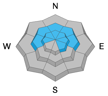
Areas of CONSIDERABLE DANGER exist on many steep west to north to southeast facing slopes at the mid and upper elevations. Human triggered avalanches 2-5'+ deep are likely and potentially unsurvivable. Don't be fooled by the lack of signs of instability today.
Pay attention to developing sensitive drifts of wind blown snow primarily on upper elevation west to north to east facing aspects today. These are to be avoided.
Depending on cloud cover, wet loose avalanches may become a problem on the solar aspects as well as some shady sheltered slopes up to the mid elevations. You'll need to watch for signs of dampening snow surfaces, rollerballs, and pinwheels and some sluffing.

If you're leaving a resort boundary through an exit point, you are stepping into CONSIDERABLE avalanche danger.
***Remember that more than half of our ski/snowboard fatalities over the past 20 years have occurred with people leaving the ski area for out of bounds.
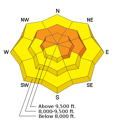
Low
Moderate
Considerable
High
Extreme
Learn how to read the forecast here
Special Announcements
With great sadness, the Utah Avalanche Center reports that a 57-year old skier, Kurt Damschroder of Park City, was killed Saturday in a backcountry avalanche off of Squaretop Peak, located on the Park City Ridgeline. The preliminary information can be found HERE. Our thoughts go out to those affected by this tragic accident, especially the family and friends of the victim.
UAC Staff, along with PCMR Ski Patrol, investigated the accident yesterday and will have the full report available in a couple of days.
Weather and Snow
Skies are partly cloudy.
Ahead of tomorrow's storm, we have warm overnight low temperatures and gusty southwest winds.
Mountain temperatures are in the upper 20s to low 30s with southerly winds averaging 30-35mph. The highest elevation anemometers are recording gusts to near 70mph.
Many solar aspect will be crusted this morning but you'll still find soft settled powder and perhaps developing surface hoar feathers in the sheltered shady terrain today.

For today, we can expect mountain temperatures in the upper 30s to low 40s. Southwest winds will increase to 35-40mph+ by the afternoon into the overnight hours.

The OUTLOOK:
We have a decent storm on tap for tomorrow into Thursday.
We should start to see some light precipitation overnight and heavier precipitation in the morning hours before frontal passage just before noon.
The rain/snow line will hover at or near 8000' prior to the cold front. Storm totals look to be 6-12".
You may want to swap the ice-tools for tax forms in the morning...as wet sluffs tomorrow are likely in the low elevation bands.

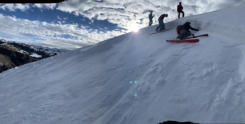
Beautiful day yesterday looking at one of the many close calls from the weekend. This one involved three very experienced backcountry skiers where it wasn't the first but the second person on the slope who was caught, carried, deployed their avalanche airbag, washed through trees, and nearly fully buried even with a fully deployed airbag. They're friends of mine and I'm glad everyone is ok.
Avalanche pro Pete Earle taking a look at the fracture line.
Recent Avalanches
The avalanche list is growing, and as always, you can find all observations and recent avalanches HERE.
SKI AREA control teams triggered some larger avalanches into old weak layers yesterday in upper elevation northerly terrain of upper Big Cottonwood Canyon.
Otherwise, we heard of no new avalanches from the backcountry yesterday. Still, observers continue to find more evidence of the natural avalanche cycle on Saturday.
Ad
Avalanche Problem #1
Persistent Weak Layer
Type
Location
Likelihood
Size
Description
Dangerous avalanche conditions continue to exist in the backcountry. Human triggered avalanches remain likely on many steep slopes facing west to north to southeast at the mid and upper elevations. We are primarily dealing with not one but two weak layers that are causing avalanches: a layer of facets and perhaps surface hoar buried Jan 22nd....and the old rotten facets and depth hoar in the basement. Both of these layers roared to life over the weekend and the avalanche cycle - both natural and human triggered - was nothing short of impressive, if not deadly.
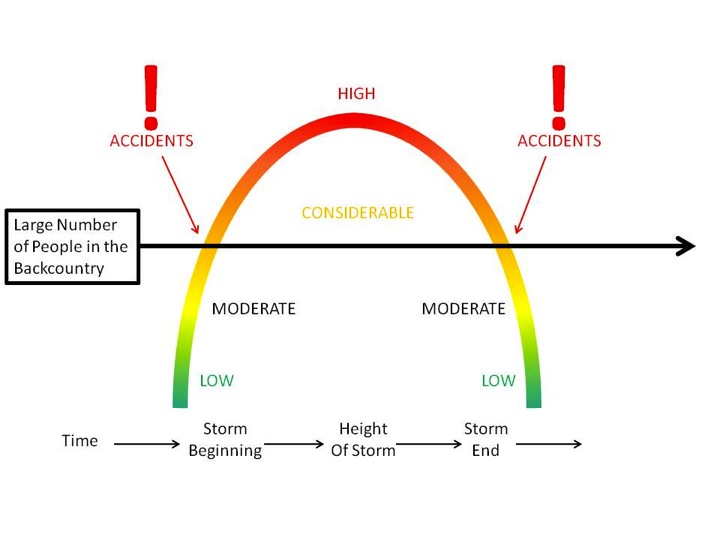
We are on the back end of the parabola as shown below. We did hear of continued cracking and collapsing into our suspect layering yesterday, but no avalanche activity- the first day in many with no reported slides.
Here's the rub - the size and locations of the avalanches remain the same: They're predominantly on west to north to southeast facing slopes and the avalanches remain large and destructive - 2-5'+ deep and a few hundred feet wide. While likelihood/sensitivity slowly decreases, the uncertainty increases. In other words whereas the danger was obvious over the weekend, now it is less so...and I fear people may ride a couple slopes, get away with it, and think they're in the clear. They're not.
AVALANCHE TREND: STEADY
Avalanche Problem #2
Wind Drifted Snow
Type
Location
Likelihood
Size
Description
New and developing wind drifts should be on your radar if headed into the more exposed terrain today. The increasing southerly winds are strong enough to paint part of the landscape with soft wind drifts easily large enough to catch and carry a person in steep terrain. The drifts will be more pronounced on upper elevation west to north to east facing slopes in the higher elevation bands.
AVALANCHE TREND: INCREASING
General Announcements
Please visit this website with information about Responsible Winter Recreation by the Utah Office of Outdoor Recreation.

This information does not apply to developed ski areas or highways where avalanche control is normally done. This forecast is from the U.S.D.A. Forest Service, which is solely responsible for its content. This forecast describes general avalanche conditions and local variations always occur.