Forecast for the Salt Lake Area Mountains

Nikki Champion
Issued by Nikki Champion on
Wednesday morning, February 19, 2025
Avalanche danger remains CONSIDERABLE on mid and upper-elevation slopes, where triggering an avalanche on one of several buried weak layers is likely. This danger also extends to many other steep slopes due to wind-drifted snow and lingering new snow. A MODERATE danger exists at lower elevations, where human-triggered avalanches are still possible.
Though danger has decreased, the travel advice remains the same—avoid avalanche terrain.
Low
Moderate
Considerable
High
Extreme
Learn how to read the forecast here
Special Announcements
Help the University of Utah understand risk behavior in the backcountry by participating in a 15-minute survey. The U will compensate up to $30 for your time! Please note: responses will not be confidential but will be handled ethically under IRB guidelines.
Weather and Snow
This morning, there’s a slight temperature inversion in the mountains, with trailhead temps near 8°F and the highest ridgelines sitting around 10–14°F. Winds out of the west have been steady overnight, averaging 10–15 mph with gusts up to 25 mph at mid-elevations and 30–40 mph, gusting to 50 mph, on the highest ridgelines. Snowfall tapered off overnight, leaving a trace to 1 inch of new accumulation, with up to 5 inches since yesterday morning.
Today, temps will rise into the mid-30s °F. A small blip of high pressure will settle over the area this morning before giving way to partly cloudy skies and scattered snow showers this afternoon. Winds will stay westerly, averaging 5–10 mph with gusts up to 20 mph at mid-elevations and 15–30 mph, gusting to 35–40 mph, on the highest ridgelines. Expect a trace to an inch of new snow by sunset.
The main cold front will cross the northern Utah mountains late tonight through early Thursday, bringing the bulk of the storm’s snowfall. Snow will linger through Thursday before tapering off, with 6–12 inches expected and up to 0.8 inches of water. High pressure will follow, ushering in an extended stretch of dry weather.

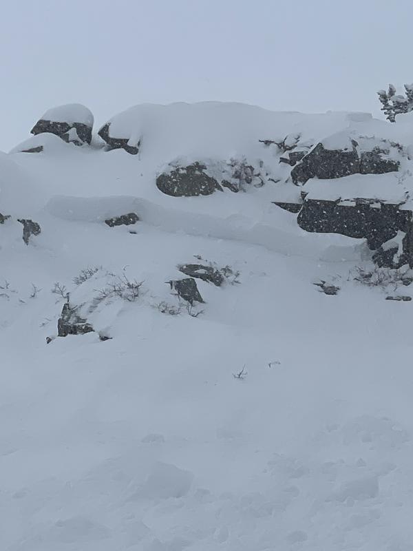
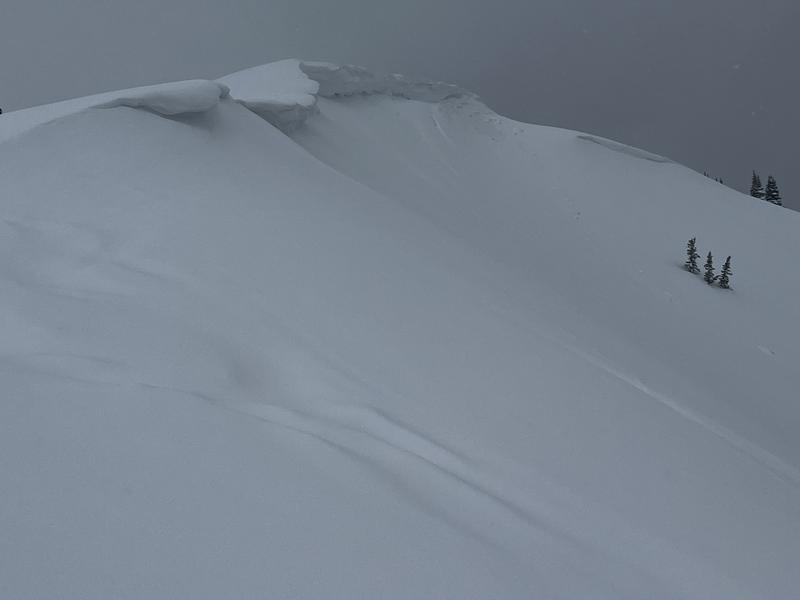
Widespread signs of instability are slowly decreasing, as are natural avalanches, but none of us trust this snowpack. With the incoming storm, avalanche danger will only rise again. We’ve seen avalanches on nearly every aspect and elevation over the past five days, and with multiple weak layers in play, there’s no way to know which one will fail. I don’t recommend trying to navigate the hazard right now. Plenty of excellent powder riding can be found on slopes under 30 degrees. Plain and simple.
Recent Avalanches
Yesterday, there was another close call near Lackawaxen Lake when a snowboarder was caught and carried after dropping a cliff on a northeast aspect at 10,300 feet. The avalanche released just below the cliff, breaking 2 feet deep and 60 feet wide. The rider was carried about 175 feet, while the full avalanche ran closer to 350 feet. See photo below.
Reports of natural activity from the weekend are still trickling in. In the last 10 days, nearly 70 avalanches have been reported to the UAC—more than half of them human-triggered. Ski resorts also reported avalanche results from explosives, along with natural activity.
Avalanche crown - Lackawaxen Lake - Scheuerlein
Read all observations HERE.
Ad
Avalanche Problem #1
Persistent Weak Layer
Type
Location
Likelihood
Size
Description
This isn’t our typical February Wasatch setup. We have four distinct weak layers buried in the snowpack that skiers and riders continue to trigger avalanches on.
  • November/December faceted snow near the ground. Particularly in rocky, shallower terrain.
  • Repeater slopes—terrain that has previously avalanched.
  • Late January faceted snow, present on many aspects.
  • Facet/crust combos on many solar slopes. The locator rose now includes low and mid-elevation SE-facing slopes.
Avalanches may fail on a variety of weak layers, on nearly any aspect, and it’s hard to determine which one. Now is not the time to thread the needle, hoping to find the one steep slope that won’t slide—there’s just too much spatial variability.
Conditions can vary drastically over short distances, and snow pits may not reflect what’s happening nearby, even on similar aspects and elevations. Yesterday, Greg, Dave K, Dave G, and I were all out in the Central Wasatch. Each of us dug pits on some similar aspects, yet we found different layering and got different stability test results. This is a clear reminder that there’s no guarantee conditions in one spot reflect what’s happening just a few hundred feet away.
Until this snowpack simplifies, we highly recommend staying out of avalanche terrain.
Avalanche Problem #2
Wind Drifted Snow
Type
Location
Likelihood
Size
Description
Elevated winds continue to form sensitive wind drifts on all aspects at mid and upper elevations. Cornices have grown large and may break farther back from ridgelines than expected. Any avalanche involving wind-drifted snow could step down to a buried persistent weak layer.
Outside the wind-affected zones, especially on shaded slopes, new snow may still be reactive in steep terrain. These interfaces are slowly stabilizing, but soft slabs remain possible on many aspects and elevations.
Additional Information
We've had four people tragically die already this year. Please do not try to outsmart the snowpack. Keep it simple and avoid steep terrain.
General Announcements
This information does not apply to developed ski areas or highways where avalanche control is normally done. This forecast is from the U.S.D.A. Forest Service, which is solely responsible for its content. This forecast describes general avalanche conditions and local variations always occur.