
Observation Date
2/18/2025
Observer Name
Kelly, Garcia
Region
Salt Lake » Little Cottonwood Canyon
Location Name or Route
Upper Cottonwood Canyons
Comments
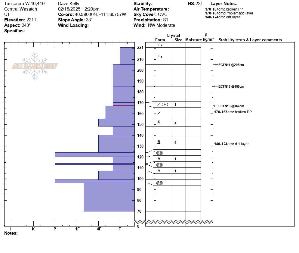
West facing snowpit at 10,440' in elevation. No propagation with an extended column test. 3 failures in density changes within the newest snow. The graupel layer did not have any failure in this location. After testing we pried on the block and had failure on a layer of broken stellars 2' from the surface. Faceted snow we found in this pit location was showing signs of rounding and with a depth of 7' (221cm).
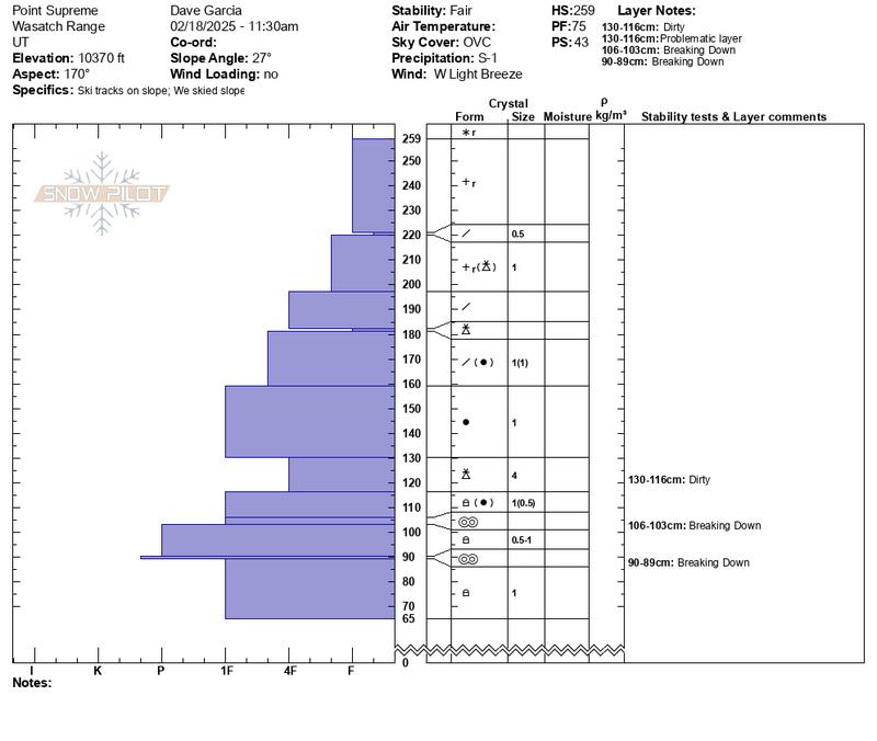
Southerly facing snowpit at 10,370' in elevation. We felt good about the stability in this pit, but this was a relatively low angle slope. Steep slopes with a southerly aspect may have more facet/crust combos and they might exist higher up in the pack.
South facing snowpit at 10,370'
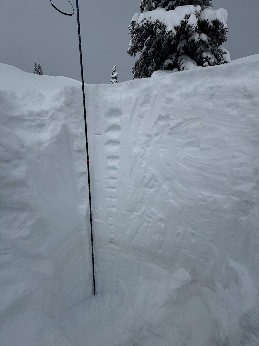
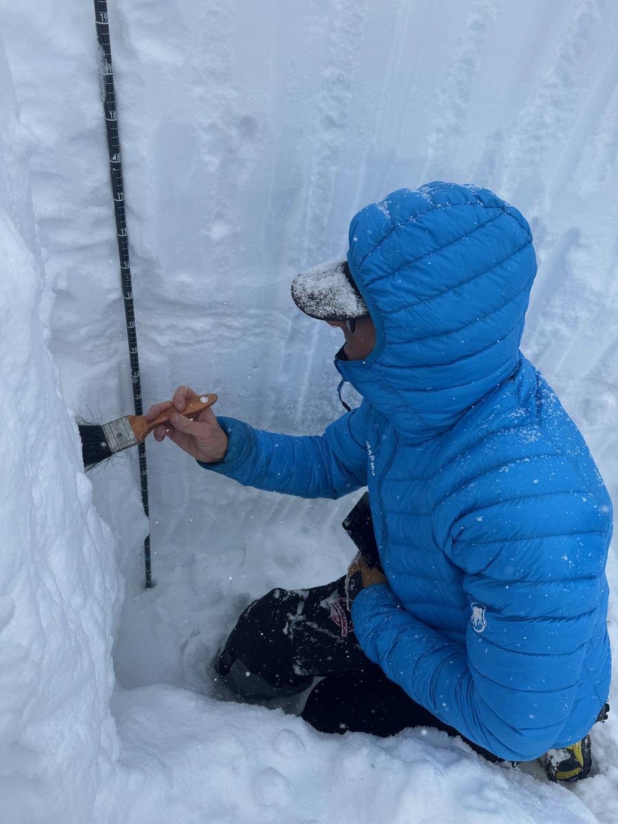
Photo of UAC Moab Forecaster Dave Garcia digging deep into the layers
We traveled today at elevations ranging from 9,000' to 10,800' on all aspects. We set out to dig on westerly and southerly facing terrain and where we dug above 10,000' we did not find that the persistent weak layer was a player in these locations. We found some rounding facets and imagine in thinner westerly facing (wind stripped) locations or repeater avalanche paths there would be more developed facets. With the complexity of this season's snowpack, we would assess each steep slope individually before committing to traveling on or underneath it.
Today's Observed Danger Rating
Considerable
Tomorrows Estimated Danger Rating
Considerable
Coordinates


