Check out our Holiday Auction - Sign Up for the Utah Snow and Avalanche Workshop (USAW)

Forecast for the Salt Lake Area Mountains

Drew Hardesty
Issued by Drew Hardesty on
Monday morning, December 18, 2023
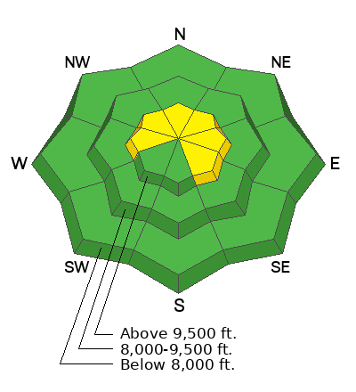
I expect the avalanche danger to rise to MODERATE on steep wind drifted slopes in the upper elevations today. It will be possible to trigger shallow soft slabs of wind drifted snow, primarily on west to north to southeast facing slopes. The wild card - and I can't believe I'm writing this near the Solstice - involves the possibility of shallow wet sluffs today on many aspects.
Low
Moderate
Considerable
High
Extreme
Learn how to read the forecast here
Weather and Snow
A weak storm system to the west is kicking in high thin clouds, warm temperatures and increasing winds from the southwest. As of 4am, temperatures are in the mid to upper 30s, about 10°F warmer than they were Sunday morning. Winds are from the southwest and are beginning to blow 15mph with gusts to 25. Along the 11,000' level, hourly wind speeds are already 30-35mph with gusts to 40.
For today, we'll have thin and patchy high and mid level clouds (greenhousing?) with mountain temperatures in the upper 30s to mid-40s. Winds will be blow 25-30mph+ from the southwest.
The Outlook: at this point, we'll take anything that'll mix out the haze in the valleys. It may be awhile. We have a couple of weak waves this week that will increase cloud cover and drop the temperatures a few degrees. It's possible the mountains may squeeze a snowflake or two out of these systems. The weekend holds promise, but it may be just a mirage.

An excerpt from my forecast Jan 5, 2010 -
  • There is a beautiful book, written by the French aviator Antoine de St. Exupery, called Wind, Sand, and Stars. Part of it details a time when his plane crashed in the Libyan desert. I think it was 1935. With little water between them, it wasn’t long until he and his navigator began experiencing visual and auditory hallucinations. Mirages appeared on the landscape, though they were always just out of reach. It’s a little like looking at the weather models these days…
Recent Avalanches
None.
Ad
Avalanche Problem #1
Wind Drifted Snow
Type
Location
Likelihood
Size
Description
Moderate to strong winds from the southwest will lead to shallow soft slabs of wind drifted snow in lee terrain today. Look for smooth rounded wind features, particularly in the upper elevation west to north to southeast facing slopes. These drifts may be surprisingly sensitive on the north half of the compass, as the they will in many cases be blown on to weak cohesionless faceted snow on the snow surface.
Avalanche Problem #2
Persistent Weak Layer
Type
Location
Likelihood
Size
Description
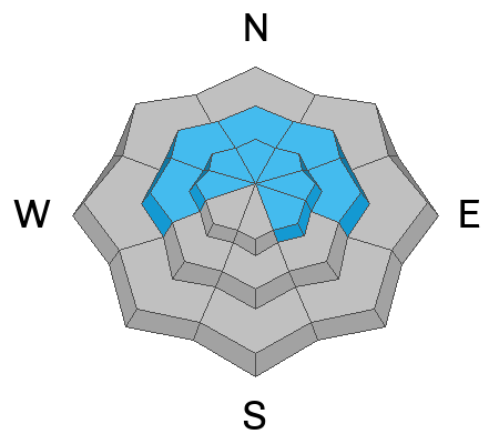
Our conditionally unstable snowpack structure has gone mostly dormant. In general, we have a poor structure of strong snow over weak snow, but time has allowed this structure to become (temporarily) stable. Forecaster Greg Gagne was in Porter Fork of Mill Creek yesterday and well explains the situation below. You can see his full observation HERE>
Avalanche Problem #3
Wet Snow
Type
Location
Likelihood
Size
Description
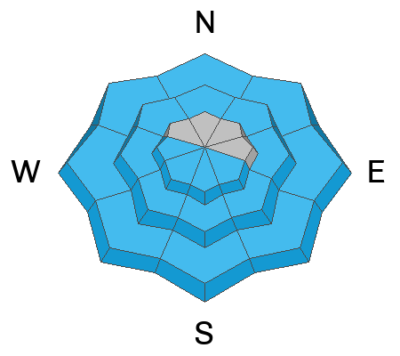
Something else to have on your radar: I don't like last night's overnight "low" temperatures in the mid to upper 30s...and even low 40s. These temps are - in some cases - over 10°F warmer than the night before. Adding complexity will be today's cloud cover. High thin clouds will possibly lead to "greenhousing", where snow on all aspects (even north facing) into the mid-elevations may become damp and lead to some wet loose avalanches.
General Announcements
This information does not apply to developed ski areas or highways where avalanche control is normally done. This forecast is from the U.S.D.A. Forest Service, which is solely responsible for its content. This forecast describes general avalanche conditions and local variations always occur.