Most ski areas are now closed to uphill travel as they open or prepare to open for winter operations. Resort uphill travel policies can be found
HERE.
Alta Ski Area has closed the Summer Road and access to Catherine's for lift area operations. Grizzly Gulch remains open.
A dry cold front is sagging into northern Utah this morning with temperatures in the upper single digits. Winds are from the northwest and light, less than 10 mph at mid elevations, while averaging in the 20's mph with slightly higher gusts at the upper-most elevations. Skies are partly cloudy.
For today, temperatures will rise into the low to mid teens with northwest winds gusting to near 20 mph at mid elevations and into the mid 20's mph at upper elevations. Skies will be partly cloudy.
Winds will shift to the northeast overnight with and will remain northerly this weekend as temperatures slowly warm under sunny skies. The extended forecast does not look promising, with an outside chance - at best - for light precipitation midweek.
Snow depths in the Central Wasatch Range are 3-4' above 9000' with varying s
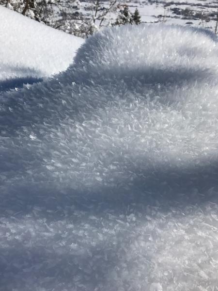
now surface conditions due to wind, sun, and cold temperatures. The cold temperatures and clear skies has preserved soft snow on shady slopes as the snow surface weakens and becomes faceted as well as surface hoar development (see photos below).This is not a problem presently, but this beautiful,
sparkly snow may become an issue if it gets buried underneath any new snow or wind-drifted snow. As you venture out in the coming days, notice the aspects and elevations you are seeing faceted snow and/or surface hoar. We welcome your
observations!
Surface Hoar (Brian Smith photo)
Near-Surface Facets (photo Schoening)