Sign Up for the Utah Snow and Avalanche Workshop (USAW) on December 7th!

Forecast for the Salt Lake Area Mountains

Drew Hardesty
Issued by Drew Hardesty on
Wednesday morning, January 20, 2021
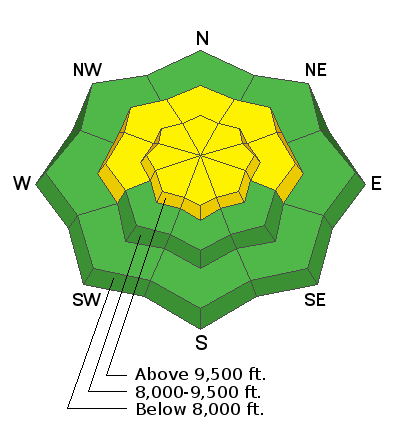
Areas of MODERATE danger exist on many slopes at the mid and upper elevations. Human-triggered avalanches are possible, particularly where there has been recent wind loading.
Continue to practice safe travel habits: one at a time across the slope, get out of the way at the bottom, make a plan.

All other aspects have a LOW avalanche danger.
Low
Moderate
Considerable
High
Extreme
Learn how to read the forecast here
Special Announcements
Expect intermittent road closures at 1030am this morning in BCC near milepost 8/Mineral Fork as UDOT Avalanche teams conduct training operations.

Thanks to the generous support of our local resorts, Ski Utah, and Backcountry, discount lift tickets are now available.
Support the UAC while you ski at the resorts this season. Tickets are available here.
Weather and Snow
Skies are clear.
Mountain temperatures are in the mid to upper teens.
The east winds are in the rear-view mirror but their lasting damage is done. The words boiler-plate, sastrugi, and hard slab all come to mind. And that is where snow exists at all.
Winds veered across the south end of the compass overnight and are 10-15mph from the west-southwest.
Snow depths range from 2-4' across the range and truth-be-told, riding conditions are not half-bad in the wind and sun protected terrain.
For today, we'll have sunny skies, 15mph westerly winds and temps rising to the mid-20s.

The Outlook:
A storm is on the horizon. We should start to see mountain snow Friday midday with heavy snowfall overnight into Saturday. 1-2' of snow is not out of the question. The weather models keep the storm track active with another storm for early next week and beyond.
We've been left standing at the altar of storms all winter. Let's do this.
Recent Avalanches
Ski area avalanche teams found new stiff and stubborn 6-10" wind drifts from the strong east winds yesterday. There were no reports of activity in the backcountry.
You can find all the backcountry observations HERE.
Ad
Avalanche Problem #1
Persistent Weak Layer
Type
Location
Likelihood
Size
Description
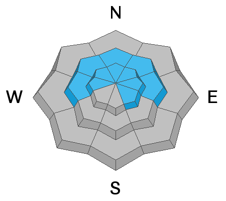
The main problem continues to be the poor snowpack structure that exists throughout the entire Wasatch Range. The problem primarily exists on shady slopes at the mid and upper elevations, where a strong slab of snow can release and fail in the weak faceted snow below. Snowpit results, significantly fewer reports of cracking and collapsing and lack of avalanche activity show that the likelihood of triggering an avalanche is decreasing....however, it is still not zero.
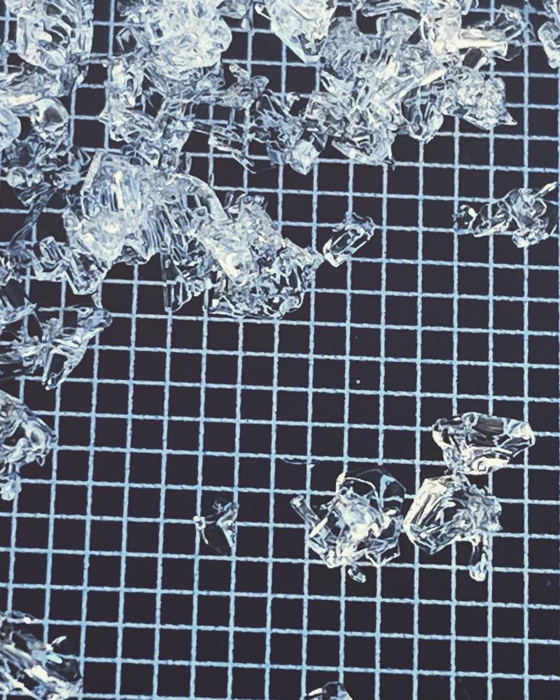
Much of our snowpack is made up of varying sizes of weak sugary snow known as facets...or even depth hoar. They're quite beautiful really - often large, angular, crystaline, cupped, even chained sometimes, but they're also quite dangerous when overloaded by heavy snowfall and/or strong winds. If the storm(s) verify, these will be the players in many of the avalanches we see.
Longtime avalanche pro Jake Hutchinson has a nice photo below.
Avalanche Problem #2
Wind Drifted Snow
Type
Location
Likelihood
Size
Description
If you're traveling into the upper elevations, particularly into the higher alpine or most wind exposed terrain, take note to avoid new and old drifts of wind deposited snow. Both soft and hard wind drifts litter the landscape and while most are fairly well welded in, don't be surprised to find that you can trigger one in steep terrain. These drifts - owing to the strong winds and variable directions over the past week - can be found on nearly any aspect.
Additional Information
NOW is the time to again practice your companion rescue skills.
With a series of storms on the way, the avalanche danger will be on the rise Friday into the weekend.
Be a good backcountry partner - Practice and know that you'll be able to find and dig your buddy out of the debris if there's been an avalanche.
General Announcements
Please visit this website with information about Responsible Winter Recreation by the Utah Office of Outdoor Recreation.

This information does not apply to developed ski areas or highways where avalanche control is normally done. This forecast is from the U.S.D.A. Forest Service, which is solely responsible for its content. This forecast describes general avalanche conditions and local variations always occur.