UDOT PLANNED AVALANCHE CLOSURES!!

Forecast for the Provo Area Mountains

Trent Meisenheimer
Issued by Trent Meisenheimer on
Saturday morning, December 10, 2022
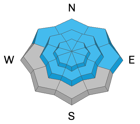
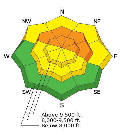
The avalanche danger is CONSIDERABLE on mid and upper elevation aspects facing northwest through north and east, where human-triggered avalanches may break down 1-3' deep and over 200' wide, failing on a persistent weak layer of faceted snow.
These avalanches can be triggered from a distance, so make sure there are no steep slopes above you.
Continue to avoid being on slopes steeper than 30˚ degrees.
Low
Moderate
Considerable
High
Extreme
Learn how to read the forecast here
Weather and Snow
Under mostly cloudy skies, the mountain temperatures span 20-28 °F across the Provo Range. Winds are blowing southwest with many anemometers spinning 10-15 mph.
Today, we can expect mostly cloudy skies and temperatures rising into the upper 20s and low 30s °F. Winds will remain from the southwest and strengthen throughout the day and are forecast to reach speeds of 20-30 mph gusting into the 30s & 40s across the upper elevation terrain.
A significant winter storm is churning off the coast of northern California and heading our way. This storm will impact Utah beginning today with an increase in southerly winds. Sunday morning light snow showers will begin to develop along the Wasatch Front lasting through Tuesday, with the heaviest precipitation overnight Sunday into Monday. Storm totals could stack up to 10-18" inches of new snow.
Recent Avalanches
No new avalanches were reported from the Provo area. Be sure to check out all observations HERE.
Ad
Avalanche Problem #1
Persistent Weak Layer
Type
Location
Likelihood
Size
Description
We have plenty of weak sugary faceted snow (persistent weak layer) scattered on almost all aspects and elevations throughout the Provo Range. However, what varies is the slab (the snow sitting above the weak layer). In sheltered locations, this slab might only be 10-15" inches deep, and in areas where the wind has loaded the slope, the slab could be anywhere from 1-3' feet deep and hard as a rock. In any case, we have dangerous avalanche conditions and you can still trigger a season-ending slab avalanche 1-3' feet deep and hundreds of feet wide, failing on a persistent weak layer.
With more snow and wind on the way, the avalanche danger will be on the rise. It's going to get a lot worse before it gets better. But, the good news! This problem will go away, just not this week. Remember, it's a long season, and it's shaping up to be an epic winter, don't ruin it now by getting caught in an avalanche.
Video: Drew Hardesty & Wilson from Mt. Aire.
Avalanche Problem #2
Wind Drifted Snow
Type
Location
Likelihood
Size
Description
As the southerly winds continue to strengthen over the next 24 hours, and with plenty of snow available to transport, we can expect to find new slabs of wind-drifted snow dotted across the terrain. These slabs of wind-drifted snow can be soft or hard and will be most pronounced at upper elevations on slopes facing west through north through southeast.
Remember, any wind slab avalanche that you trigger has the potential to step down into deeper weaker layers in the snowpack, creating a much more dangerous avalanche.
Additional Information
General Announcements

This information does not apply to developed ski areas or highways where avalanche control is normally done. This forecast is from the U.S.D.A. Forest Service, which is solely responsible for its content. This forecast describes general avalanche conditions and local variations always occur.