UDOT PLANNED AVALANCHE CLOSURES!!

Forecast for the Provo Area Mountains

Evelyn Lees
Issued by Evelyn Lees for
Friday, November 2, 2018
Weather and Snow
  • We have no new observations from the Provo area, but conditions up high are probably similar to the Salt Lake area mountains. Below is information from the Salt Lake mountains and forecast.
  • Across the upper elevation shady terrain, snow still remains from the early October storm. Snow depths range from 8-16" in these spots. Our snowpack consists of three breakable crusts close to the snow surface. Underneath the three crusts we have faceted snow to the ground as seen in the video below from October 31st. A few observers noted that the rain did not saturate through the crusts and the snow underneath is still faceted and loose in many locations.
  • Yesterday morning (Nov 1st), Alta reported 4" of new snow with 0.64" water. Rain began to fall overnight around 2:00 am and continued until sunrise, soaking the upper snow surface. The rain/snow line was roughly 9500' in elevation. The northerly winds continue to blow across the upper elevations with speeds of 15-20 mph gusting into the 30's.
  • Riding conditions today were spongy and supportable (see Mark White's photo below and his observation HERE). However, with temperatures plummeting into the 20's overnight, it is worth noting that the damp snow surface might freeze solid making tomorrows riding less appealing.
Ad
Avalanche Problem #1
Wind Drifted Snow
Type
Location
Likelihood
Size
Description
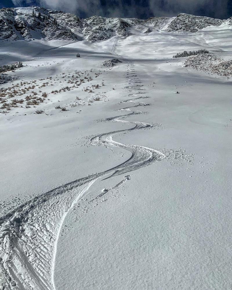
The winds have been blowing from the northwest at speeds of 15-25 mph for the past 24hrs. With the passing of another shortwave trough this evening the winds are expected to increase to 25-35 mph gusting into the 50's & 60's at upper elevations with an additional 2-6" of new snow. Be on the lookout for wind drifted snow on the lee sides of ridgelines. These avalanches could be up to 1-2' deep in the most loaded areas at upper elevations.
Additional Information
Today will be very warm, with increasing winds ahead of a storm expected to cross the Wasatch tonight. Strong winds are the primary concern, winds should peak late evening and early overnight. The storm is quick-moving, with the potential for a couple inches of fluff through early Saturday morning.
Another storm will spread into the region late Sunday and exit Monday morning. Expect another round of high winds with this second storm. Despite being another quick-moving storm, this next system contains more moisture, which should bring an average of 2-6 inches of new snow to the Wasatch.
  • Hitting rocks and stumps is a real danger. Don't end your season before it starts with an injury from hitting one of these obstacles.
  • Avalnaches are a real possiblity. It doesn't matter if you are hiking, hunting, skiing, etc., be prepared with rescue gear and a partner. Many people have died during early season snow storms. Listen to this podcast episode about a bad day in November 2011 when many avalanches were triggered and pro skier Jamie Pierre died. HERE
  • Ski resorts all have different uphill travel policies. Some are closed, like Snowbird, others are open. Resorts with open uphill travel can be great places to get in a little skiing especially in you know of a rock free slope, but it should be treated as backcountry terrain.