

Forecast for the Provo Area Mountains

Issued by Drew Hardesty on
Wednesday morning, January 1, 2025
Wednesday morning, January 1, 2025
The avalanche danger is CONSIDERABLE. You will likely trigger an unsurvivable avalanche 2-4 feet deep and a couple hundred feet wide in steep northwest to north to east facing terrain today. You will be able to trigger these from a distance or below. These are very dangerous conditions and we have had two avalanche fatalities since Saturday. We don't want any more tragedy. Please help us spread the word.
Low
Moderate
Considerable
High
Extreme
Learn how to read the forecast here
 Special Announcements
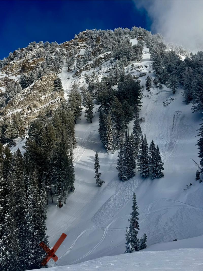
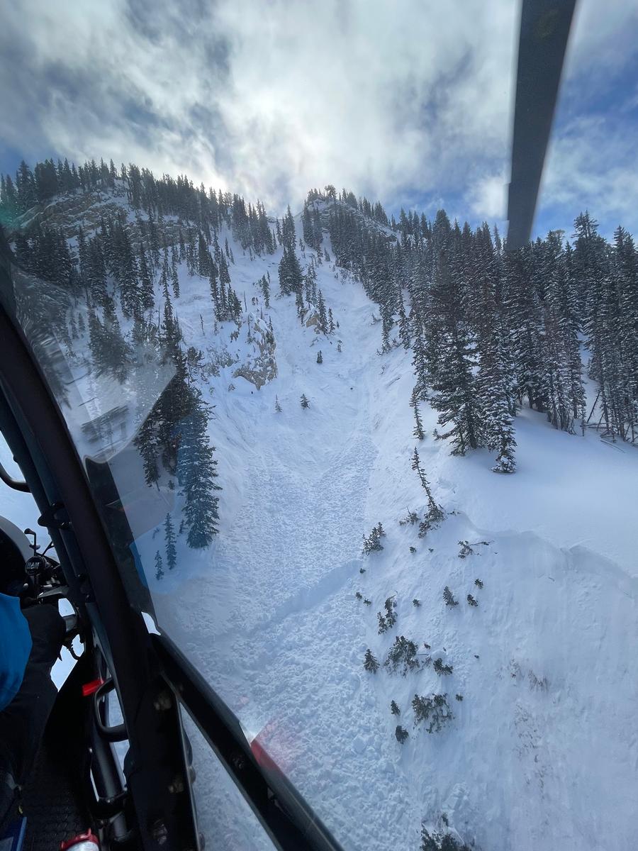
We are deeply saddened to confirm two avalanche fatalities. The first involved a 38 year old man in Main Porter Fork of Mill Creek Canyon who went missing on Saturday. The second avalanche fatality occurred yesterday that involved a 54 year old man off Davenport Hill into Silver Fork of BCC. Both individuals were traveling alone in the backcountry. Our condolences go out to to the family and friends of the victims.
Many thanks to those who responded to these accidents: search and rescue teams from AirMed, LifeFlight, Utah Dept Public Safety, Utah Department of Transportation, Salt Lake County Search and Rescue, Wasatch Backcountry Rescue, Alta Ski Area, and members of the Utah Avalanche Center.
Main Porter Preliminary Accident Report (1st photo -SL County SAR) Accident avalanche obscured by recent snow/wind. Avalanches in photo are from explosives to protect rescuers.
Davenport Hill Preliminary Accident Report (2nd photo - Wasatch Backcountry Rescue) The victim was buried 20 feet deep.
 Weather and Snow
Skies are becoming overcast and temperatures are warming ahead of this next storm. Temperatures are in the mid to upper teens. Winds are from the southwest, blowing 15-20mph. We should start to see some snowfall by the afternoon, with storm totals of 4-8 inches by tomorrow. Unfortunately, the snow will be coming on a warming trend, making for upside-down snow. Accompanying winds will be moderate to strong from the west. Another storm is slated for the weekend with another early next week.
The weekend storm improved coverage in the Provo mountains, but we need more snow. Storm totals since the 26th are roughly 10-18" of new with nearly 2 inches of water weight. Unfortunately, the rain-snow line extended to 6500' or more.
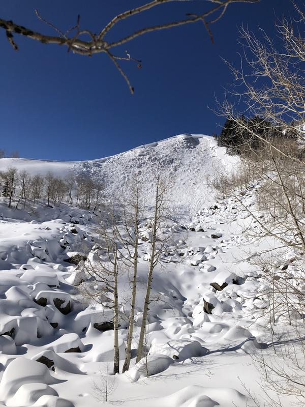
 Recent Avalanches
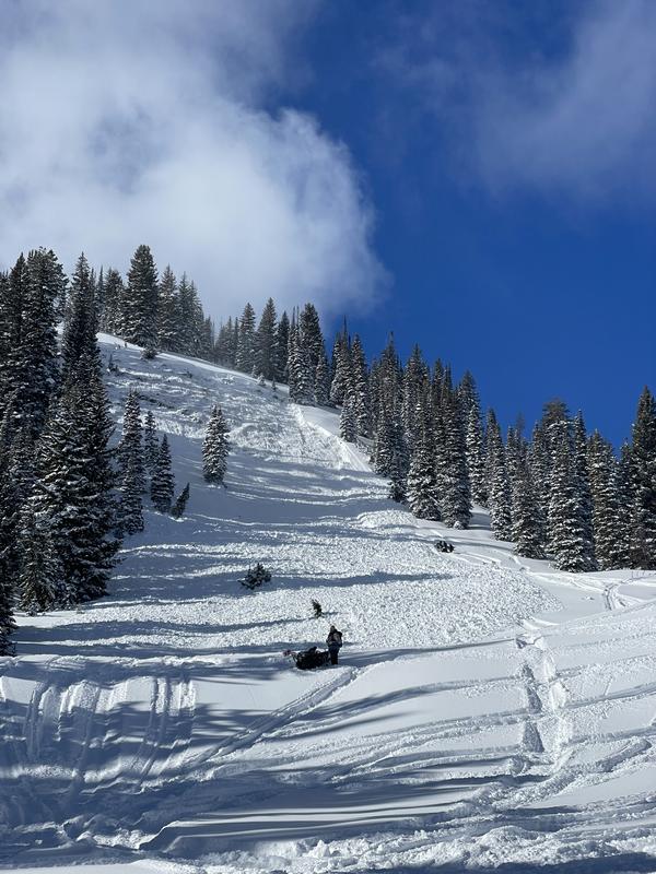
Large natural avalanches were reported over the weekend in the Provo area mountains. As of yesterday, more human triggered avalanches were triggered, particularly in the Wasatch Back terrain near the Ant Knolls. This avalanche below was remotely triggered on a steep northeast facing slope at 9500'.
For detailed observations and reports, check out all avalanche observations HERE.

Avalanche Problem #1
Persistent Weak Layer
Type
Location
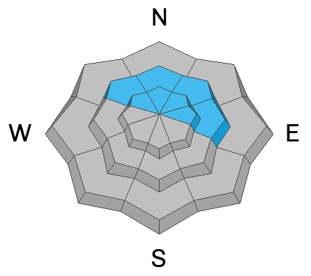
Likelihood
Size
Description
These are dangerous and tricky avalanche conditions. We clearly have a strong slab 2-4 feet thick overlying a persistent weak layer (PWL) of weak sugary faceted grains and there's no mystery here: avalanches, cracking and collapsing are nearly omnipresent. Don't try to outsmart this set-up or thread the needle: choose low angle terrain (less than 30°) with no adjacent or overhead hazard or terrain where the PWL does not exist.
Remember that as these overlying slabs gain strength, they can propagate wider and pull back onto lower angle connected slopes.
This avalanche was remotely triggered in upper Snake Creek yesterday.
Avalanche Problem #2
Wind Drifted Snow
Type
Location
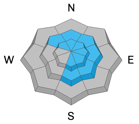
Likelihood
Size
Description
You'll find lingering and newly developing soft and hard slabs of wind blown snow on many aspects and elevations today and over the next few days with sustained winds. Triggering one of these may then subsequently step down to the ground.
Additional Information
Researchers Ian McCammon and Kelly McNeil looked into safety habits that markedly increase our margins of safety. Please take a moment to look over these and recalibrate your safety habits: Six Tips That Could Save Your Life (Recent updates to Safety Messaging)
General Announcements
This information does not apply to developed ski areas or highways where avalanche control is normally done. This forecast is from the U.S.D.A. Forest Service, which is solely responsible for its content. This forecast describes general avalanche conditions and local variations always occur.