Sign Up for the Utah Snow and Avalanche Workshop (USAW) on December 7th!

Forecast for the Ogden Area Mountains

Drew Hardesty
Issued by Drew Hardesty on
Saturday morning, December 7, 2019
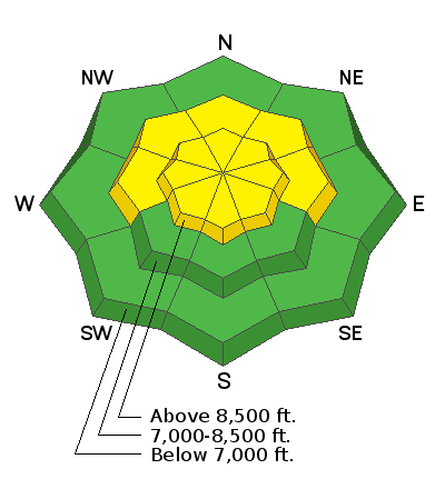
Areas of MODERATE danger exist on upper elevation northerly facing slopes. Recent warm weather has strengthened the snowpack, but triggering an avalanche on old weak snow near the ground remains possible. A MODERATE danger also exists for fresh wind drifts in lee terrain.
Low
Moderate
Considerable
High
Extreme
Learn how to read the forecast here
Special Announcements
Thanks to the generous support of our Utah ski resorts and Ski Utah, we have discount lift tickets available. All proceeds from these go towards paying for avalanche forecasting and education! Get your tickets HERE.

Get one of these cool t-shirts to support the UAC and other avalanche centers across the U.S. INFO
Weather and Snow
Skies are clear. Temps are in the upper 20s to low 30s. Winds again play the spoiler and are blowing 45-50mph with gusts near 70mph along the Ogden skyline. Even anemometers well off the ridgelines can't hind from the wind, with the anemometers spinning 20-30mph. Snow depths are 2-3' in the Ogden mountains with good early season coverage even at the low elevations.

Clouds will increase today and we should start to see some light snowfall overnight with storm totals through early Monday pegged at 5-10". Mountain temps will be in the upper 20s up high...the mid to upper 30s down low today with moderate south/southwest winds. Clearing expected Monday eve through Wednesday with generally unsettled weather the latter part of the work week.
Recent Avalanches
None.
Ad
Avalanche Problem #1
Persistent Weak Layer
Type
Location
Likelihood
Size
Description
It's a bit of a trust issue. Old faceted early season snow sits beneath the Thanksgiving storms on northwest to northeast facing slopes above about 8200'. Long time observer Dr. Brian Smith found this layer reactive to testing yesterday but guide/educator Derek DeBruin found this layer inconsistent and generally unreactive. Any old avalanche professional will tell you that they have a hard time trusting faceted snow, particularly mercurial and coy ones such as this one. Truth-be-told, we've only heard about a couple avalanches into this layering during the Thanksgiving storms and these were during avalanche control work at the ski areas. Still, I would like more snow and snow depths and more data to make me comfortable to get on the steepest northerly facing slopes.
Recent observations can be found here -
Additional Information
With sun and warming, shallow wet push-alanches and rollerballs are likely on steep sunny slopes.
Take some time to refresh your Companion Rescue Skills. This includes (1) beacon practice, (2) probing, and (3) strategic shoveling. I encourage others to spend time practicing these skills. Need to learn these skills or take a refresher, consider signing up for a companion rescue course!