Fall Auction is now live! Check it out now

Forecast for the Ogden Area Mountains

Mark Staples
Issued by Mark Staples on
Tuesday morning, December 3, 2019
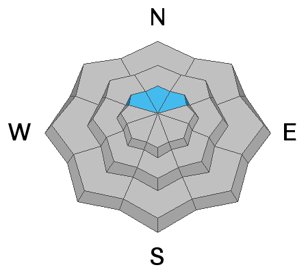
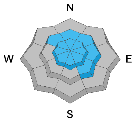
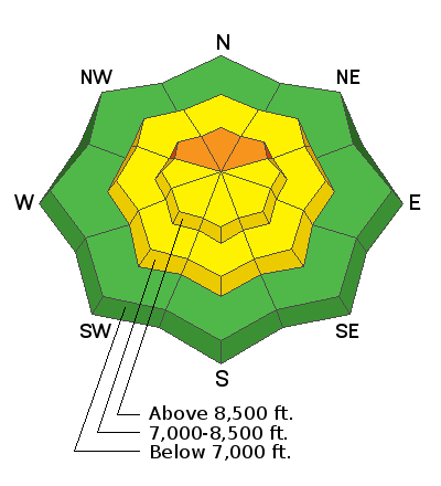
Today the avalanche danger is CONSIDERABLE on northerly facing upper elevation slopes where a soft slab of snow rest on top of a layer of old, faceted snow. All other slopes at upper elevations and all mid-elevation slopes have a MODERATE danger where recently formed slabs of wind drifted snow are the main avalanche hazard. Low elevations below 7000 feet have a LOW avalanche danger.
Low
Moderate
Considerable
High
Extreme
Learn how to read the forecast here
Special Announcements
The First Annual Statewide Avalanche Awareness Week is December 2-7. We have a week full of fun and educational events planned. Check out the schedule here.
The first UAC podcast of the season " Early Season Essentials with Program Director Bo Torrey" check it out HERE.
Weather and Snow
Currently in the Ogden area mountains settled snow depths are genearally 24-30 inches following the Thanksgiving snowfall which totalled 40-50 inches.
This morning mountain temperatures are generally in the mid to upper 20s F. Westerly winds this morning were mostly averaging 5 mph and gusting to 10 mph except near Snowbasin where they were gusting 21-27 mph. HOWEVER, strong winds on Sunday and Monday morning were blowing strong from the SW and drifting snow (see the video below from Ben Lomond Peak on Sunday).
For today, high level clouds should build this afternoon. Temperatures should warm into the low 30s F. Winds shouldn't change much from where they are this morning. Some snow may arrive Wednesday afternooon or evening.
Recent Avalanches
No new avalanches were reported from the ski resorts or the Ogden backcountry yesterday.

A number of recent observations can be found here.
Ad
Avalanche Problem #1
Persistent Weak Layer
Type
Location
Likelihood
Size
Description
In the Ogden area mountains, slopes above 8500 feet contained old snow that became weak and faceted. These slopes generally face NW, N, and NE at the highest elevations. This old snow formed a persistent weak layer that now has a soft slab 2-3 feet thick on top. Drew found this layer on Ben Lomond on Sunday, Greg found it in the Snowbasin backcountry, and Powder Mountain snow safety personnel found it as well.
This layer produced a widespread avalanche cycle further south in Cottonwood Canyons near Salt Lake City. It is not as widespread in the Ogden area mountains, but it does exist and shouldn't be trusted. This avalanche problem has created dangerous avalanche conditions and requires careful snowpack evaluations.
Avalanche Problem #2
Wind Drifted Snow
Type
Location
Likelihood
Size
Description
Recent southerly winds transported snow and formed slabs of wind drifted snow. These wind slabs should be less sensitive today EXCEPT where they will be very easy to trigger where they sit on top of a persistent weak layer of facets.
Basically, I'd avoid any slope that appears to have wind drifted snow. Read more about how to identify fresh wind drifts HERE.
General Announcements
This information does not apply to developed ski areas or highways where avalanche control is normally done. This forecast is from the U.S.D.A. Forest Service, which is solely responsible for its content. This forecast describes general avalanche conditions and local variations always occur.
Remember your information can save lives. If you see anything we should know about, please help us out by submitting snow and avalanche conditions. You can also call us at 801-524-5304, email by clicking HERE, or include #utavy in your tweet or Instagram.
To get help in an emergency (to request a rescue) in the Wasatch, call 911. Be prepared to give your GPS coordinates or the run name.
Backcountry Emergencies. It outlines your step-by-step method in the event of a winter backcountry incident.
If you trigger an avalanche in the backcountry, but no one is hurt and you do not need assistance, please notify the nearest ski area dispatch to avoid a needless response by rescue teams. Thanks.
Salt Lake and Park City – Alta Central (801-742-2033), Canyons Resort/PCMR Dispatch (435-615-1911)
Ogden - Snowbasin Resort Dispatch (801-620-1017), Powder Mountain Dispatch (801-745-3772 x 123)
Provo - Sundance Dispatch (801-223-4150)