Fall Auction is now live! Check it out now

Forecast for the Ogden Area Mountains

Mark Staples
Issued by Mark Staples on
Wednesday morning, November 27, 2019
HEADS UP: The avalanche danger will be increasing during the next few days as a major storm impacts most of the state.

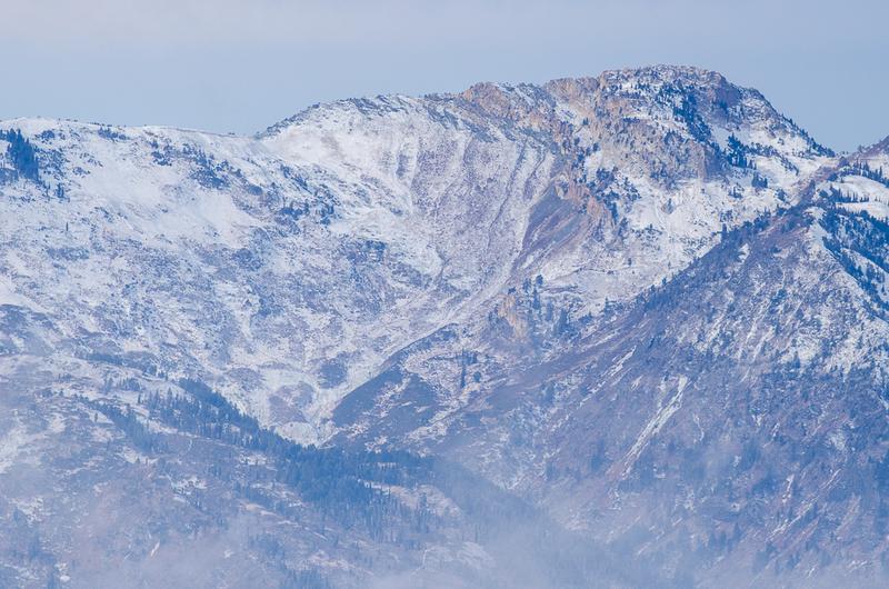
Today, the avalanche danger is CONSIDERABLE on upper elevation northerly facing slopes. A combination of wind drifted snow and old, weak, faceted snow underneath will create dangerous avalanche conditions on these slopes. A MODERATE danger exists on upper elevation, southerly facing slopes, and on mid-elevations northerly facing slopes.
Slopes at low elevations and south-facing slopes mid-elevations, simply don't have enough snow to ride and hardly enough snow to create an avalanche, thus they have a LOW danger.

What to do? The only viable strategy is to ride low angle slopes (less than 30 degrees in steepness) which are not steep enough for an avalanche. With such thin snow cover, hitting rocks or stumps remains the greatest hazard.
Low
Moderate
Considerable
High
Extreme
Learn how to read the forecast here
Avalanche Watch
An Avalanche Watch has been issued for mountain south of Ogden; HOWEVER, stay tuned as the storm unfolds. Depending on how the storm progresses the included area could be expanded to include the mountains around Ogden.
Special Announcements
The First Annual Statewide Avalanche Awareness Week is December 2-7. We have a week full of fun and educational events planned. Check out the schedule here.
Weather and Snow
Winds ramped up this morning ahead of the next storm. At 5 a.m. southerly winds were averaging 15-35 mph and gusting 40 mph. Ogden Peak had wind gusts 60-75 mph.
Temperatures were mostly in mid-teens F with wind chills in below zero.
Snowfall was just beginning this morning. It appears that 2-3 inches had fallen near Snowbasin and Ben Lomond as of 5 a.m.
Today snowfall will increase and produce about a foot of snow by this evening. Exactly how much snow will be dependent on how this storm unfolds. Much of the precipitation could remain a little west or the system could line up directly over the Wasatch and produce more snow than expected. Temperatures will remain cold and only reach about 20 degrees F before cooling again this afteroon.
Scroll to the bottom of the page for a video from the National Weather Service about this storm.
Recent Avalanches
None reported
Ad
Avalanche Problem #1
Persistent Weak Layer
Type
Location
Likelihood
Size
Description
Old snow that covered northerly facing slopes through much of November became weak and faceted. This weak snow is not widespread and exists mostly at the highest elevations and now has soft slab of new snow on top of it now. Yesterday's new snow wasn't enough of a load to stress this weak snow and cause avalanches. That should change today as a result of strong south winds transporting snow this morning followed by snowfall today. The combination of this wind-blown snow and snow falling from the sky will stress the weak, faceted snow underneath. This added stress will make human triggered avalanches likely and create dangerous avalanche conditions.
The dilemma is that with such early season conditions, the deepest snow and best coverage is on upper elevation, north-facing slopes. These slopes are the ones that will produce avalanches. The only option is then to find similar slopes that are not steep enough to avalanche (less than 30 degrees in steepness). South-facing slopes simply don't have enough snow to ride today.
Doug Wewer snapped a few great photos of old snow coverage on Ben Lomond Peak like the one below.
Avalanche Problem #2
Wind Drifted Snow
Type
Location
Likelihood
Size
Description
Expect both hard and soft slabs of wind drifted snow from this morning's very strong southerly winds.
These fresh slabs will be especially sensitive and break over a wider area on upper elevation, northerly facing slopes where they rest on top of the old, weak, faceted snow. What complicates the situation is that yesterday's strong north winds loaded some south-facing slopes where avalanches remain possible.
Additional Information
Below is a video from the National Weather Service outlining how the storm over the next few days could unfold.
General Announcements
This information does not apply to developed ski areas or highways where avalanche control is normally done. This forecast is from the U.S.D.A. Forest Service, which is solely responsible for its content. This forecast describes general avalanche conditions and local variations always occur.