Forecast for the Ogden Area Mountains

Issued by Trent Meisenheimer on
Sunday morning, January 22, 2023
Sunday morning, January 22, 2023
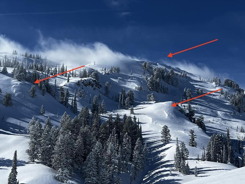
The avalanche danger is MODERATE on all steep mid and upper-elevation slopes where it's possible to find old and new pockets of sensitive wind-drifted snow. As the winds increase throughout the day, be on the lookout and avoid any fresh drift of wind-blown snow. Here avalanches can be 1-2 feet deep and up to 50-100 feet wide.
Avoid traveling underneath or along the edge of corniced ridgelines, as large cornices may easily break off. Long-running dry loose avalanches (sluffs) are also possible in steep, sustained terrain.

Low
Moderate
Considerable
High
Extreme
Learn how to read the forecast here